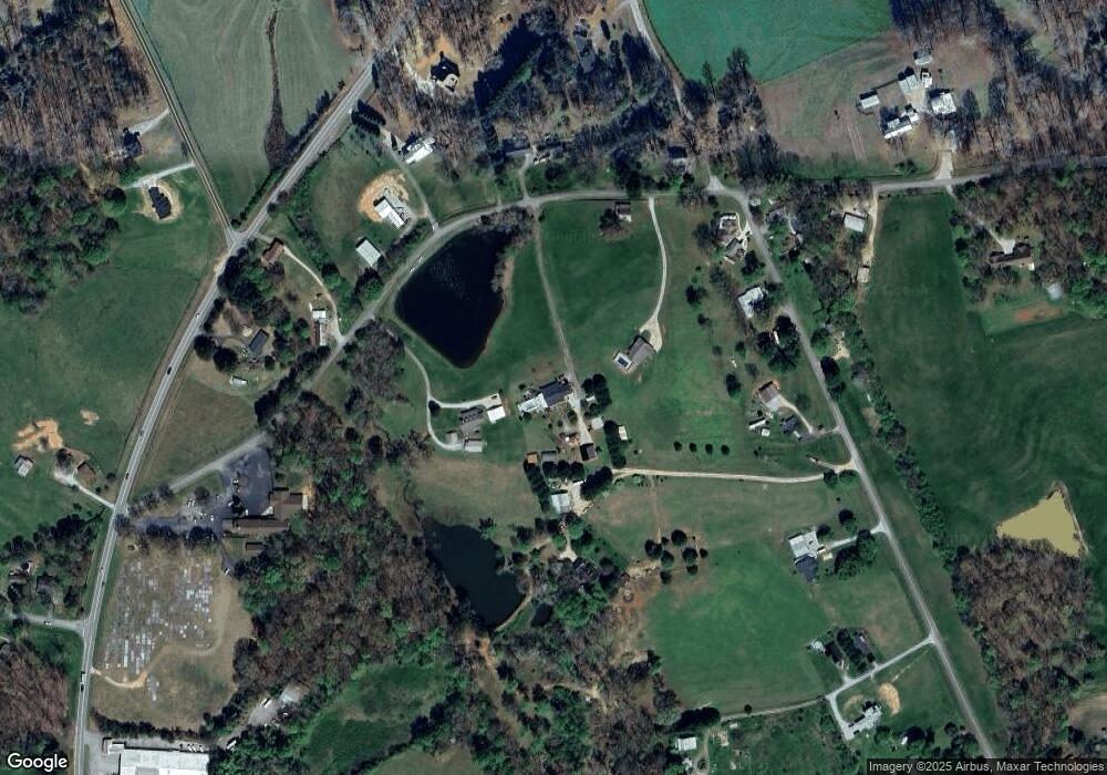
372 Sutton Rd Demorest, GA 30535
Estimated Value: $348,000 - $507,000
2
Beds
2
Baths
1,706
Sq Ft
$247/Sq Ft
Est. Value
About This Home
This home is located at 372 Sutton Rd, Demorest, GA 30535 and is currently estimated at $421,144, approximately $246 per square foot. 372 Sutton Rd is a home located in Habersham County with nearby schools including Fairview Elementary School, North Habersham Middle School, and Habersham Success Academy.
Ownership History
Date
Name
Owned For
Owner Type
Purchase Details
Closed on
Jun 22, 2010
Sold by
Mcinvale Brenda
Bought by
Mcinvale Brenda
Current Estimated Value
Purchase Details
Closed on
Jun 1, 2010
Sold by
Black Imogene
Bought by
Federal National Mtg Associati
Purchase Details
Closed on
Jan 5, 2010
Sold by
Bac Home Loans Servicing L
Bought by
Federal National Mtg Associati
Create a Home Valuation Report for This Property
The Home Valuation Report is an in-depth analysis detailing your home's value as well as a comparison with similar homes in the area
Home Values in the Area
Average Home Value in this Area
Purchase History
| Date | Buyer | Sale Price | Title Company |
|---|---|---|---|
| Mcinvale Brenda | -- | -- | |
| Mcinvale Brenda | -- | -- | |
| Federal National Mtg Associati | -- | -- | |
| Federal National Mtg Associati | $211,469 | -- | |
| Bac Home Loans Servicing Lp | $211,469 | -- |
Source: Public Records
Tax History Compared to Growth
Tax History
| Year | Tax Paid | Tax Assessment Tax Assessment Total Assessment is a certain percentage of the fair market value that is determined by local assessors to be the total taxable value of land and additions on the property. | Land | Improvement |
|---|---|---|---|---|
| 2025 | $3,765 | $168,119 | $19,571 | $148,548 |
| 2024 | $3,448 | $132,836 | $14,480 | $118,356 |
| 2023 | $2,845 | $113,788 | $14,480 | $99,308 |
| 2022 | $2,506 | $96,088 | $10,076 | $86,012 |
| 2021 | $2,082 | $80,204 | $10,076 | $70,128 |
| 2020 | $1,846 | $68,648 | $8,184 | $60,464 |
| 2019 | $1,848 | $68,648 | $8,184 | $60,464 |
| 2018 | $1,834 | $68,648 | $8,184 | $60,464 |
| 2017 | $1,663 | $61,912 | $6,296 | $55,616 |
| 2016 | $1,614 | $154,780 | $6,296 | $55,616 |
| 2015 | $1,595 | $154,780 | $6,296 | $55,616 |
| 2014 | $1,583 | $150,770 | $6,296 | $54,012 |
| 2013 | -- | $60,308 | $6,296 | $54,012 |
Source: Public Records
Map
Nearby Homes
- 110 Corbett York Rd
- 600 Smith Fork Dr
- 1045 Fairview School Rd
- 255 Cool Springs Road Lot Rd Unit 7
- 255 Cool Springs Road -Lot #7 Rd
- 239 Cool Springs Rd Unit LOT 8
- 368 Dixon Rd
- 474 White Pine Cir
- 239 Cool Springs Lot #8 Rd
- 385 Amys Rd
- 0 Harvest Church Rd Unit LOT 2 10606590
- 0 Harvest Church Rd Unit LOT 1 10606522
- 0 Wheeler Rd Unit 22579726
- 415 Pardue Mill Rd
- 257 Iris Dr
- 7 ACRES Wheeler Rd
- 230 Skyview Dr
- 271 Panacea Ln
- 663 Wheeler Rd
- 350 Kitty Hawk Ln
- 1245 Jim Thomas Rd
- 268 Sutton Rd
- 1265 Jim Thomas Rd
- 1337 Jim Thomas Rd
- 404 Sutton Rd SW
- 1271 Jim Thomas Rd
- 1395 Jim Thomas Rd
- 371 Sutton Rd
- 2468 Highway 105
- 1423 Jim Thomas Rd
- 2490 Highway 105
- 1378 Jim Thomas Rd
- 1320 Jim Thomas Rd
- 1294 Jim Thomas Rd
- 2416 Highway 105
- 1207 Jim Thomas Rd
- 1434 Jim Thomas Rd
- 2236 Highway 105
- 2500 Highway 105
- 1519 Jim Thomas Rd
