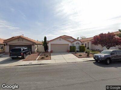
3724 Alliance St Las Vegas, NV 89129
Lone Mountain NeighborhoodEstimated Value: $388,000 - $403,000
3
Beds
2
Baths
1,500
Sq Ft
$265/Sq Ft
Est. Value
About This Home
This home is located at 3724 Alliance St, Las Vegas, NV 89129 and is currently estimated at $397,185, approximately $264 per square foot. 3724 Alliance St is a home located in Clark County with nearby schools including Marc Kahre Elementary School, Dorothy Eisenberg Elementary School, and Irwin & Susan Molasky Junior High School.
Ownership History
Date
Name
Owned For
Owner Type
Purchase Details
Closed on
Jul 30, 2019
Sold by
Magee Daniel
Bought by
Magee Daniel and Magee Anne L
Current Estimated Value
Purchase Details
Closed on
Jul 25, 1995
Sold by
Woodside Homes Of Nevada Inc
Bought by
Clark Robert F
Home Financials for this Owner
Home Financials are based on the most recent Mortgage that was taken out on this home.
Original Mortgage
$94,930
Interest Rate
7.62%
Create a Home Valuation Report for This Property
The Home Valuation Report is an in-depth analysis detailing your home's value as well as a comparison with similar homes in the area
Home Values in the Area
Average Home Value in this Area
Purchase History
| Date | Buyer | Sale Price | Title Company |
|---|---|---|---|
| Magee Daniel | -- | None Available | |
| Clark Robert F | $119,000 | Nevada Title Company |
Source: Public Records
Mortgage History
| Date | Status | Borrower | Loan Amount |
|---|---|---|---|
| Closed | Clark Robert F | $73,764 | |
| Closed | Clark Robert F | $94,930 |
Source: Public Records
Tax History Compared to Growth
Tax History
| Year | Tax Paid | Tax Assessment Tax Assessment Total Assessment is a certain percentage of the fair market value that is determined by local assessors to be the total taxable value of land and additions on the property. | Land | Improvement |
|---|---|---|---|---|
| 2025 | $1,613 | $81,942 | $31,500 | $50,442 |
| 2024 | $1,567 | $81,942 | $31,500 | $50,442 |
| 2023 | $1,567 | $77,293 | $29,400 | $47,893 |
| 2022 | $1,521 | $67,597 | $23,800 | $43,797 |
| 2021 | $1,477 | $64,908 | $23,100 | $41,808 |
| 2020 | $1,431 | $64,003 | $22,400 | $41,603 |
| 2019 | $1,389 | $61,453 | $20,300 | $41,153 |
| 2018 | $1,349 | $54,216 | $14,700 | $39,516 |
| 2017 | $1,771 | $54,020 | $14,000 | $40,020 |
| 2016 | $1,264 | $49,437 | $9,100 | $40,337 |
| 2015 | $1,260 | $42,736 | $8,400 | $34,336 |
| 2014 | $1,223 | $36,208 | $7,000 | $29,208 |
Source: Public Records
Map
Nearby Homes
- 7973 Macklin St
- 3695 Funston Way
- 3632 Julia Waldene Ct
- 3619 Bixbee Ct
- 8240 W Gilmore Ave
- 3640 Ash Springs Way
- 3729 Bronco Billy Ct
- 7904 Seabourn Ct
- 7730 Brambly Creek Ct
- 8028 Hurricane Cove Ct
- 7900 Holly Knoll Ave
- 7718 Willow Cove Cir
- 3525 Dover Bay St
- 4005 Poppy Fields Dr
- 4050 N Tomsik St
- 8205 Harrogate Ave
- 3525 Tuscany Village Dr
- 3473 Conough Ln Unit 5
- 3968 Moon Tango St
- 7800 Four Seasons Dr
- 3724 Alliance St
- 3720 Alliance St
- 3728 Alliance St
- 3716 Alliance St
- 3732 Alliance St Unit None
- 3732 Alliance St
- 3732 Alliance St
- 3712 Alliance St Unit 1
- 3736 Alliance St
- 8100 Calvin Crest Ave
- 3740 Alliance St
- 3708 Alliance St
- 8101 Calvin Crest Ave
- 8104 Calvin Crest Ave
- 3743 Funston Way
- 3751 Funston Way
- 3737 Alliance St
- 3704 Alliance St
- 3759 Funston Way
- 8105 Calvin Crest Ave