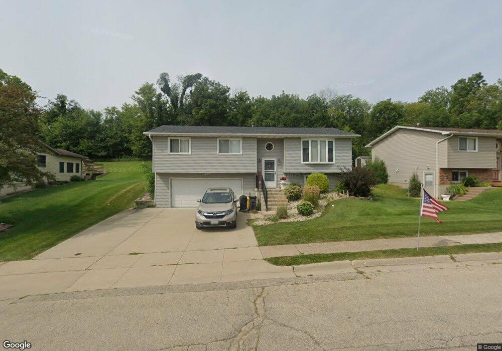
3727 Aerostar Dr Dubuque, IA 52001
Estimated Value: $214,069 - $248,000
3
Beds
2
Baths
1,130
Sq Ft
$208/Sq Ft
Est. Value
About This Home
This home is located at 3727 Aerostar Dr, Dubuque, IA 52001 and is currently estimated at $234,767, approximately $207 per square foot. 3727 Aerostar Dr is a home located in Dubuque County with nearby schools including Marshall Elementary School, Thomas Jefferson Middle School, and Hempstead High School.
Ownership History
Date
Name
Owned For
Owner Type
Purchase Details
Closed on
Jun 17, 2025
Sold by
Balfe Michael W and Balfe Helen J
Bought by
Michael And Helen Balfe Joint Revocable Livin
Current Estimated Value
Create a Home Valuation Report for This Property
The Home Valuation Report is an in-depth analysis detailing your home's value as well as a comparison with similar homes in the area
Home Values in the Area
Average Home Value in this Area
Purchase History
| Date | Buyer | Sale Price | Title Company |
|---|---|---|---|
| Michael And Helen Balfe Joint Revocable Livin | -- | None Listed On Document |
Source: Public Records
Tax History Compared to Growth
Tax History
| Year | Tax Paid | Tax Assessment Tax Assessment Total Assessment is a certain percentage of the fair market value that is determined by local assessors to be the total taxable value of land and additions on the property. | Land | Improvement |
|---|---|---|---|---|
| 2025 | $2,310 | $198,200 | $36,100 | $162,100 |
| 2024 | $2,310 | $184,500 | $32,100 | $152,400 |
| 2023 | $2,332 | $184,500 | $32,100 | $152,400 |
| 2022 | $2,394 | $153,670 | $24,080 | $129,590 |
| 2021 | $2,394 | $153,670 | $24,080 | $129,590 |
| 2020 | $2,332 | $139,950 | $24,080 | $115,870 |
| 2019 | $2,332 | $139,950 | $24,080 | $115,870 |
| 2018 | $2,292 | $133,940 | $22,470 | $111,470 |
| 2017 | $2,176 | $133,940 | $22,470 | $111,470 |
| 2016 | $2,128 | $121,220 | $22,470 | $98,750 |
| 2015 | $2,128 | $121,220 | $22,470 | $98,750 |
| 2014 | $2,070 | $121,220 | $22,470 | $98,750 |
Source: Public Records
Map
Nearby Homes
- 3705 Aerostar Dr
- 3400 Jackson St
- 931 Liberty Ave
- 51 Milwaukee St
- 3110 Burden St
- Lot 1 Hawkeye Heights No 5 Heights
- LOT 2 Olympic Heights Rd
- 3046 Central Ave
- 2921 Balke St
- 809 Goethe St
- 2901 Washington St
- 811 Lawther St
- 2920 Central Ave
- 2915 White St
- 2901 Central Ave
- 1917 Amelia Dr
- 1927 Amelia Dr
- 9935 Ginger Ridge
- 2768 Jackson St
- 2887 Timberline St
- 3749 Aerostar Dr
- 3720 Aerostar Dr
- 3695 Aerostar Dr
- 3750 Aerostar Dr
- 3673 Aerostar Dr
- 660 Cessna Dr
- 655 Piper Ct
- 665 Cessna Dr
- 3670 Aerostar Dr
- 3665 Aerostar Dr
- 630 Cessna Dr
- 635 Piper Ct
- 645 Cessna Dr
- 610 Cessna Dr
- 3650 Aerostar Dr
- 3649 Aerostar Dr
- 625 Cessna Dr
- 615 Piper Ct
- 628 Enstrom Ct
- 620 Piper Ct