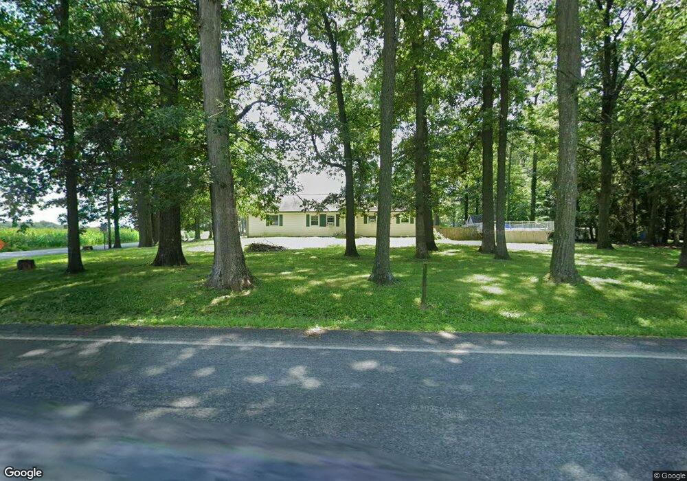
3727 Brownton Rd Felton, PA 17322
Estimated Value: $289,000 - $497,000
3
Beds
2
Baths
1,555
Sq Ft
$226/Sq Ft
Est. Value
About This Home
This home is located at 3727 Brownton Rd, Felton, PA 17322 and is currently estimated at $351,442, approximately $226 per square foot. 3727 Brownton Rd is a home located in York County with nearby schools including Pleasant View Elementary School, Red Lion Area Junior High School, and Red Lion Area Senior High School.
Ownership History
Date
Name
Owned For
Owner Type
Purchase Details
Closed on
Mar 26, 2002
Sold by
Thompson Robert E and Thompson Rae L
Bought by
Syrylo Albert G and Syrylo Maura H
Current Estimated Value
Home Financials for this Owner
Home Financials are based on the most recent Mortgage that was taken out on this home.
Original Mortgage
$132,600
Outstanding Balance
$55,243
Interest Rate
6.88%
Mortgage Type
VA
Estimated Equity
$296,199
Purchase Details
Closed on
Mar 31, 1994
Bought by
Thompson Robert E
Create a Home Valuation Report for This Property
The Home Valuation Report is an in-depth analysis detailing your home's value as well as a comparison with similar homes in the area
Home Values in the Area
Average Home Value in this Area
Purchase History
| Date | Buyer | Sale Price | Title Company |
|---|---|---|---|
| Syrylo Albert G | $128,762 | -- | |
| Thompson Robert E | $94,000 | -- |
Source: Public Records
Mortgage History
| Date | Status | Borrower | Loan Amount |
|---|---|---|---|
| Open | Syrylo Albert G | $132,600 |
Source: Public Records
Tax History Compared to Growth
Tax History
| Year | Tax Paid | Tax Assessment Tax Assessment Total Assessment is a certain percentage of the fair market value that is determined by local assessors to be the total taxable value of land and additions on the property. | Land | Improvement |
|---|---|---|---|---|
| 2025 | $4,070 | $132,320 | $35,290 | $97,030 |
| 2024 | $3,940 | $132,320 | $35,290 | $97,030 |
| 2023 | $3,940 | $132,320 | $35,290 | $97,030 |
| 2022 | $3,940 | $132,320 | $35,290 | $97,030 |
| 2021 | $3,808 | $132,320 | $35,290 | $97,030 |
| 2020 | $3,808 | $132,320 | $35,290 | $97,030 |
| 2019 | $3,795 | $132,320 | $35,290 | $97,030 |
| 2018 | $3,755 | $132,320 | $35,290 | $97,030 |
| 2017 | $3,755 | $132,320 | $35,290 | $97,030 |
| 2016 | $0 | $132,320 | $35,290 | $97,030 |
| 2015 | -- | $132,320 | $35,290 | $97,030 |
| 2014 | -- | $132,320 | $35,290 | $97,030 |
Source: Public Records
Map
Nearby Homes
- 151 Cold Stream Trail
- 3005 Acorn Ln
- 18 Oriole Cir
- 335 E Snyder Corner Rd
- 276 Oakbrook Dr
- 1059 Main Street Extension
- 1151 Delta Rd
- 935 Pleasant Grove Rd
- 2019 Snyder Rd
- 2733 Manor Furnace Rd
- 2727 Manor Furnace Rd
- 880 Springvale Rd
- 874 Delta Rd
- 0 Seitz Rd
- 1063 Snyder Corner Rd
- 180 Burkholder Rd
- 0 Burkholder Rd Unit PAYK2092426
- 534 Heffner Rd
- 850 Jefferson Ln
- 738 Wise Ave
- 3715 Brownton Rd
- Lot 9 Brownton Rd
- Lot 10 Brownton Rd
- Lot 7 Brownton Rd
- 3730 Brownton Rd
- 3699 Brownton Rd
- 916 Trinity Rd
- 3710 Brownton Rd
- 3770 Brownton Rd
- 3700 Brownton Rd
- 917 Trinity Rd
- 921 Trinity Rd
- 3680 Brownton Rd
- 3786 Brownton Rd
- 924 Trinity Rd
- 3718 Brownton Rd
- 3824 Brownton Rd
- 927 Trinity Rd
- 3828 Brownton Rd
- 3832 Brownton Rd