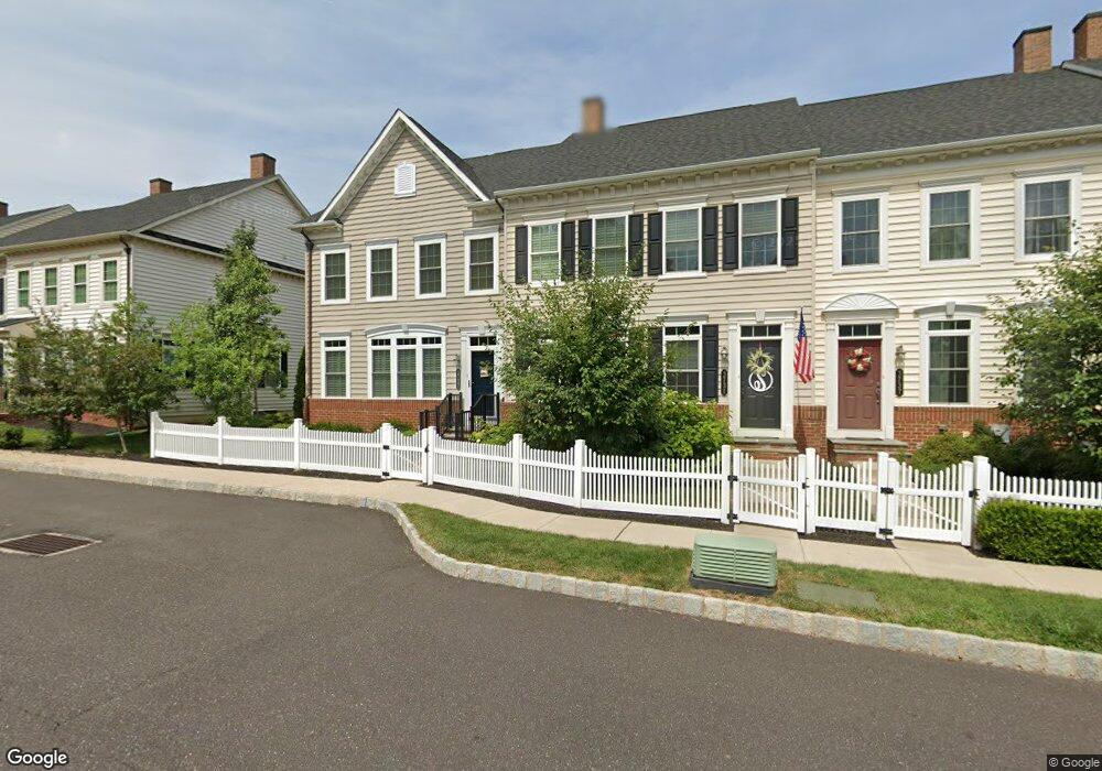
3727 William Daves Rd Doylestown, PA 18902
Plumstead NeighborhoodEstimated Value: $644,147 - $687,000
3
Beds
2
Baths
2,400
Sq Ft
$275/Sq Ft
Est. Value
About This Home
This home is located at 3727 William Daves Rd, Doylestown, PA 18902 and is currently estimated at $661,037, approximately $275 per square foot. 3727 William Daves Rd is a home with nearby schools including Groveland Elementary School, Tohickon Middle School, and Central Bucks High School-West.
Ownership History
Date
Name
Owned For
Owner Type
Purchase Details
Closed on
Jun 26, 2012
Sold by
Nvr Inc
Bought by
Cevasco Heather A and Platek John R
Current Estimated Value
Home Financials for this Owner
Home Financials are based on the most recent Mortgage that was taken out on this home.
Original Mortgage
$322,600
Outstanding Balance
$223,842
Interest Rate
3.78%
Mortgage Type
New Conventional
Estimated Equity
$437,195
Purchase Details
Closed on
Feb 2, 2012
Sold by
Carriage Hill Jv Llc
Bought by
Nvr Inc and Nv Homes
Create a Home Valuation Report for This Property
The Home Valuation Report is an in-depth analysis detailing your home's value as well as a comparison with similar homes in the area
Home Values in the Area
Average Home Value in this Area
Purchase History
| Date | Buyer | Sale Price | Title Company |
|---|---|---|---|
| Cevasco Heather A | $403,292 | None Available | |
| Nvr Inc | $810,000 | None Available |
Source: Public Records
Mortgage History
| Date | Status | Borrower | Loan Amount |
|---|---|---|---|
| Open | Cevasco Heather A | $322,600 |
Source: Public Records
Tax History Compared to Growth
Tax History
| Year | Tax Paid | Tax Assessment Tax Assessment Total Assessment is a certain percentage of the fair market value that is determined by local assessors to be the total taxable value of land and additions on the property. | Land | Improvement |
|---|---|---|---|---|
| 2025 | $8,041 | $46,280 | $3,640 | $42,640 |
| 2024 | $8,041 | $46,280 | $3,640 | $42,640 |
| 2023 | $7,786 | $46,280 | $3,640 | $42,640 |
| 2022 | $7,699 | $46,280 | $3,640 | $42,640 |
| 2021 | $7,613 | $46,280 | $3,640 | $42,640 |
| 2020 | $7,613 | $46,280 | $3,640 | $42,640 |
| 2019 | $7,566 | $46,280 | $3,640 | $42,640 |
| 2018 | $7,566 | $46,280 | $3,640 | $42,640 |
| 2017 | $7,462 | $46,280 | $3,640 | $42,640 |
| 2016 | $7,462 | $46,280 | $3,640 | $42,640 |
| 2015 | -- | $46,280 | $3,640 | $42,640 |
| 2014 | -- | $46,280 | $3,640 | $42,640 |
Source: Public Records
Map
Nearby Homes
- 3723 William Daves Rd
- 3765 William Daves Rd
- 4748 Bishop Cir
- 3838 Jacob Stout Rd
- 5437 Rinker Cir Unit 283
- 100 Bishops Gate Ln Unit 67
- 114 Blackfriars Cir
- 4263 Kleinot Dr
- 4317 Kleinot Dr
- 4464 Kleinot Dr
- 4330 Kleinot Dr
- 4246 Kleinot Dr
- 4298 Kleinot Dr
- 4306 Kleinot Dr
- 90 Chapman Ave
- 418 North St
- 3867 Charter Club Dr
- 62 Constitution Ave
- 1 Gatehouse Ln
- Lot 6 Henry Ct
- 3731 William Daves Rd
- 3737 William Daves Rd
- 3719 William Daves Rd
- 3741 William Daves Rd
- 3715 William Daves Rd
- 3711 William Daves Rd
- 3749 William Daves Rd
- 3707 William Daves Rd
- 3724 Christopher Day Rd
- 3736 Christopher Day Rd
- 3718 Christopher Day Rd
- 3753 William Daves Rd
- 3703 William Daves Rd
- 3742 Christopher Day Rd
- 3752 William Daves Rd Unit 8
- 3752 William Daves Rd
- 3752 William Daves Rd Unit 13
- 3752 William Daves Rd Unit 10
- 3752 William Daves Rd Unit 9
- 3752 William Daves Rd Unit 5