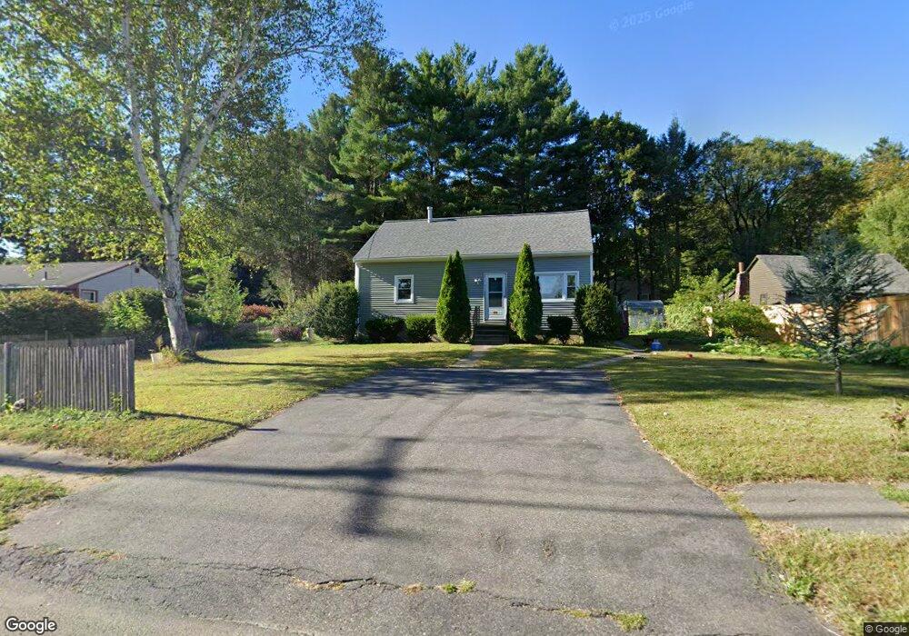
373 Bridge Rd Florence, MA 01062
Florence NeighborhoodEstimated Value: $476,000 - $663,000
4
Beds
2
Baths
1,722
Sq Ft
$317/Sq Ft
Est. Value
About This Home
This home is located at 373 Bridge Rd, Florence, MA 01062 and is currently estimated at $545,166, approximately $316 per square foot. 373 Bridge Rd is a home located in Hampshire County with nearby schools including Northampton High School, The Montessori School of Northampton, and Lander Grinspoon Academy.
Ownership History
Date
Name
Owned For
Owner Type
Purchase Details
Closed on
Jun 6, 1997
Sold by
Beaulieu Gail R
Bought by
Cheung Kwong Kuen and Li-Cheung Nim Wa
Current Estimated Value
Home Financials for this Owner
Home Financials are based on the most recent Mortgage that was taken out on this home.
Original Mortgage
$70,000
Outstanding Balance
$10,017
Interest Rate
7.98%
Mortgage Type
Purchase Money Mortgage
Estimated Equity
$535,149
Create a Home Valuation Report for This Property
The Home Valuation Report is an in-depth analysis detailing your home's value as well as a comparison with similar homes in the area
Home Values in the Area
Average Home Value in this Area
Purchase History
| Date | Buyer | Sale Price | Title Company |
|---|---|---|---|
| Cheung Kwong Kuen | $125,000 | -- |
Source: Public Records
Mortgage History
| Date | Status | Borrower | Loan Amount |
|---|---|---|---|
| Open | Cheung Kwong Kuen | $70,000 | |
| Previous Owner | Cheung Kwong Kuen | $100,000 | |
| Previous Owner | Cheung Kwong Kuen | $35,000 | |
| Previous Owner | Cheung Kwong Kuen | $88,300 |
Source: Public Records
Tax History
| Year | Tax Paid | Tax Assessment Tax Assessment Total Assessment is a certain percentage of the fair market value that is determined by local assessors to be the total taxable value of land and additions on the property. | Land | Improvement |
|---|---|---|---|---|
| 2025 | $5,473 | $392,900 | $121,500 | $271,400 |
| 2024 | $4,826 | $317,700 | $121,500 | $196,200 |
| 2023 | $4,055 | $256,000 | $110,400 | $145,600 |
| 2022 | $4,535 | $253,500 | $110,400 | $143,100 |
| 2021 | $3,901 | $224,600 | $105,400 | $119,200 |
| 2020 | $3,773 | $224,600 | $105,400 | $119,200 |
| 2019 | $3,557 | $204,800 | $90,400 | $114,400 |
| 2018 | $3,386 | $198,700 | $90,400 | $108,300 |
| 2017 | $3,316 | $198,700 | $90,400 | $108,300 |
| 2016 | $3,211 | $198,700 | $90,400 | $108,300 |
| 2015 | $3,435 | $217,400 | $90,400 | $127,000 |
| 2014 | $3,346 | $217,400 | $90,400 | $127,000 |
Source: Public Records
Map
Nearby Homes
- 575 Bridge Rd Unit 12-7
- 76 Maple St
- 67 Park St Unit A
- 67 Park St Unit B
- 2 Juniper Place
- 0 Terrace Ln
- 37 Landy Ave
- 88 Pines Edge Dr Unit 88
- 289 Hatfield St
- 32 Stonewall Dr
- 63 Riverside Dr
- 61 Woodlawn Ave
- 42 Clark St
- 80 Damon Rd Unit 5104
- 80 Damon Rd Unit 4302
- 14 Arlington St
- 53 E Center St
- 66 Laurel Park Unit 66
- 218 Elm St
- 61 Harrison Ave
- 389 Bridge Rd
- 379 Bridge Rd
- 253 Chestnut St
- 385 Bridge Rd
- 245 Chestnut St
- 391 Bridge St
- 264 Chestnut St
- 256 Chestnut St
- 384 Bridge Rd
- 237 Chestnut St
- 395 Bridge Rd
- 347 Bridge Rd
- 246 Chestnut St
- 394 Bridge Rd
- 229 Chestnut St
- 339 Bridge Rd
- 400 Bridge Rd
- 225 Chestnut St
- 226 Chestnut St
- 408 Bridge Rd Unit 3
Your Personal Tour Guide
Ask me questions while you tour the home.