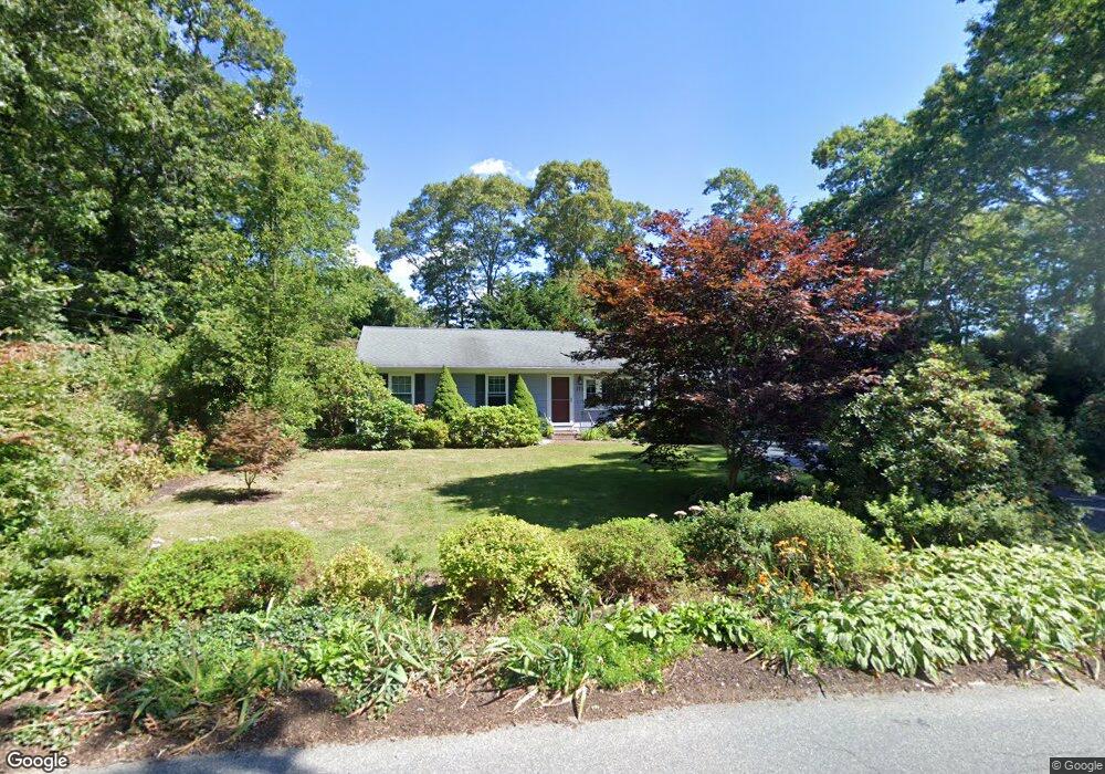
373 Locustfield Rd East Falmouth, MA 02536
Hatchville NeighborhoodEstimated Value: $603,000 - $730,000
3
Beds
2
Baths
1,501
Sq Ft
$429/Sq Ft
Est. Value
About This Home
This home is located at 373 Locustfield Rd, East Falmouth, MA 02536 and is currently estimated at $644,125, approximately $429 per square foot. 373 Locustfield Rd is a home located in Barnstable County with nearby schools including Mullen-Hall School, Morse Pond School, and Lawrence School.
Ownership History
Date
Name
Owned For
Owner Type
Purchase Details
Closed on
May 16, 2002
Sold by
Rich Patricia G
Bought by
Lynch Stephen J and Lynch Jean M
Current Estimated Value
Home Financials for this Owner
Home Financials are based on the most recent Mortgage that was taken out on this home.
Original Mortgage
$200,000
Interest Rate
7.15%
Mortgage Type
Purchase Money Mortgage
Create a Home Valuation Report for This Property
The Home Valuation Report is an in-depth analysis detailing your home's value as well as a comparison with similar homes in the area
Home Values in the Area
Average Home Value in this Area
Purchase History
| Date | Buyer | Sale Price | Title Company |
|---|---|---|---|
| Lynch Stephen J | $250,000 | -- | |
| Lynch Stephen J | $250,000 | -- |
Source: Public Records
Mortgage History
| Date | Status | Borrower | Loan Amount |
|---|---|---|---|
| Open | Lynch Stephen J | $162,799 | |
| Closed | Lynch Stephen J | $205,000 | |
| Closed | Lynch Stephen J | $200,000 |
Source: Public Records
Tax History Compared to Growth
Tax History
| Year | Tax Paid | Tax Assessment Tax Assessment Total Assessment is a certain percentage of the fair market value that is determined by local assessors to be the total taxable value of land and additions on the property. | Land | Improvement |
|---|---|---|---|---|
| 2025 | $2,803 | $477,500 | $144,800 | $332,700 |
| 2024 | $2,756 | $438,800 | $137,200 | $301,600 |
| 2023 | $2,733 | $394,900 | $137,200 | $257,700 |
| 2022 | $2,593 | $322,100 | $103,400 | $218,700 |
| 2021 | $2,509 | $295,200 | $98,900 | $196,300 |
| 2020 | $2,312 | $269,100 | $89,900 | $179,200 |
| 2019 | $2,214 | $258,700 | $89,900 | $168,800 |
| 2018 | $2,135 | $248,300 | $89,900 | $158,400 |
| 2017 | $2,072 | $242,900 | $89,900 | $153,000 |
| 2016 | $2,033 | $242,900 | $89,900 | $153,000 |
| 2015 | $1,989 | $242,900 | $89,900 | $153,000 |
| 2014 | $2,009 | $246,500 | $94,700 | $151,800 |
Source: Public Records
Map
Nearby Homes
- 12 Beach Plum Path
- 4 Josiah Path
- 7 Josiah Path
- 18 Josiah Path
- 20 Josiah Path
- 21 Josiah Path
- 30 Josiah Path
- 273 Sandwich Rd
- 149 Brick Kiln Rd
- 32 Jamie Ln
- 25 Percival Rd
- 17 Pinewood Dr
- 12 Rock Hollow Dr
- 63 Pine Valley Dr Unit 63 aka 30A
- 68 Deepwood Dr
- 59 Whitecaps Dr
- 131 Heritage Cir
- 70 Meredith Dr
- 100 Tanglewood Dr
- 34 Mckenna Ridge Rd
- 379 Locustfield Rd
- 369 Locustfield Rd
- 39 Mares Pond Dr
- 41 Mares Pond Dr
- 383 Locustfield Rd
- 31 Mares Pond Dr
- 372 Locustfield Rd
- 365 Locustfield Rd
- 376 Locustfield Rd
- 49 Mares Pond Dr
- 42 Mares Pond Dr
- 368 Locustfield Rd
- 25 Mares Pond Dr
- 46 Mares Pond Dr
- 38 Mares Pond Dr
- 393 Locustfield Rd
- 359 Locustfield Rd
- 382 Locustfield Rd
- 382A Locustfield Rd
- 16 Pattee Rd