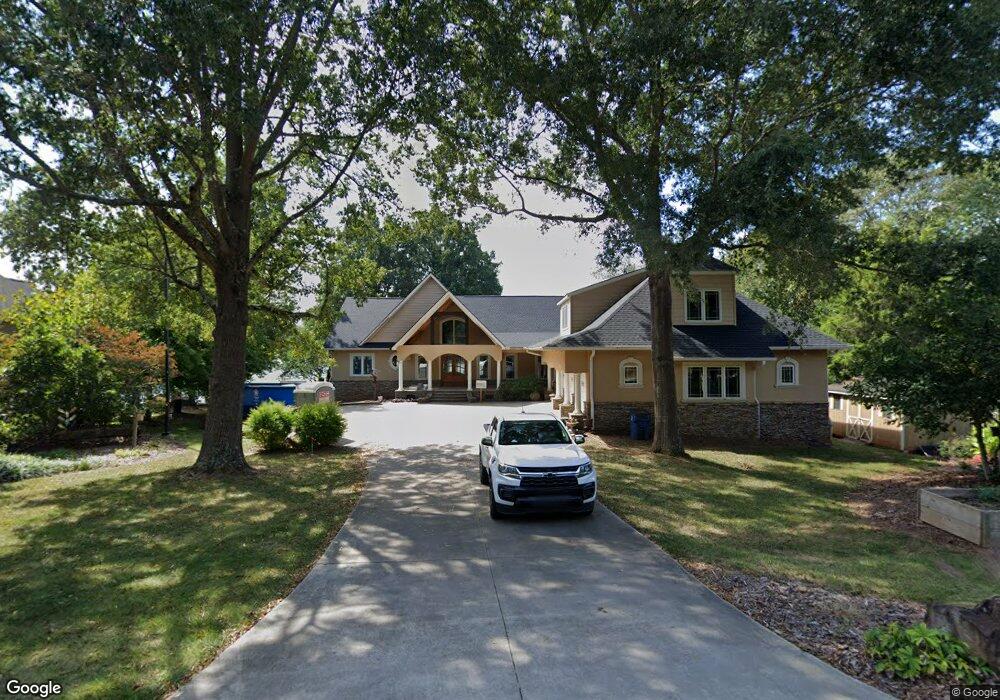
3731 Reid Cir Sherrills Ford, NC 28673
Estimated Value: $1,180,000 - $1,578,329
4
Beds
2
Baths
3,084
Sq Ft
$431/Sq Ft
Est. Value
About This Home
This home is located at 3731 Reid Cir, Sherrills Ford, NC 28673 and is currently estimated at $1,328,082, approximately $430 per square foot. 3731 Reid Cir is a home located in Catawba County with nearby schools including Bandys High School, Sherrills Ford Elementary School, and Mill Creek Middle School.
Ownership History
Date
Name
Owned For
Owner Type
Purchase Details
Closed on
Jul 24, 2013
Sold by
Andrews Mark A and Andrews Erin K
Bought by
Andrews Mark A and Andrews Erin K
Current Estimated Value
Purchase Details
Closed on
Jan 14, 2005
Sold by
Andrews Mark A and Andrews Erin K
Bought by
Andrews Mark A and Andrews Erin K
Home Financials for this Owner
Home Financials are based on the most recent Mortgage that was taken out on this home.
Original Mortgage
$610,500
Outstanding Balance
$307,416
Interest Rate
5.71%
Mortgage Type
Construction
Estimated Equity
$1,020,666
Purchase Details
Closed on
May 1, 1987
Bought by
Andrews Mark Anthony
Purchase Details
Closed on
Jun 14, 1984
Purchase Details
Closed on
Apr 28, 1976
Create a Home Valuation Report for This Property
The Home Valuation Report is an in-depth analysis detailing your home's value as well as a comparison with similar homes in the area
Home Values in the Area
Average Home Value in this Area
Purchase History
| Date | Buyer | Sale Price | Title Company |
|---|---|---|---|
| Andrews Mark A | -- | None Available | |
| Andrews Mark A | -- | None Available | |
| Andrews Mark Anthony | $103,500 | -- | |
| -- | $60,000 | -- | |
| -- | -- | -- |
Source: Public Records
Mortgage History
| Date | Status | Borrower | Loan Amount |
|---|---|---|---|
| Open | Andrews Mark A | $610,500 |
Source: Public Records
Tax History Compared to Growth
Tax History
| Year | Tax Paid | Tax Assessment Tax Assessment Total Assessment is a certain percentage of the fair market value that is determined by local assessors to be the total taxable value of land and additions on the property. | Land | Improvement |
|---|---|---|---|---|
| 2025 | $2,728 | $1,352,500 | $328,100 | $1,024,400 |
| 2024 | $2,728 | $553,900 | $328,100 | $225,800 |
| 2023 | $2,673 | $297,200 | $131,300 | $165,900 |
| 2022 | $2,095 | $297,200 | $131,300 | $165,900 |
| 2021 | $4,989 | $707,600 | $131,300 | $576,300 |
| 2020 | $4,989 | $707,600 | $131,300 | $576,300 |
| 2019 | $4,989 | $707,600 | $0 | $0 |
| 2018 | $4,430 | $646,700 | $131,300 | $515,400 |
| 2017 | $4,430 | $0 | $0 | $0 |
| 2016 | $4,430 | $0 | $0 | $0 |
| 2015 | $3,671 | $646,740 | $131,300 | $515,440 |
| 2014 | $3,671 | $611,900 | $131,300 | $480,600 |
Source: Public Records
Map
Nearby Homes
- 939 Exeter Dr
- 916 Exeter Dr
- 3861 Swanson Rd
- 6997 Waterstone Dr
- 0 Chevlot Hills Rd
- 3915 Chevlot Hills Rd
- 3565 Big Timber Dr
- 3578 Big Timber Dr
- 3678 Norman View Dr
- 7850 Fountaingrass Ln
- 3930 Norman View Dr
- 3645 Lake Bluff Dr
- 3538 Chubs Ln
- 3835 Norman View Dr
- 000 Slanting Bridge Rd
- 7869 Stillwater Dr
- 7883 Stillwater Dr
- 4159 Todd St
- 3595 Lake Bluff Dr
- 7264 Right Angle St
- 3743 Reid Cir
- 3717 Reid Cir
- 3711 Reid Cir
- 3705 Reid Cir
- 3693 Reid Cir
- 3809 Swanson Rd
- 3685 Reid Cir
- 3783 Reid Cir
- 3677 Reid Cir
- 3825 Swanson Rd
- 3665 Reid Cir
- 3839 Swanson Rd
- 3657 Reid Cir
- 3804 Swanson Rd
- 3816 Swanson Rd
- 3816 Swanson Rd Unit 161
- 3778 Dock Side Ln
- 3768 Dock Side Ln
- 3788 Swanson Rd
- 3788 Dock Side Ln