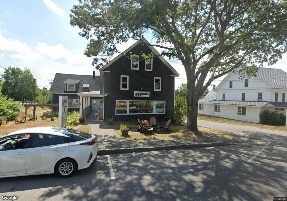
374 Main St New London, NH 03257
Estimated Value: $1,181,185
--
Bed
--
Bath
5,894
Sq Ft
$200/Sq Ft
Est. Value
About This Home
This home is located at 374 Main St, New London, NH 03257 and is currently estimated at $1,181,185, approximately $200 per square foot. 374 Main St is a home located in Merrimack County with nearby schools including Kearsarge Elementary School - New London, Kearsarge Regional Middle School, and Kearsarge Regional High School.
Ownership History
Date
Name
Owned For
Owner Type
Purchase Details
Closed on
May 1, 2003
Sold by
Charles G Ash T
Bought by
Matthew T Conway Llc
Current Estimated Value
Home Financials for this Owner
Home Financials are based on the most recent Mortgage that was taken out on this home.
Original Mortgage
$240,000
Outstanding Balance
$104,537
Interest Rate
5.82%
Mortgage Type
Commercial
Estimated Equity
$1,076,648
Create a Home Valuation Report for This Property
The Home Valuation Report is an in-depth analysis detailing your home's value as well as a comparison with similar homes in the area
Home Values in the Area
Average Home Value in this Area
Purchase History
| Date | Buyer | Sale Price | Title Company |
|---|---|---|---|
| Matthew T Conway Llc | $482,500 | -- |
Source: Public Records
Mortgage History
| Date | Status | Borrower | Loan Amount |
|---|---|---|---|
| Open | Matthew T Conway Llc | $240,000 |
Source: Public Records
Tax History Compared to Growth
Tax History
| Year | Tax Paid | Tax Assessment Tax Assessment Total Assessment is a certain percentage of the fair market value that is determined by local assessors to be the total taxable value of land and additions on the property. | Land | Improvement |
|---|---|---|---|---|
| 2024 | $8,539 | $735,500 | $269,800 | $465,700 |
| 2023 | $7,951 | $735,500 | $269,800 | $465,700 |
| 2022 | $8,506 | $536,300 | $219,800 | $316,500 |
| 2021 | $8,248 | $535,900 | $219,800 | $316,100 |
| 2020 | $8,006 | $535,900 | $219,800 | $316,100 |
| 2019 | $7,883 | $535,900 | $219,800 | $316,100 |
| 2018 | $7,055 | $552,000 | $220,100 | $331,900 |
| 2017 | $7,190 | $552,000 | $220,100 | $331,900 |
| 2016 | $7,037 | $552,000 | $220,100 | $331,900 |
| 2015 | $8,528 | $552,000 | $220,100 | $331,900 |
| 2014 | $8,451 | $552,000 | $220,100 | $331,900 |
| 2013 | $8,308 | $552,000 | $220,100 | $331,900 |
Source: Public Records
Map
Nearby Homes
- 27 Pipers Glen
- 385 Seamans Rd
- 158 Quail Run
- 0 Newport Rd Unit 10
- 58 Kearsarge Rd
- 106-23 Fieldstone Ln
- 10 Highland Ridge Rd
- 71 Hilltop Place
- 295 Andover Rd
- 195 Pine Hill Rd
- 712 Sugarhouse Rd
- 000 Shaker Rd Unit 288
- 273 Forest Acres Rd
- 0 Fairway Ln Unit 8
- 000 Farwell Ln Unit 17
- 0 Summit Rd Unit 431
- 155 Wilder Ln
- 00 Mountainside Dr Unit 183
- 617 & 619 Route 103a Map 91 Lot 37 38
- 0 Little Lake Sunapee Rd Unit 40 4989636
- 370 Main St Unit 2 & 3
- 370 Main St Unit 3rd Floor
- 370 Main St
- 394 Main St
- 406 Main St
- 353 Main St
- 420 Main St
- 428 Main St
- 428 Main St Unit 4, 2nd floor of the
- 428 Main St Unit Cottage Shop
- 253 Barrett Rd
- 88 Gould Rd
- 263 Barrett Rd
- 16 Whipple Ct
- 246 Barrett Rd
- 65 Gould Rd
- 22 Pleasant St
- 73 Gould Rd
- 108 Gould Rd
- 24 Pleasant St