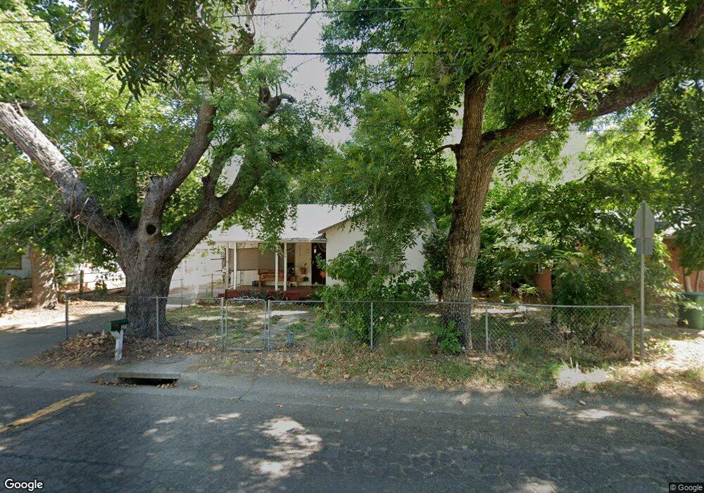
374 Rio St Redding, CA 96001
Parkview NeighborhoodEstimated Value: $176,000 - $247,000
2
Beds
1
Bath
1,036
Sq Ft
$209/Sq Ft
Est. Value
About This Home
This home is located at 374 Rio St, Redding, CA 96001 and is currently estimated at $216,670, approximately $209 per square foot. 374 Rio St is a home located in Shasta County with nearby schools including Juniper, Sequoia Middle School, and Shasta High School.
Ownership History
Date
Name
Owned For
Owner Type
Purchase Details
Closed on
Apr 30, 2024
Sold by
Bente Robert B
Bought by
Robert B Bente Revocable Trust and Bente
Current Estimated Value
Purchase Details
Closed on
Jan 20, 2012
Sold by
Bente Kim R
Bought by
Bente Robert B
Purchase Details
Closed on
Jul 11, 2002
Sold by
Bente Kim R
Bought by
Bente Robert B
Home Financials for this Owner
Home Financials are based on the most recent Mortgage that was taken out on this home.
Original Mortgage
$55,000
Interest Rate
6.7%
Mortgage Type
Purchase Money Mortgage
Purchase Details
Closed on
Sep 3, 1997
Sold by
Zeis Steven J and Zeis Donna L
Bought by
Bente Robert B and Bente Kim R
Home Financials for this Owner
Home Financials are based on the most recent Mortgage that was taken out on this home.
Original Mortgage
$55,200
Interest Rate
7.34%
Mortgage Type
Purchase Money Mortgage
Create a Home Valuation Report for This Property
The Home Valuation Report is an in-depth analysis detailing your home's value as well as a comparison with similar homes in the area
Home Values in the Area
Average Home Value in this Area
Purchase History
| Date | Buyer | Sale Price | Title Company |
|---|---|---|---|
| Robert B Bente Revocable Trust | -- | None Listed On Document | |
| Bente Robert B | -- | None Available | |
| Bente Robert B | -- | Fidelity National Title Co | |
| Bente Robert B | $69,000 | Fidelity National Title Co |
Source: Public Records
Mortgage History
| Date | Status | Borrower | Loan Amount |
|---|---|---|---|
| Previous Owner | Bente Robert B | $55,000 | |
| Previous Owner | Bente Robert B | $55,200 |
Source: Public Records
Tax History Compared to Growth
Tax History
| Year | Tax Paid | Tax Assessment Tax Assessment Total Assessment is a certain percentage of the fair market value that is determined by local assessors to be the total taxable value of land and additions on the property. | Land | Improvement |
|---|---|---|---|---|
| 2025 | $1,167 | $110,147 | $31,921 | $78,226 |
| 2024 | $1,149 | $107,989 | $31,296 | $76,693 |
| 2023 | $1,149 | $105,873 | $30,683 | $75,190 |
| 2022 | $1,129 | $103,798 | $30,082 | $73,716 |
| 2021 | $1,123 | $101,764 | $29,493 | $72,271 |
| 2020 | $1,137 | $100,721 | $29,191 | $71,530 |
| 2019 | $1,080 | $98,747 | $28,619 | $70,128 |
| 2018 | $1,090 | $96,811 | $28,058 | $68,753 |
| 2017 | $1,083 | $94,913 | $27,508 | $67,405 |
| 2016 | $1,049 | $93,053 | $26,969 | $66,084 |
| 2015 | $1,036 | $91,656 | $26,564 | $65,092 |
| 2014 | $1,029 | $89,861 | $26,044 | $63,817 |
Source: Public Records
Map
Nearby Homes
- 351 Weldon St
- 362 Revilo Dr
- 2940 Anita St
- 751 Leland Ct
- 804 Kite Ln
- 745 Parkview Ave
- 2590 Henderson Rd
- 2980 Wyndham Ln
- 3244 Veda St
- 1025 Parkview Ave
- 2630 Wyndham Ln
- 77 Wilshire Dr
- 3425 Riverview Dr
- 3835 Riverview Dr
- 3443 West St
- 2514 California St
- 3035 West St
- 3660-3671 Technology Way
- 3817 Thea Dr
- 760 Locust St