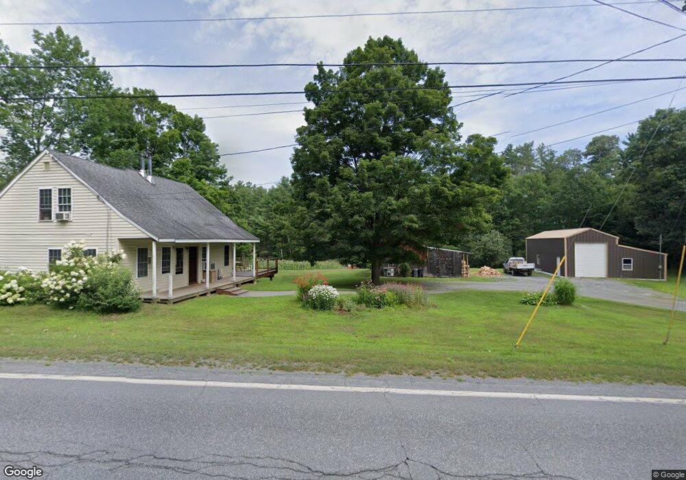
374 Route 12a Plainfield, NH 03781
Estimated Value: $398,650 - $513,000
3
Beds
3
Baths
1,442
Sq Ft
$316/Sq Ft
Est. Value
About This Home
This home is located at 374 Route 12a, Plainfield, NH 03781 and is currently estimated at $455,883, approximately $316 per square foot. 374 Route 12a is a home located in Sullivan County with nearby schools including Plainfield Elementary School, Lebanon High School, and Estabrook Christian School.
Ownership History
Date
Name
Owned For
Owner Type
Purchase Details
Closed on
Mar 1, 2006
Sold by
Drye Robert C and Drye Margaret M
Bought by
Unknown
Current Estimated Value
Home Financials for this Owner
Home Financials are based on the most recent Mortgage that was taken out on this home.
Original Mortgage
$92,000
Interest Rate
6.16%
Mortgage Type
Purchase Money Mortgage
Create a Home Valuation Report for This Property
The Home Valuation Report is an in-depth analysis detailing your home's value as well as a comparison with similar homes in the area
Home Values in the Area
Average Home Value in this Area
Purchase History
| Date | Buyer | Sale Price | Title Company |
|---|---|---|---|
| Unknown | $115,000 | -- |
Source: Public Records
Mortgage History
| Date | Status | Borrower | Loan Amount |
|---|---|---|---|
| Open | Unknown | $156,998 | |
| Closed | Unknown | $17,500 | |
| Closed | Unknown | $152,000 | |
| Closed | Unknown | $92,000 |
Source: Public Records
Tax History Compared to Growth
Tax History
| Year | Tax Paid | Tax Assessment Tax Assessment Total Assessment is a certain percentage of the fair market value that is determined by local assessors to be the total taxable value of land and additions on the property. | Land | Improvement |
|---|---|---|---|---|
| 2023 | $5,938 | $377,000 | $149,800 | $227,200 |
| 2022 | $5,545 | $222,700 | $74,900 | $147,800 |
| 2021 | $5,913 | $222,700 | $74,900 | $147,800 |
| 2020 | $5,624 | $221,400 | $74,900 | $146,500 |
| 2019 | $5,756 | $221,400 | $74,900 | $146,500 |
| 2018 | $4,347 | $221,400 | $74,900 | $146,500 |
| 2017 | $4,170 | $185,900 | $64,300 | $121,600 |
| 2016 | $4,590 | $161,900 | $64,300 | $97,600 |
| 2015 | $4,412 | $161,900 | $64,300 | $97,600 |
| 2014 | $4,452 | $161,900 | $64,300 | $97,600 |
| 2013 | $4,452 | $161,900 | $64,300 | $97,600 |
Source: Public Records
Map
Nearby Homes
- 40 Mill St
- 00 Nh Route 12a Unit 7
- 654 Us Route 5
- 149 Old County Rd
- 6 Rockwood St
- 25 Maxfield Ln
- 846 New Hampshire 12a
- 66 Webster Rd
- 56 Mount Hunger Rd
- 561 Neal Rd
- 25 Independent Dr
- 286 Ladieu Rd
- 00 Willow Brook Rd
- 527 Neal Rd
- 0 Freeman Rd Unit 22
- 1118 New Hampshire 12a
- 6 Blodgett Ln
- 10 Bischoff Ln
- 1041 Stage Rd
- 89 Route 12