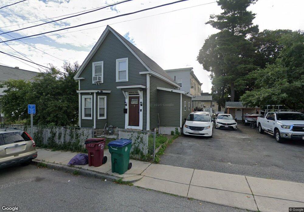
374 Walker St Lowell, MA 01851
Lower Highlands NeighborhoodEstimated Value: $434,000 - $496,000
4
Beds
1
Bath
1,695
Sq Ft
$278/Sq Ft
Est. Value
About This Home
This home is located at 374 Walker St, Lowell, MA 01851 and is currently estimated at $471,233, approximately $278 per square foot. 374 Walker St is a home located in Middlesex County with nearby schools including Charles W. Morey Elementary School, Abraham Lincoln Elementary School, and Joseph McAvinnue Elementary School.
Ownership History
Date
Name
Owned For
Owner Type
Purchase Details
Closed on
Apr 15, 1997
Sold by
Moloney Mary
Bought by
Horl Chhlav and Suon Soeung
Current Estimated Value
Home Financials for this Owner
Home Financials are based on the most recent Mortgage that was taken out on this home.
Original Mortgage
$61,700
Interest Rate
7.55%
Mortgage Type
Purchase Money Mortgage
Create a Home Valuation Report for This Property
The Home Valuation Report is an in-depth analysis detailing your home's value as well as a comparison with similar homes in the area
Home Values in the Area
Average Home Value in this Area
Purchase History
| Date | Buyer | Sale Price | Title Company |
|---|---|---|---|
| Horl Chhlav | $65,000 | -- | |
| Horl Chhlav | $65,000 | -- |
Source: Public Records
Mortgage History
| Date | Status | Borrower | Loan Amount |
|---|---|---|---|
| Open | Horl Chhlav | $65,975 | |
| Closed | Horl Chhlav | $61,700 | |
| Previous Owner | Horl Chhlav | $55,000 |
Source: Public Records
Tax History
| Year | Tax Paid | Tax Assessment Tax Assessment Total Assessment is a certain percentage of the fair market value that is determined by local assessors to be the total taxable value of land and additions on the property. | Land | Improvement |
|---|---|---|---|---|
| 2025 | $4,614 | $401,900 | $153,600 | $248,300 |
| 2024 | $4,433 | $372,200 | $138,200 | $234,000 |
| 2023 | $4,166 | $335,400 | $120,200 | $215,200 |
| 2022 | $3,886 | $306,200 | $109,300 | $196,900 |
| 2021 | $3,619 | $268,900 | $95,000 | $173,900 |
| 2020 | $3,315 | $248,100 | $83,000 | $165,100 |
| 2019 | $3,079 | $219,300 | $76,900 | $142,400 |
| 2018 | $2,961 | $205,800 | $70,000 | $135,800 |
| 2017 | $2,854 | $191,300 | $63,600 | $127,700 |
| 2016 | $2,688 | $177,300 | $60,600 | $116,700 |
| 2015 | $2,632 | $170,000 | $62,000 | $108,000 |
| 2013 | $2,367 | $157,700 | $74,100 | $83,600 |
Source: Public Records
Map
Nearby Homes
- 312 Wilder St
- 3 Butman Place
- 19 Lawton St
- 11 Warwick St Unit 3
- 137 Pine St Unit 11
- 17 Edson St
- 42 Branch St
- 68 Smith St
- 18 Burgess St
- 49 Marginal St
- 45 Harvard St Unit 5 3rd fl
- 710 School St
- 15 Barclay St
- 173 Princeton Blvd
- 45 Marshall St
- 85 B St
- 1311 Middlesex St
- 694 Westford St
- 186 Powell St
- 57 Wannalancit St Unit 6
- 96 Grove St Unit 2
- 98 Grove St Unit 2
- 98 Grove St Unit 3
- 96 Grove St Unit 1
- 96 Grove St Unit 3
- 366 Walker St
- 1 Wellington Square
- 116 Grove St
- 388 Walker St
- 97 Grove St
- 383 Walker St
- 377 Walker St
- 90 Grove St
- 363 Walker St
- 3 Wellington Square
- 3 Wellington Square
- 356 Walker St
- 351A Walker St
- 126 Grove St
- 29 Manahan St Unit 4
Your Personal Tour Guide
Ask me questions while you tour the home.