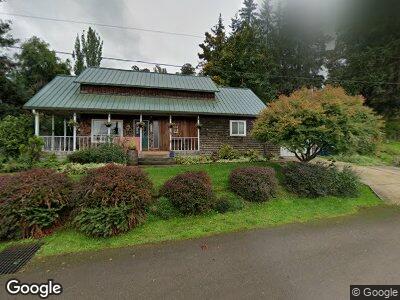
375 4th St Scotts Mills, OR 97375
Estimated Value: $415,467 - $488,000
1
Bed
2
Baths
2,170
Sq Ft
$206/Sq Ft
Est. Value
About This Home
This home is located at 375 4th St, Scotts Mills, OR 97375 and is currently estimated at $447,367, approximately $206 per square foot. 375 4th St is a home with nearby schools including Scotts Mills Elementary School and Silverton High School.
Ownership History
Date
Name
Owned For
Owner Type
Purchase Details
Closed on
Aug 29, 2002
Sold by
Sirr Victor M and Sirr Pauline F
Bought by
Hawkins Clifton W and Hawkins Lisa
Current Estimated Value
Home Financials for this Owner
Home Financials are based on the most recent Mortgage that was taken out on this home.
Original Mortgage
$147,250
Interest Rate
5.21%
Mortgage Type
Purchase Money Mortgage
Create a Home Valuation Report for This Property
The Home Valuation Report is an in-depth analysis detailing your home's value as well as a comparison with similar homes in the area
Home Values in the Area
Average Home Value in this Area
Purchase History
| Date | Buyer | Sale Price | Title Company |
|---|---|---|---|
| Hawkins Clifton W | $155,000 | First American |
Source: Public Records
Mortgage History
| Date | Status | Borrower | Loan Amount |
|---|---|---|---|
| Open | Hawkins Clifton W | $2,500,000 | |
| Closed | Hawkins Clifton W | $168,500 | |
| Closed | Hawkins Clifton W | $182,390 | |
| Closed | Hawkins Clifton W | $180,000 | |
| Closed | Hawkins Clifton W | $147,000 | |
| Closed | Hawkins Clifton W | $147,250 |
Source: Public Records
Tax History Compared to Growth
Tax History
| Year | Tax Paid | Tax Assessment Tax Assessment Total Assessment is a certain percentage of the fair market value that is determined by local assessors to be the total taxable value of land and additions on the property. | Land | Improvement |
|---|---|---|---|---|
| 2024 | $2,147 | $164,190 | -- | -- |
| 2023 | $2,093 | $159,410 | $0 | $0 |
| 2022 | $1,983 | $154,770 | $0 | $0 |
| 2021 | $1,929 | $150,270 | $0 | $0 |
| 2020 | $1,881 | $145,900 | $0 | $0 |
| 2019 | $1,824 | $141,660 | $0 | $0 |
| 2018 | $1,830 | $0 | $0 | $0 |
| 2017 | $1,790 | $0 | $0 | $0 |
| 2016 | $1,747 | $0 | $0 | $0 |
| 2015 | $1,696 | $0 | $0 | $0 |
| 2014 | $1,647 | $0 | $0 | $0 |
Source: Public Records
Map
Nearby Homes
- 291 Grandview Ave
- 0 Crooked Finger Rd NE Unit 827344
- 0 Crooked Finger Rd NE Unit 265826977
- 000 Crooked Finger Rd NE
- 823 Terrace Dr
- 0 Off of Crooked Finge Rd
- 0 Crooked Finger (Lot 1600 Off Of) Rd
- 7118 Grandview Ave
- 0 Hazelnut Ridge Rd
- 37486 S Hwy 213 (Adj To)
- 37486 S Highway 213 (Adj To)
- 5952 Peaks View Rd NE
- 6057 Peaceful Ln NE
- 20739 Hazelnut Ridge Rd
- 17576 Abiqua Rd NE
- 17857 S Abiqua Rd NE
- 10471 Wagon Rd NE
- 3647 Briar Knob Loop
- 35267 S Acer Ln
- 4194 Davis Creek Rd NE