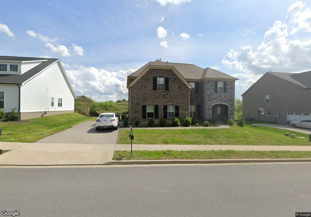
375 Cloverbrook Way Gallatin, TN 37066
Estimated Value: $589,000 - $621,000
4
Beds
4
Baths
2,980
Sq Ft
$203/Sq Ft
Est. Value
About This Home
This home is located at 375 Cloverbrook Way, Gallatin, TN 37066 and is currently estimated at $604,012, approximately $202 per square foot. 375 Cloverbrook Way is a home located in Sumner County with nearby schools including Station Camp High School.
Ownership History
Date
Name
Owned For
Owner Type
Purchase Details
Closed on
Jan 25, 2022
Sold by
Deluca Matthew E and Deluca Kimberly N
Bought by
Deluca Matthew E
Current Estimated Value
Home Financials for this Owner
Home Financials are based on the most recent Mortgage that was taken out on this home.
Original Mortgage
$448,000
Outstanding Balance
$416,052
Interest Rate
3.56%
Mortgage Type
New Conventional
Estimated Equity
$187,960
Purchase Details
Closed on
Feb 12, 2021
Sold by
Clayton Properties Group Inc
Bought by
Deluca Matthew E and Deluca Kimberly N
Home Financials for this Owner
Home Financials are based on the most recent Mortgage that was taken out on this home.
Original Mortgage
$400,639
Interest Rate
2.65%
Mortgage Type
New Conventional
Create a Home Valuation Report for This Property
The Home Valuation Report is an in-depth analysis detailing your home's value as well as a comparison with similar homes in the area
Home Values in the Area
Average Home Value in this Area
Purchase History
| Date | Buyer | Sale Price | Title Company |
|---|---|---|---|
| Deluca Matthew E | -- | Windsor John O | |
| Deluca Matthew E | -- | None Listed On Document | |
| Deluca Matthew E | $421,726 | None Available |
Source: Public Records
Mortgage History
| Date | Status | Borrower | Loan Amount |
|---|---|---|---|
| Open | Deluca Matthew E | $448,000 | |
| Closed | Deluca Matthew E | $448,000 | |
| Previous Owner | Deluca Matthew E | $400,639 |
Source: Public Records
Tax History Compared to Growth
Tax History
| Year | Tax Paid | Tax Assessment Tax Assessment Total Assessment is a certain percentage of the fair market value that is determined by local assessors to be the total taxable value of land and additions on the property. | Land | Improvement |
|---|---|---|---|---|
| 2024 | $1,992 | $140,175 | $22,500 | $117,675 |
| 2023 | $2,938 | $96,250 | $12,000 | $84,250 |
| 2022 | $2,947 | $96,250 | $12,000 | $84,250 |
| 2021 | $2,947 | $96,250 | $12,000 | $84,250 |
| 2020 | $367 | $96,250 | $12,000 | $84,250 |
Source: Public Records
Map
Nearby Homes
- 101 Santa Rosa Dr
- 319 Cloverbrook Way
- 315 Gulfstream Dr
- 2039 Liberty Ln
- 170 Upper Station Camp Crk Rd
- 402 Upper Station Camp Crk Rd
- 149 Upper Station Camp Crk Rd
- 1935 Liberty Ln
- 337 Carellton Dr
- 137 Cavalcade Loop
- 360 Turfway Park
- The Ridgeport Plan at Carellton
- 249 Cavalcade Loop
- 172 Cavalcade Loop
- 308 Cheval Dr
- 427 Deveron Dr
- 1019 Lacebark Ln
- 1033 Merrick Rd
- 1080 Abberley Cir
- 2436 Long Hollow Pike
- 371 Cloverbrook Way
- 379 Cloverbrook Way
- 367 Cloverbrook Way
- 372 Cloverbrook Way
- 368 Cloverbrook Way
- 364 Cloverbrook Way
- 376 Cloverbrook Way
- 363 Cloverbrook Way
- 360 Cloverbrook Way
- 360 Cloverbrook Way
- 225 Ferdinand Dr
- 380 Cloverbrook Way
- 359 Cloverbrook Way
- 359 Cloverbrook Way
- 356 Cloverbrook Way
- 300 Cloverbrook Way
- 355 Cloverbrook Way
- 352 Cloverbrook Way
- 351 Cloverbrook Way
- 61 Grindstone Dr