--
Bed
2
Baths
2,237
Sq Ft
2.4
Acres
About This Home
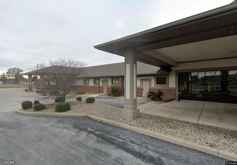
This home is located at 375 N Eastown Rd, Lima, OH 45807. 375 N Eastown Rd is a home located in Allen County with nearby schools including Maplewood Elementary School, Elmwood Elementary School, and Shawnee Middle School.
Ownership History
Date
Name
Owned For
Owner Type
Purchase Details
Closed on
Sep 13, 2011
Sold by
Westside Swim & Racquet Club
Bought by
West Ohio Medical Office Holding Company
Home Financials for this Owner
Home Financials are based on the most recent Mortgage that was taken out on this home.
Original Mortgage
$75,000
Interest Rate
4.09%
Mortgage Type
Commercial
Purchase Details
Closed on
Jun 7, 2005
Sold by
Thornock Margaret L and Thonock James M
Bought by
West Ohio Medical Office Holding Company
Home Financials for this Owner
Home Financials are based on the most recent Mortgage that was taken out on this home.
Original Mortgage
$250,000
Interest Rate
5.91%
Mortgage Type
Commercial
Purchase Details
Closed on
Oct 20, 1993
Sold by
Thornock Margaret L
Bought by
Kahle Marie
Purchase Details
Closed on
Apr 20, 1992
Bought by
Kahle Marie
Create a Home Valuation Report for This Property
The Home Valuation Report is an in-depth analysis detailing your home's value as well as a comparison with similar homes in the area
Home Values in the Area
Average Home Value in this Area
Purchase History
| Date | Buyer | Sale Price | Title Company |
|---|---|---|---|
| West Ohio Medical Office Holding Company | $100,000 | None Available | |
| West Ohio Medical Office Holding Company | $250,000 | None Available | |
| Kahle Marie | -- | -- | |
| Kahle Marie | -- | -- |
Source: Public Records
Mortgage History
| Date | Status | Borrower | Loan Amount |
|---|---|---|---|
| Previous Owner | West Ohio Medical Office Holding Company | $75,000 | |
| Previous Owner | West Ohio Medical Office Holding Company | $250,000 |
Source: Public Records
Tax History Compared to Growth
Tax History
| Year | Tax Paid | Tax Assessment Tax Assessment Total Assessment is a certain percentage of the fair market value that is determined by local assessors to be the total taxable value of land and additions on the property. | Land | Improvement |
|---|---|---|---|---|
| 2024 | $25,018 | $444,610 | $20,620 | $423,990 |
| 2023 | $24,970 | $404,190 | $18,730 | $385,460 |
| 2022 | $25,094 | $404,190 | $18,730 | $385,460 |
| 2021 | $25,126 | $404,190 | $18,730 | $385,460 |
| 2020 | $23,382 | $391,090 | $11,270 | $379,820 |
| 2019 | $23,382 | $391,090 | $11,270 | $379,820 |
| 2018 | $23,294 | $391,090 | $11,270 | $379,820 |
| 2017 | $23,271 | $391,090 | $11,270 | $379,820 |
| 2016 | $23,927 | $391,090 | $11,270 | $379,820 |
| 2015 | $17,913 | $391,090 | $11,270 | $379,820 |
| 2014 | $17,913 | $295,610 | $11,270 | $284,340 |
| 2013 | $16,571 | $295,610 | $11,270 | $284,340 |
Source: Public Records
Map
Nearby Homes
- 2956 W High St
- N/A Eastown Rd N
- 2940 Koop Rd
- 2925 Koop Rd
- 3948 Chestnut Oak Trail
- 391 N Fernwood Dr
- 2964 Hanover Dr
- 2958 Hanover Dr
- 2700 Lowell Ave
- 00 Seriff
- 1392 Chancellor Dr
- 2921 Canterbury Dr
- 704 Bentwood Dr
- 514 N Cable Rd
- 0 Springview Dr
- 00 Allentown Rd
- 0 Allentown Rd
- 209 N Dale Dr
- 2050 W Market St
- 2997 Cletus Pkwy