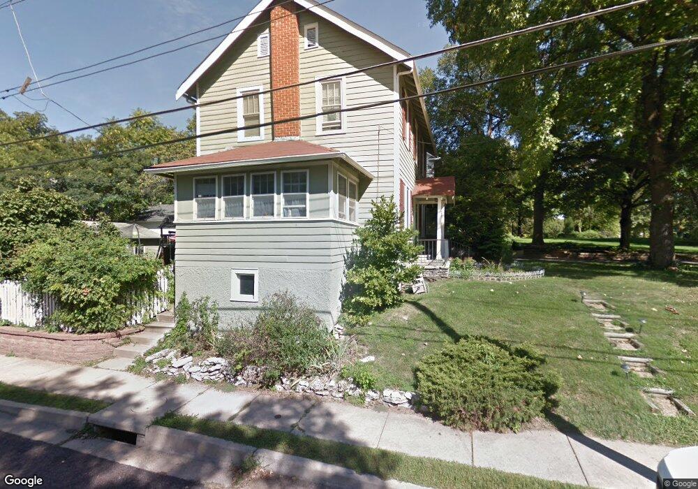
375 S Maple Ave Saint Louis, MO 63119
Estimated Value: $460,329 - $580,000
3
Beds
1
Bath
1,699
Sq Ft
$308/Sq Ft
Est. Value
About This Home
This home is located at 375 S Maple Ave, Saint Louis, MO 63119 and is currently estimated at $524,082, approximately $308 per square foot. 375 S Maple Ave is a home located in St. Louis County with nearby schools including Bristol Elementary School, Hixson Middle School, and Webster Groves High School.
Ownership History
Date
Name
Owned For
Owner Type
Purchase Details
Closed on
Mar 4, 2005
Sold by
Heyl Thomas J and Heyle Thomas J
Bought by
Schroeder Kevin J and Schroeder Aidan H
Current Estimated Value
Home Financials for this Owner
Home Financials are based on the most recent Mortgage that was taken out on this home.
Original Mortgage
$276,800
Outstanding Balance
$139,382
Interest Rate
5.71%
Mortgage Type
New Conventional
Estimated Equity
$384,700
Purchase Details
Closed on
Mar 31, 2004
Sold by
Nesbitt Teresa L
Bought by
Nesbitt Teresa L
Purchase Details
Closed on
Jul 30, 2003
Sold by
Dollison Cathy A and Dollison James
Bought by
Nesbitt Teresa L
Purchase Details
Closed on
Mar 15, 2003
Sold by
Thomas Milam Porter and Trail Jan
Bought by
Nesbitt Teresa L
Create a Home Valuation Report for This Property
The Home Valuation Report is an in-depth analysis detailing your home's value as well as a comparison with similar homes in the area
Home Values in the Area
Average Home Value in this Area
Purchase History
| Date | Buyer | Sale Price | Title Company |
|---|---|---|---|
| Schroeder Kevin J | $346,000 | -- | |
| Nesbitt Teresa L | -- | -- | |
| Nesbitt Teresa L | $55,000 | -- | |
| Nesbitt Teresa L | -- | -- |
Source: Public Records
Mortgage History
| Date | Status | Borrower | Loan Amount |
|---|---|---|---|
| Open | Schroeder Kevin J | $276,800 |
Source: Public Records
Tax History
| Year | Tax Paid | Tax Assessment Tax Assessment Total Assessment is a certain percentage of the fair market value that is determined by local assessors to be the total taxable value of land and additions on the property. | Land | Improvement |
|---|---|---|---|---|
| 2025 | $5,327 | $94,750 | $68,400 | $26,350 |
| 2024 | $5,327 | $76,710 | $47,030 | $29,680 |
| 2023 | $5,327 | $76,710 | $47,030 | $29,680 |
| 2022 | $4,898 | $65,760 | $47,030 | $18,730 |
| 2021 | $4,882 | $65,760 | $47,030 | $18,730 |
| 2020 | $5,320 | $66,800 | $52,590 | $14,210 |
| 2019 | $5,289 | $66,800 | $52,590 | $14,210 |
| 2018 | $4,887 | $54,780 | $42,750 | $12,030 |
| 2017 | $4,854 | $54,780 | $42,750 | $12,030 |
| 2016 | $4,460 | $48,150 | $34,200 | $13,950 |
| 2015 | $4,472 | $48,150 | $34,200 | $13,950 |
| 2014 | $4,035 | $42,240 | $16,420 | $25,820 |
Source: Public Records
Map
Nearby Homes
- 321 S Elm Ave
- 539 Colebrook Dr Unit B
- 514 S Gore Ave
- 324 Stark Ct
- 426 Pasadena Ave
- 210 Jefferson Rd
- 8361 Big Bend Blvd
- 319 Baker Ave
- 475 Catalina Ave
- 618 S Rock Hill Rd
- 450 E Lockwood Ave Unit 303
- 1116 S Elm Ave
- 581 W Lockwood Ave
- 443 Sherwood Dr
- 804 Edgar Rd
- 106 Mason Ave
- 439 Landscape Ct
- 1139 Hawken Place Unit 6
- 400 Corona Ct
- 1330 Drayton Ave
- 369 S Maple Ave
- 58 E Jackson Rd
- 365 S Maple Ave
- 8623 Big Bend Blvd
- 33 E Jackson Rd
- 8627 Big Bend Blvd
- 60 E Jackson Rd
- 8631 Big Bend Blvd
- 36 E Jackson Rd
- 370 S Maple Ave
- 34 E Jackson Rd
- 21 E Jackson Rd
- 361 S Maple Ave
- 15 E Jackson Rd
- 362 S Maple Ave
- 8620 Big Bend Blvd
- 351 S Maple Ave
- 8575 Big Bend Blvd
- 8637 Big Bend Blvd
- 9 E Jackson Rd
Your Personal Tour Guide
Ask me questions while you tour the home.