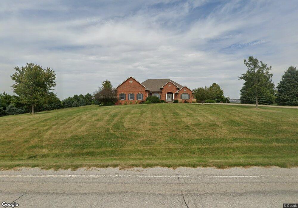
3754 500th St SW Riverside, IA 52327
Estimated Value: $628,000 - $796,914
2
Beds
4
Baths
2,843
Sq Ft
$252/Sq Ft
Est. Value
About This Home
This home is located at 3754 500th St SW, Riverside, IA 52327 and is currently estimated at $716,638, approximately $252 per square foot. 3754 500th St SW is a home located in Johnson County with nearby schools including Hills Elementary School, Northwest Junior High School, and West High School.
Ownership History
Date
Name
Owned For
Owner Type
Purchase Details
Closed on
Dec 13, 2023
Sold by
Stutsman Roger C and Stutsman Sally A
Bought by
Roger C Stutsman Revocable Trust and Stutsman
Current Estimated Value
Create a Home Valuation Report for This Property
The Home Valuation Report is an in-depth analysis detailing your home's value as well as a comparison with similar homes in the area
Home Values in the Area
Average Home Value in this Area
Purchase History
| Date | Buyer | Sale Price | Title Company |
|---|---|---|---|
| Roger C Stutsman Revocable Trust | -- | None Listed On Document | |
| Sally A Stutsman Revocable Trust | -- | None Listed On Document | |
| Roger C Stutsman Revocable Trust | -- | None Listed On Document | |
| Roger C Stutsman Revocable Trust | -- | None Listed On Document |
Source: Public Records
Tax History Compared to Growth
Tax History
| Year | Tax Paid | Tax Assessment Tax Assessment Total Assessment is a certain percentage of the fair market value that is determined by local assessors to be the total taxable value of land and additions on the property. | Land | Improvement |
|---|---|---|---|---|
| 2024 | $7,514 | $578,900 | $2,300 | $576,600 |
| 2023 | $7,398 | $578,900 | $2,300 | $576,600 |
| 2022 | $6,964 | $490,300 | $1,800 | $488,500 |
| 2021 | $6,936 | $490,400 | $1,900 | $488,500 |
| 2020 | $6,936 | $467,000 | $1,700 | $465,300 |
| 2019 | $7,048 | $467,000 | $1,700 | $465,300 |
| 2018 | $6,918 | $467,800 | $0 | $0 |
| 2017 | $6,654 | $468,000 | $2,700 | $465,300 |
| 2016 | $6,366 | $447,800 | $2,700 | $445,100 |
| 2015 | $6,366 | $447,800 | $2,700 | $445,100 |
| 2014 | $5,802 | $407,100 | $3,000 | $404,100 |
Source: Public Records
Map
Nearby Homes
- 260 Knoll Ridge Dr
- 110 Oak Crest Hill Rd SE
- 250 Knoll Ridge Dr
- 111 Oak Ridge Ave
- 5319 Oak Crest Hill Rd SE
- 5241 Oak Crest Hill Rd SE
- 5239 Oak Crest Hill Rd SE
- 5211 Oak Crest Hill Rd SE
- 5231 Oak Crest Hill Rd SE
- 201 Sierra Park Dr
- 5317 Oak Crest Hill Rd SE
- 121 Brady St
- Tbd Maier Ave SW
- 4591 Sand Rd SE
- 4589 Sand Rd SE
- TBD Maier Ave SW
- 3744 Lacina Dr SW
- 0 Soccer Park Rd at Napoleon St SE Unit NOC6329595
- 0 Napoleon St SE
- Rr Napoleon St SE
- 3776 500th St SW
- 3714 500th St SW
- 3810 500th St SW
- 3690 500th St SW
- 5024 Frantz Ln
- 5029 Frantz Ln
- 4956 No Where Ave SW
- 3911 500th St SW
- 5255 Ruppenkamps Rd SW
- 3916 500th St SW
- 5245 Observatory Ave SW
- 5249 Observatory Ave SW
- 5243 Jenn Mill Rd SW
- 5241 Jenn Mill Rd SW
- 5195 Naples Ave SW
- 5237 Jenn Mill Rd SW
- 5255 Jenn Mill Rd SW
- 5279 Observatory Ave SW
- 5285 Ruppenkamps Rd SW
- 5261 Jenn Mill Rd SW