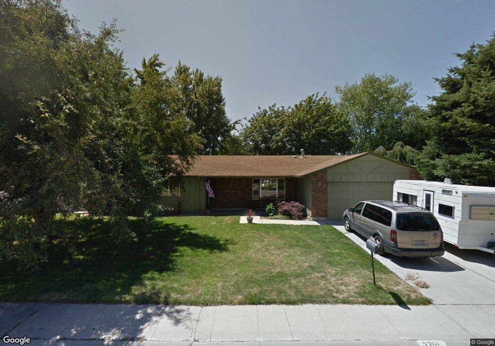
3761 Elgin Way Boise, ID 83713
West Boise NeighborhoodEstimated Value: $424,520 - $447,000
3
Beds
2
Baths
1,520
Sq Ft
$284/Sq Ft
Est. Value
About This Home
This home is located at 3761 Elgin Way, Boise, ID 83713 and is currently estimated at $432,130, approximately $284 per square foot. 3761 Elgin Way is a home located in Ada County with nearby schools including Frontier Elementary School, Lowell Scott Middle School, and Centennial High School.
Ownership History
Date
Name
Owned For
Owner Type
Purchase Details
Closed on
May 29, 2025
Sold by
Jennings Brian Glenn and Jennings Heather Herrick
Bought by
Jennings Family Trust and Jennings
Current Estimated Value
Purchase Details
Closed on
Jan 5, 2016
Sold by
Jennings Brian
Bought by
Jennings Brian and Jennings Heather
Home Financials for this Owner
Home Financials are based on the most recent Mortgage that was taken out on this home.
Original Mortgage
$123,000
Interest Rate
3.14%
Mortgage Type
New Conventional
Create a Home Valuation Report for This Property
The Home Valuation Report is an in-depth analysis detailing your home's value as well as a comparison with similar homes in the area
Home Values in the Area
Average Home Value in this Area
Purchase History
| Date | Buyer | Sale Price | Title Company |
|---|---|---|---|
| Jennings Family Trust | -- | None Listed On Document | |
| Jennings Brian | -- | Titleone Boise |
Source: Public Records
Mortgage History
| Date | Status | Borrower | Loan Amount |
|---|---|---|---|
| Previous Owner | Jennings Brian | $123,000 |
Source: Public Records
Tax History Compared to Growth
Tax History
| Year | Tax Paid | Tax Assessment Tax Assessment Total Assessment is a certain percentage of the fair market value that is determined by local assessors to be the total taxable value of land and additions on the property. | Land | Improvement |
|---|---|---|---|---|
| 2025 | $2,371 | $381,200 | -- | -- |
| 2024 | $2,497 | $358,600 | -- | -- |
| 2023 | $2,497 | $358,800 | $0 | $0 |
| 2022 | $2,795 | $414,000 | $0 | $0 |
| 2021 | $2,813 | $320,900 | $0 | $0 |
| 2020 | $2,447 | $245,500 | $0 | $0 |
| 2019 | $2,938 | $229,400 | $0 | $0 |
| 2018 | $2,800 | $197,100 | $0 | $0 |
| 2017 | $2,670 | $176,800 | $0 | $0 |
| 2016 | $2,571 | $166,200 | $0 | $0 |
| 2015 | $1,180 | $154,900 | $0 | $0 |
| 2012 | -- | $104,700 | $0 | $0 |
Source: Public Records
Map
Nearby Homes
- 11000 W Ramrod Dr
- 3552 N Covered Wagon Way
- 10974 W Edna St
- 10778 W Ripley St
- 11175 W Hinsdale St
- 11143 W Ramrod Dr
- 4256 N Buckboard Way
- 10490 W Wildrose Ct
- 10679 W Richey Ct
- 3845 N Shamrock Ave
- 3958 N Bryson Way
- 4432 N Wisteria Place
- 3289 N Dove Place
- 11301 W Goldenrod Ave
- 3832 N Jullion Way
- 10742 W Ardyce Ln Unit 11
- 3375 N Jones Place
- 10000 W Tudor Dr
- 11288 W Race Ct
- 9874 W Whirlaway Ct
- 3761 N Elgin Way
- 3795 N Elgin Way
- 3795 Elgin Way
- 3743 Elgin Way
- 10888 Musket St
- 10904 Musket St
- 3683 Covered Wagon Way
- 3760 Elgin Way
- 3799 Elgin Way
- 3742 Elgin Way
- 3796 Elgin Way
- 10926 Musket St
- 3809 Elgin Way
- 10887 Musket St
- 10809 W Hinsdale St
- 3698 Covered Wagon Way
- 10887 Musket St
- 10903 Musket St
- 10948 Musket St
- 3655 Covered Wagon Way