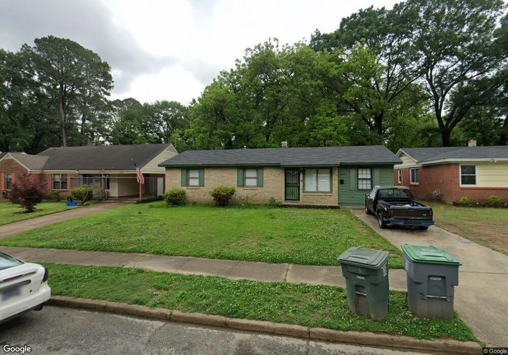
3767 Philsdale Ave Memphis, TN 38111
Audubon Park NeighborhoodEstimated Value: $128,000 - $137,000
4
Beds
2
Baths
1,555
Sq Ft
$86/Sq Ft
Est. Value
About This Home
This home is located at 3767 Philsdale Ave, Memphis, TN 38111 and is currently estimated at $133,289, approximately $85 per square foot. 3767 Philsdale Ave is a home located in Shelby County with nearby schools including Sherwood Elementary School, Sherwood Middle, and Melrose High School.
Ownership History
Date
Name
Owned For
Owner Type
Purchase Details
Closed on
Dec 18, 2024
Sold by
Bratica Jeremy and Muya Masumi
Bought by
Terraform Llc
Current Estimated Value
Purchase Details
Closed on
Dec 5, 2024
Sold by
Nelson Stanley
Bought by
Bratica Jeremy and Muya Masumi
Purchase Details
Closed on
Apr 5, 2019
Sold by
Wo Sfr Llc
Bought by
Nelson Stanle
Purchase Details
Closed on
Feb 12, 2019
Sold by
I2l Llc
Bought by
Wo Sfr Llc
Purchase Details
Closed on
Feb 4, 2019
Sold by
Ellis Betty
Bought by
12L Llc
Create a Home Valuation Report for This Property
The Home Valuation Report is an in-depth analysis detailing your home's value as well as a comparison with similar homes in the area
Home Values in the Area
Average Home Value in this Area
Purchase History
| Date | Buyer | Sale Price | Title Company |
|---|---|---|---|
| Terraform Llc | -- | Foundation Title & Escrow | |
| Bratica Jeremy | $130,000 | Preferred Title | |
| Nelson Stanle | $48,000 | Preferred Title & Escrow Llc | |
| Wo Sfr Llc | -- | Closetrak Closing & Ttl Svcs | |
| 12L Llc | $23,400 | Close Trak Closing & Ttl Svc |
Source: Public Records
Tax History Compared to Growth
Tax History
| Year | Tax Paid | Tax Assessment Tax Assessment Total Assessment is a certain percentage of the fair market value that is determined by local assessors to be the total taxable value of land and additions on the property. | Land | Improvement |
|---|---|---|---|---|
| 2025 | $565 | $31,725 | $4,250 | $27,475 |
| 2024 | $565 | $16,675 | $2,975 | $13,700 |
| 2023 | $1,016 | $16,675 | $2,975 | $13,700 |
| 2022 | $1,016 | $16,675 | $2,975 | $13,700 |
| 2021 | $1,028 | $16,675 | $2,975 | $13,700 |
| 2020 | $982 | $13,550 | $2,975 | $10,575 |
| 2019 | $433 | $13,550 | $2,975 | $10,575 |
| 2018 | $433 | $13,550 | $2,975 | $10,575 |
| 2017 | $443 | $13,550 | $2,975 | $10,575 |
| 2016 | $617 | $14,125 | $0 | $0 |
| 2014 | $617 | $14,125 | $0 | $0 |
Source: Public Records
Map
Nearby Homes
- 3776 Kimball Ave
- 3715 Barron Ave
- 3845 Kimball Ave
- 1249 W Goodman Cir
- 3909 Fizer Ave
- 3784 Dunn Ave
- 1486 Patterson St
- 3537 Deerwood Ave
- 3672 Maid Marian Ln
- 1558 Patterson St
- 3801 Wilshire Rd
- 1604 Echles St
- 1118 Robin Hood Ln
- 3889 Danny Ave
- 3707 Wilshire Rd
- 3553 Rhodes Ave
- 3607 Vanuys Rd
- 3466 Heckle Ave
- 3515 Vanuys Rd
- 1422 Titus Rd
- 3761 Philsdale Ave
- 3773 Philsdale Ave
- 3755 Philsdale Ave
- 3779 Philsdale Ave
- 3749 Philsdale Ave
- 3785 Philsdale Ave
- 3762 Philsdale Ave
- 3768 Philsdale Ave
- 3756 Philsdale Ave
- 3774 Philsdale Ave
- 3743 Philsdale Ave
- 3791 Philsdale Ave
- 3750 Philsdale Ave
- 3780 Philsdale Ave
- 3744 Philsdale Ave
- 3786 Philsdale Ave
- 3795 Philsdale Ave
- 3737 Philsdale Ave
- 3738 Philsdale Ave
- 3792 Philsdale Ave