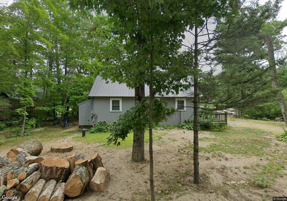
377 Cobb Farm Rd Bartlett, NH 03812
Estimated Value: $510,000 - $663,000
2
Beds
4
Baths
1,709
Sq Ft
$339/Sq Ft
Est. Value
About This Home
This home is located at 377 Cobb Farm Rd, Bartlett, NH 03812 and is currently estimated at $578,753, approximately $338 per square foot. 377 Cobb Farm Rd is a home with nearby schools including Josiah Bartlett Elementary School.
Ownership History
Date
Name
Owned For
Owner Type
Purchase Details
Closed on
Jan 11, 2002
Sold by
Jones Alvin D and Jones Patricia Ann
Bought by
Bernard Linda R
Current Estimated Value
Home Financials for this Owner
Home Financials are based on the most recent Mortgage that was taken out on this home.
Original Mortgage
$161,500
Interest Rate
7.04%
Create a Home Valuation Report for This Property
The Home Valuation Report is an in-depth analysis detailing your home's value as well as a comparison with similar homes in the area
Home Values in the Area
Average Home Value in this Area
Purchase History
| Date | Buyer | Sale Price | Title Company |
|---|---|---|---|
| Bernard Linda R | $170,000 | -- |
Source: Public Records
Mortgage History
| Date | Status | Borrower | Loan Amount |
|---|---|---|---|
| Open | Bernard Linda R | $130,000 | |
| Closed | Bernard Linda R | $149,250 | |
| Closed | Bernard Linda R | $161,500 |
Source: Public Records
Tax History Compared to Growth
Tax History
| Year | Tax Paid | Tax Assessment Tax Assessment Total Assessment is a certain percentage of the fair market value that is determined by local assessors to be the total taxable value of land and additions on the property. | Land | Improvement |
|---|---|---|---|---|
| 2024 | $2,528 | $453,100 | $169,000 | $284,100 |
| 2023 | $2,338 | $453,100 | $169,000 | $284,100 |
| 2022 | $2,244 | $451,600 | $169,000 | $282,600 |
| 2021 | $2,039 | $214,000 | $81,500 | $132,500 |
| 2020 | $2,067 | $214,000 | $81,500 | $132,500 |
| 2019 | $1,999 | $214,000 | $81,500 | $132,500 |
| 2018 | $1,954 | $214,000 | $81,500 | $132,500 |
| 2016 | $2,321 | $244,300 | $101,700 | $142,600 |
| 2015 | $2,345 | $245,800 | $101,700 | $144,100 |
| 2014 | $2,406 | $245,800 | $101,700 | $144,100 |
| 2010 | $2,236 | $244,400 | $74,800 | $169,600 |
Source: Public Records
Map
Nearby Homes
- 114 Cobb Farm Rd
- 0 Parker Ridge Rd Unit 47 5058947
- 30 Parker Ridge Rd
- 83 Parker Ridge Rd
- F4 Cave Mountain Rd
- 0 U S 302 Unit 1 and 2 5003976
- 12 Forest Ave
- 53 Saco Ridge Rd
- 70 River St
- 1331 Us Rte 302
- 19 Hill & Vale Ln Unit 19
- 00 Tall Woods Loop Unit 9
- 8 River Run Dr Unit G
- 4 Mountainside at Attitash Rd
- 6S River Run Dr
- 2E/F River Run Dr Unit E/F
- 461 Jericho Rd
- 46 Ammonoosuc Dr
- 53 Ammonoosuc Dr
- 30 Top Notch Rd Unit 30
- 381 Cobb Farm Rd
- 45 Wiles Rd
- 51 Wiles Rd
- 1748 Us Route 302
- 1714 Us Route 302
- Lot 1 Cobb Farm Rd
- 262 Cobb Farm Rd
- 55 Cobb Farm Rd Unit 3
- Lot E Cobb Farm Rd Unit E
- A Cobb Farm Rd
- TBD Cobb Farm Rd
- 21 Wiles Rd
- 296 Cobb Farm Rd
- 1327 Us Route 302
- 288 Cobb Farm Rd
- 36 Wiles Rd
- 1333 Us Route 302
- 1717 Crawford Notch Rd
- 1729 Crawford Notch Rd
- 1343 Us Route 302