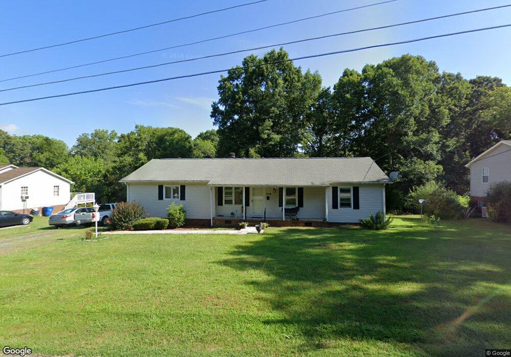
378 Curtis St Ramseur, NC 27316
Estimated Value: $182,000 - $203,000
3
Beds
2
Baths
1,012
Sq Ft
$193/Sq Ft
Est. Value
About This Home
This home is located at 378 Curtis St, Ramseur, NC 27316 and is currently estimated at $194,858, approximately $192 per square foot. 378 Curtis St is a home located in Randolph County with nearby schools including Ramseur Elementary School, Southeastern Randolph Middle School, and Eastern Randolph High School.
Ownership History
Date
Name
Owned For
Owner Type
Purchase Details
Closed on
Sep 17, 2024
Sold by
Fernandez Garcia Andres and Pascual Osmara G
Bought by
Fernandez Garcia Andres and Pascual Osmara G
Current Estimated Value
Purchase Details
Closed on
Jan 26, 2021
Sold by
Hardee Brenda and Estate Of Annette B Loflin
Bought by
Garcia Andres Fernandez
Home Financials for this Owner
Home Financials are based on the most recent Mortgage that was taken out on this home.
Original Mortgage
$105,600
Interest Rate
2.6%
Mortgage Type
New Conventional
Purchase Details
Closed on
Nov 29, 2005
Sold by
Jones Macon Thomas Kent and Jones Macon Jo Elaine
Bought by
Loflin Annette
Create a Home Valuation Report for This Property
The Home Valuation Report is an in-depth analysis detailing your home's value as well as a comparison with similar homes in the area
Purchase History
| Date | Buyer | Sale Price | Title Company |
|---|---|---|---|
| Fernandez Garcia Andres | -- | None Listed On Document | |
| Fernandez Garcia Andres | -- | None Listed On Document | |
| Garcia Andres Fernandez | $132,000 | None Available | |
| Fernandez Garcia Andres | $132,000 | None Listed On Document | |
| Loflin Annette | $80,000 | -- |
Source: Public Records
Mortgage History
| Date | Status | Borrower | Loan Amount |
|---|---|---|---|
| Previous Owner | Fernandez Garcia Andres | $105,600 |
Source: Public Records
Tax History
| Year | Tax Paid | Tax Assessment Tax Assessment Total Assessment is a certain percentage of the fair market value that is determined by local assessors to be the total taxable value of land and additions on the property. | Land | Improvement |
|---|---|---|---|---|
| 2025 | $1,949 | $159,780 | $22,000 | $137,780 |
| 2024 | $1,902 | $155,900 | $22,000 | $133,900 |
| 2023 | $1,824 | $155,900 | $22,000 | $133,900 |
| 2022 | $1,475 | $113,220 | $16,000 | $97,220 |
| 2021 | $1,223 | $93,920 | $16,000 | $77,920 |
| 2020 | $1,223 | $93,920 | $16,000 | $77,920 |
| 2019 | $1,223 | $93,920 | $16,000 | $77,920 |
| 2018 | $1,154 | $87,260 | $16,000 | $71,260 |
| 2016 | $1,154 | $87,255 | $16,000 | $71,255 |
| 2015 | $1,156 | $87,255 | $16,000 | $71,255 |
| 2014 | -- | $87,255 | $16,000 | $71,255 |
Source: Public Records
Map
Nearby Homes
- 444 Weatherly St
- 432 Kimrey St
- 7187 Jordan Rd
- 0 State Highway 49
- 442 Weatherly St
- 604 Oliver St
- 4737 Huntingwood Rd
- 5182 Foushee Rd
- 4650 Huntingwood Rd
- 1001 Meadowood Dr
- 2050 Welborn Cir
- 2110 Newell St
- 0 Mulberry Academy St Unit 1211590
- 5713 Us Highway 64 E
- 8521 Us Highway 64 E
- 518 E Main St
- 1804 Mulberry Academy St
- 00 Mulberry Academy St
- 000 Mulberry Academy St
- 121 Parks Crossroads Church Rd
Your Personal Tour Guide
Ask me questions while you tour the home.