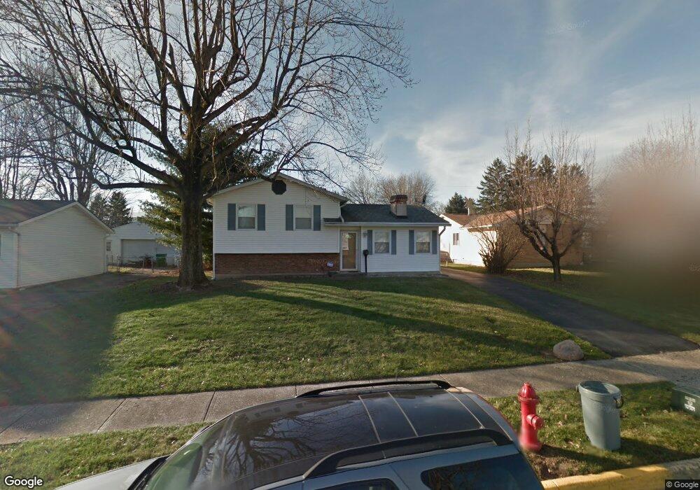
3783 Armada Rd Columbus, OH 43232
East Columbus-White Ash NeighborhoodEstimated Value: $178,000 - $226,000
3
Beds
1
Bath
949
Sq Ft
$209/Sq Ft
Est. Value
About This Home
This home is located at 3783 Armada Rd, Columbus, OH 43232 and is currently estimated at $198,090, approximately $208 per square foot. 3783 Armada Rd is a home located in Franklin County with nearby schools including Groveport Madison High School and Eastland Preparatory Academy.
Ownership History
Date
Name
Owned For
Owner Type
Purchase Details
Closed on
Feb 28, 2022
Sold by
Bonner Sr Christopher D
Bought by
Bonner Ronald W
Current Estimated Value
Purchase Details
Closed on
Feb 4, 2022
Sold by
Bonner Sr Christopher D
Bought by
Bonner Ronald W
Purchase Details
Closed on
Dec 16, 2021
Sold by
Estate Og Joe D Bonner
Bought by
Bonner Christopher D
Purchase Details
Closed on
Jun 15, 1982
Bought by
Bonner Joe D and Bonner Edna
Create a Home Valuation Report for This Property
The Home Valuation Report is an in-depth analysis detailing your home's value as well as a comparison with similar homes in the area
Home Values in the Area
Average Home Value in this Area
Purchase History
| Date | Buyer | Sale Price | Title Company |
|---|---|---|---|
| Bonner Ronald W | $100,000 | Thompson William A | |
| Bonner Ronald W | $100,000 | Thompson William A | |
| Bonner Christopher D | -- | None Available | |
| Bonner Joe D | -- | -- |
Source: Public Records
Tax History Compared to Growth
Tax History
| Year | Tax Paid | Tax Assessment Tax Assessment Total Assessment is a certain percentage of the fair market value that is determined by local assessors to be the total taxable value of land and additions on the property. | Land | Improvement |
|---|---|---|---|---|
| 2024 | $3,154 | $63,740 | $14,180 | $49,560 |
| 2023 | $3,282 | $63,735 | $14,175 | $49,560 |
| 2022 | $2,120 | $35,000 | $6,300 | $28,700 |
| 2021 | $2,164 | $35,000 | $6,300 | $28,700 |
| 2020 | $2,169 | $35,000 | $6,300 | $28,700 |
| 2019 | $2,063 | $29,260 | $5,250 | $24,010 |
| 2018 | $1,825 | $29,260 | $5,250 | $24,010 |
| 2017 | $1,832 | $29,260 | $5,250 | $24,010 |
| 2016 | $1,577 | $28,630 | $3,920 | $24,710 |
| 2015 | $1,576 | $28,630 | $3,920 | $24,710 |
| 2014 | $1,439 | $28,630 | $3,920 | $24,710 |
| 2013 | $730 | $31,780 | $4,340 | $27,440 |
Source: Public Records
Map
Nearby Homes
- 4940 Brewster Dr
- 3900 Noe Bixby Rd
- 5096 Fullerton Dr
- 5004 Bentler Dr
- 3721 Aurelia Dr
- 5145 Fullerton Dr
- 5174 Fullerton Dr
- 5044 Albany Dr
- 3856 Crestfield Dr Unit 3856
- 5106 Harbor Blvd
- 3567 Wymore Place
- 4655 Glengate Dr
- 3739 Atkinson Rd
- 4106 Wiston Dr Unit 4106
- 3773 Clearwater Dr
- 3493 Tremaine Rd
- 3773 Tylor Dr
- 4496 Reinbeau Dr
- 4344 Seahorse Ln Unit 4344
- 4468 Reinbeau Dr
- 3795 Armada Rd
- 3771 Armada Rd
- 3803 Armada Rd
- 3788 Noe Bixby Rd
- 3764 Noe Bixby Rd
- 3790 Armada Rd
- 3765 Armada Rd
- 3811 Armada Rd
- 3800 Noe Bixby Rd
- 3800 Armada Rd
- 4966 Ewald Dr
- 4979 Ewald Dr
- 4972 Ewald Dr
- 3819 Armada Rd
- 4990 Chipman Dr
- 3810 Noe Bixby Rd
- 4980 Ewald Dr
- 4983 Ewald Dr
- 4949 Brewster Dr
- 4937 Brewster Dr