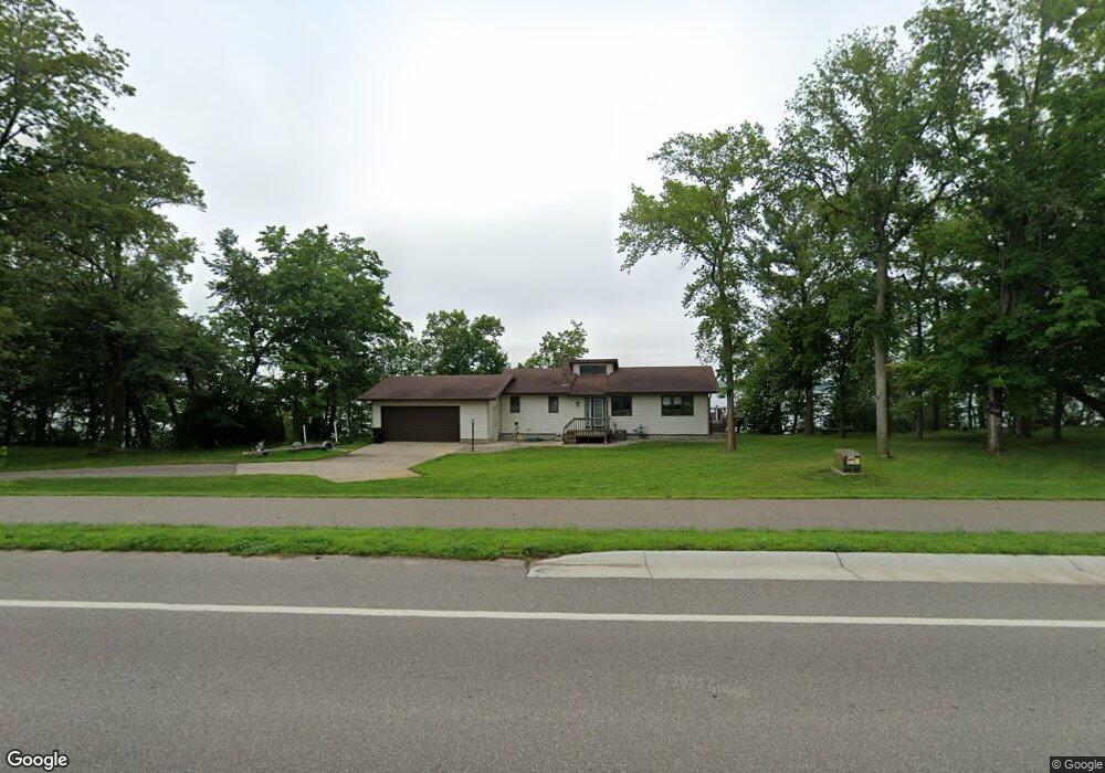
37861 County Highway 34 Perham, MN 56573
Estimated Value: $588,978 - $643,000
3
Beds
2
Baths
2,352
Sq Ft
$263/Sq Ft
Est. Value
About This Home
This home is located at 37861 County Highway 34, Perham, MN 56573 and is currently estimated at $617,995, approximately $262 per square foot. 37861 County Highway 34 is a home located in Otter Tail County with nearby schools including Heart of the Lake Elementary School and Perham Senior High School.
Ownership History
Date
Name
Owned For
Owner Type
Purchase Details
Closed on
Feb 7, 2023
Sold by
Mandate Capital Llc
Bought by
Tusow Bryan
Current Estimated Value
Home Financials for this Owner
Home Financials are based on the most recent Mortgage that was taken out on this home.
Original Mortgage
$378,026
Outstanding Balance
$366,036
Interest Rate
6.27%
Mortgage Type
New Conventional
Estimated Equity
$251,959
Purchase Details
Closed on
Nov 8, 2018
Sold by
Sanders Connie M
Bought by
Mandate Capital Llc
Create a Home Valuation Report for This Property
The Home Valuation Report is an in-depth analysis detailing your home's value as well as a comparison with similar homes in the area
Purchase History
| Date | Buyer | Sale Price | Title Company |
|---|---|---|---|
| Tusow Bryan | $385,000 | -- | |
| Mandate Capital Llc | $230,000 | Attorney Only |
Source: Public Records
Mortgage History
| Date | Status | Borrower | Loan Amount |
|---|---|---|---|
| Open | Tusow Bryan | $378,026 |
Source: Public Records
Tax History
| Year | Tax Paid | Tax Assessment Tax Assessment Total Assessment is a certain percentage of the fair market value that is determined by local assessors to be the total taxable value of land and additions on the property. | Land | Improvement |
|---|---|---|---|---|
| 2025 | $3,624 | $509,800 | $265,800 | $244,000 |
| 2024 | $3,332 | $480,700 | $231,300 | $249,400 |
| 2023 | $3,478 | $396,200 | $194,800 | $201,400 |
| 2022 | $3,674 | $347,800 | $0 | $0 |
| 2021 | $3,522 | $396,200 | $194,800 | $201,400 |
| 2020 | $3,292 | $297,700 | $134,400 | $163,300 |
| 2019 | $2,986 | $274,300 | $134,400 | $139,900 |
| 2018 | $3,010 | $274,300 | $134,400 | $139,900 |
| 2017 | $3,150 | $255,000 | $122,700 | $132,300 |
| 2016 | $3,008 | $245,400 | $119,800 | $125,600 |
| 2015 | $2,706 | $0 | $0 | $0 |
| 2014 | -- | $243,300 | $119,800 | $123,500 |
Source: Public Records
Map
Nearby Homes
- 37791 Mallard Loop
- 378 Mallard Loop
- Lot 12 Block 2 402nd Ave
- 37577 470th St
- 36865 Co Hwy 36
- Tbd Co Hwy 36
- 42626 County Highway 125
- 41165 427th St
- 34818 County Highway 36
- 41474 460 St
- 41474 460th St
- Lot 4 Seclusion Point Rd
- 34306 Twin Island Ln
- 34343 Twin Island Dr
- 37675 395th St
- 46174 County Highway 35
- 49307 368th Ave
- 902 9th St SW
- 829 9th Ave SW
- 805 9th Ave SW Unit B
- Xxx Co Rd 34
- 37921 County Highway 34
- 37847 Mallard Loop
- 37894 County Highway 34
- 44152 W Paul Lake Dr
- 37xxx Mallard Loop
- 37841 Mallard Loop
- 37827 Mallard Loop
- Xxxxx Cnty Hwy 34
- 37837 Mallard Loop
- 44157 W Paul Lake Dr
- 44114 W Paul Lake Dr
- 37989 County Highway 34
- 37759 Mallard Loop
- 44070 W Paul Lake Dr
- 44079 W Paul Lake Dr
- 37723 Mallard Loop
- 38049 County Highway 34
- 37732 County Highway 34
- 37701 Mallard Loop
Your Personal Tour Guide
Ask me questions while you tour the home.