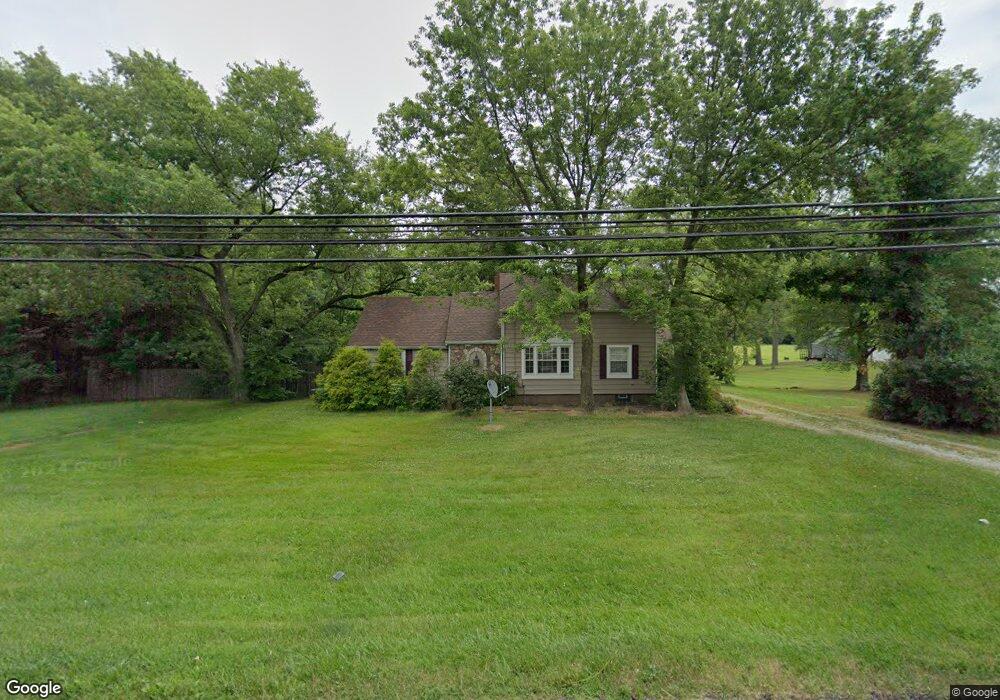
3788 State Route 44 Rootstown, OH 44272
Estimated Value: $200,000 - $239,000
3
Beds
2
Baths
1,567
Sq Ft
$140/Sq Ft
Est. Value
About This Home
This home is located at 3788 State Route 44, Rootstown, OH 44272 and is currently estimated at $219,629, approximately $140 per square foot. 3788 State Route 44 is a home located in Portage County with nearby schools including Rootstown Middle School - Schnee Building and Rootstown High School.
Ownership History
Date
Name
Owned For
Owner Type
Purchase Details
Closed on
Jun 22, 2022
Sold by
Restoration Llc
Bought by
Dyer Mark D
Current Estimated Value
Purchase Details
Closed on
Jan 22, 2010
Sold by
Portage Property Restoration Llc
Bought by
Dyer Mark D
Home Financials for this Owner
Home Financials are based on the most recent Mortgage that was taken out on this home.
Original Mortgage
$132,090
Interest Rate
4.87%
Mortgage Type
New Conventional
Purchase Details
Closed on
May 7, 2009
Sold by
Deutsche Bank National Trust Company
Bought by
Portage Property Restoration Llc
Purchase Details
Closed on
Nov 13, 2008
Sold by
Campbell Debby
Bought by
Deutsche Bank National Trust Company
Purchase Details
Closed on
Jan 1, 1990
Bought by
Campbell Debby
Create a Home Valuation Report for This Property
The Home Valuation Report is an in-depth analysis detailing your home's value as well as a comparison with similar homes in the area
Purchase History
| Date | Buyer | Sale Price | Title Company |
|---|---|---|---|
| Dyer Mark D | $18,694 | None Listed On Document | |
| Dyer Mark D | $129,500 | Attorney | |
| Portage Property Restoration Llc | $30,000 | Accutitle Agency Inc | |
| Deutsche Bank National Trust Company | $50,000 | None Available | |
| Campbell Debby | -- | -- |
Source: Public Records
Mortgage History
| Date | Status | Borrower | Loan Amount |
|---|---|---|---|
| Previous Owner | Dyer Mark D | $132,090 |
Source: Public Records
Tax History
| Year | Tax Paid | Tax Assessment Tax Assessment Total Assessment is a certain percentage of the fair market value that is determined by local assessors to be the total taxable value of land and additions on the property. | Land | Improvement |
|---|---|---|---|---|
| 2024 | $2,108 | $51,940 | $9,100 | $42,840 |
| 2023 | $1,869 | $41,060 | $8,020 | $33,040 |
| 2022 | $2,100 | $41,060 | $8,020 | $33,040 |
| 2021 | $2,259 | $41,060 | $8,020 | $33,040 |
| 2020 | $1,969 | $35,630 | $7,630 | $28,000 |
| 2019 | $1,838 | $35,630 | $7,630 | $28,000 |
| 2017 | $1,670 | $30,980 | $8,120 | $22,860 |
| 2016 | $1,492 | $30,980 | $8,120 | $22,860 |
Source: Public Records
Map
Nearby Homes
- 3701 State Route 44
- 3689 Cherry Hill
- 4079 Siefer Dr
- 0 Lynn Rd Unit 5110102
- V/L 2 Lynn Rd
- V/L Lynn Rd
- 4225 Hattrick Rd
- 3637 Old Forge Rd
- 4415 Farmette Dr
- 4691 Scenic Dr
- 3021 Hartville Rd
- sub lot Lane Ave
- 4556 Rootstown Rd
- 0 Tallmadge Rd Unit 5189301
- 0 Tallmadge Rd Unit 5189314
- 4140 Sandy Lake Rd
- 3080 Saxe Rd
- 4958 Bassett Rd
- 4058 Bayberry Knoll Ln
- 3925 Summit Rd
- 3788 Ohio 44
- 3771 State Route 44
- 3776 State Route 44
- 3789 State Route 44
- 3730 State Route 44
- 3718 State Route 44
- 4145 Karry Dr
- 4140 Karry Dr
- 3819 State Route 44
- 4135 Karry Dr
- 3713 State Route 44
- 3830 State Route 44
- 4123 Karry Dr
- 4120 Karry Dr
- 3704 State Route 44
- v-l 22 Ohio 44
- 4109 Karry Dr
- 3875 Cook Rd
- 4097 Karry Dr
- 3703 Cherry Hill
Your Personal Tour Guide
Ask me questions while you tour the home.