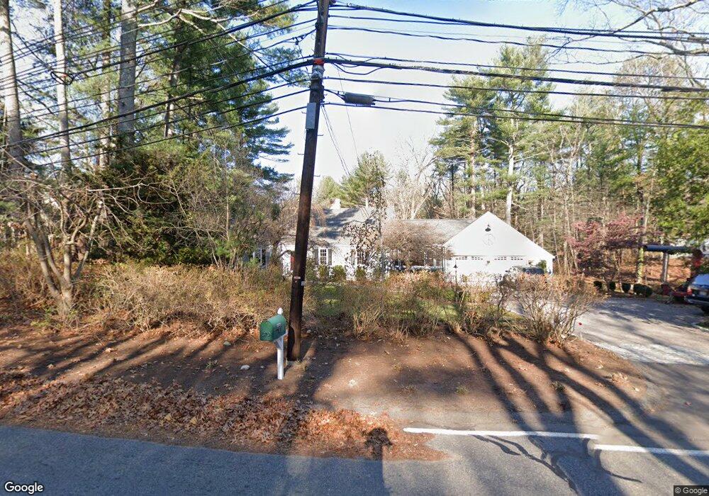
379 Charles River St Needham, MA 02492
Estimated Value: $1,464,000 - $1,974,000
4
Beds
3
Baths
1,886
Sq Ft
$936/Sq Ft
Est. Value
About This Home
This home is located at 379 Charles River St, Needham, MA 02492 and is currently estimated at $1,764,566, approximately $935 per square foot. 379 Charles River St is a home located in Norfolk County with nearby schools including Newman Elementary School, High Rock Middle School, and Pollard Middle School.
Ownership History
Date
Name
Owned For
Owner Type
Purchase Details
Closed on
Jun 1, 1998
Sold by
Wallace Asha P
Bought by
Zappala Thomas J and Zappala Lisa W
Current Estimated Value
Home Financials for this Owner
Home Financials are based on the most recent Mortgage that was taken out on this home.
Original Mortgage
$225,000
Outstanding Balance
$45,287
Interest Rate
7.12%
Mortgage Type
Purchase Money Mortgage
Estimated Equity
$1,719,279
Create a Home Valuation Report for This Property
The Home Valuation Report is an in-depth analysis detailing your home's value as well as a comparison with similar homes in the area
Home Values in the Area
Average Home Value in this Area
Purchase History
| Date | Buyer | Sale Price | Title Company |
|---|---|---|---|
| Zappala Thomas J | $557,500 | -- |
Source: Public Records
Mortgage History
| Date | Status | Borrower | Loan Amount |
|---|---|---|---|
| Open | Zappala Thomas J | $225,000 | |
| Closed | Zappala Thomas J | $150,000 |
Source: Public Records
Tax History Compared to Growth
Tax History
| Year | Tax Paid | Tax Assessment Tax Assessment Total Assessment is a certain percentage of the fair market value that is determined by local assessors to be the total taxable value of land and additions on the property. | Land | Improvement |
|---|---|---|---|---|
| 2025 | $14,965 | $1,411,800 | $814,600 | $597,200 |
| 2024 | $16,381 | $1,308,400 | $731,500 | $576,900 |
| 2023 | $16,407 | $1,258,200 | $731,500 | $526,700 |
| 2022 | $14,223 | $1,063,800 | $559,000 | $504,800 |
| 2021 | $13,861 | $1,063,800 | $559,000 | $504,800 |
| 2020 | $13,540 | $1,084,100 | $559,100 | $525,000 |
| 2019 | $13,281 | $1,071,900 | $559,100 | $512,800 |
| 2018 | $12,734 | $1,071,900 | $559,100 | $512,800 |
| 2017 | $12,009 | $1,010,000 | $559,100 | $450,900 |
| 2016 | $11,655 | $1,010,000 | $559,100 | $450,900 |
| 2015 | $11,403 | $1,010,000 | $559,100 | $450,900 |
| 2014 | $11,586 | $995,400 | $559,100 | $436,300 |
Source: Public Records
Map
Nearby Homes
- 365 Charles River St
- 1780 Central Ave
- 37 Carleton Dr
- 78 Pheasant Landing Rd
- 46 Charles River St
- 60 Claybrook Rd
- 60 Locust Ln
- 52 Willow St
- 1266 South St
- 55 Ridge Hill Farm Rd
- 182 Winding River Rd
- 12 Haven St
- 150 Dedham St
- 12 Winding River Cir
- 29 Tolman St
- 24 Deerfield Rd
- 90 Burr Dr
- 3 Burnham Rd
- 287 High Rock St
- 12 Cranberry Ln
- 395 Charles River St
- 198 Pine St
- 403 Charles River St
- Lot X Charles River St
- 419 Charles River St
- 133 Pine St
- 130 Pine St
- 338 Charles River St
- 121 Pine St
- 111 Pine St
- 116 Pine St
- 311 Charles River St
- 320 Charles River St
- 105 Pine St
- 310 Charles River St
- 102 Pine St
- 100 Pine St
- 300 Charles River St
- 299 Charles River St
- 88 Pine St