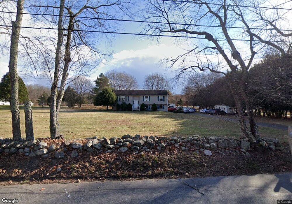
379 Parker Bridge Rd Coventry, CT 06238
Estimated Value: $333,000 - $451,026
4
Beds
2
Baths
1,146
Sq Ft
$346/Sq Ft
Est. Value
About This Home
This home is located at 379 Parker Bridge Rd, Coventry, CT 06238 and is currently estimated at $396,257, approximately $345 per square foot. 379 Parker Bridge Rd is a home located in Tolland County with nearby schools including George Hersey Robertson School, Coventry Grammar School, and Capt. Nathan Hale School.
Ownership History
Date
Name
Owned For
Owner Type
Purchase Details
Closed on
Oct 6, 2023
Sold by
Robinson Dawn M
Bought by
Viscuso Mark E
Current Estimated Value
Home Financials for this Owner
Home Financials are based on the most recent Mortgage that was taken out on this home.
Original Mortgage
$165,343
Outstanding Balance
$160,423
Interest Rate
7.12%
Mortgage Type
FHA
Estimated Equity
$235,834
Purchase Details
Closed on
Jul 1, 2005
Sold by
Papandrea Nicholas and Papandrea Jessica
Bought by
Viscuso Mark
Purchase Details
Closed on
May 30, 2000
Sold by
Cohen Steven and Cohen Florence
Bought by
Papandrea Nicholas and Papandrea Jessica
Create a Home Valuation Report for This Property
The Home Valuation Report is an in-depth analysis detailing your home's value as well as a comparison with similar homes in the area
Home Values in the Area
Average Home Value in this Area
Purchase History
| Date | Buyer | Sale Price | Title Company |
|---|---|---|---|
| Viscuso Mark E | -- | None Available | |
| Viscuso Mark E | -- | None Available | |
| Viscuso Mark | $240,000 | -- | |
| Papandrea Nicholas | $152,900 | -- | |
| Viscuso Mark | $240,000 | -- | |
| Papandrea Nicholas | $152,900 | -- |
Source: Public Records
Mortgage History
| Date | Status | Borrower | Loan Amount |
|---|---|---|---|
| Open | Viscuso Mark E | $165,343 | |
| Previous Owner | Papandrea Nicholas | $37,000 | |
| Previous Owner | Papandrea Nicholas | $152,500 |
Source: Public Records
Tax History Compared to Growth
Tax History
| Year | Tax Paid | Tax Assessment Tax Assessment Total Assessment is a certain percentage of the fair market value that is determined by local assessors to be the total taxable value of land and additions on the property. | Land | Improvement |
|---|---|---|---|---|
| 2025 | $5,453 | $229,500 | $56,000 | $173,500 |
| 2024 | $4,643 | $139,400 | $48,700 | $90,700 |
| 2023 | $4,425 | $139,400 | $48,700 | $90,700 |
| 2022 | $4,342 | $139,400 | $48,700 | $90,700 |
| 2021 | $4,342 | $139,400 | $48,700 | $90,700 |
| 2020 | $4,345 | $139,400 | $48,700 | $90,700 |
| 2019 | $4,485 | $139,300 | $48,700 | $90,600 |
| 2018 | $4,376 | $135,900 | $48,700 | $87,200 |
| 2017 | $4,349 | $135,900 | $48,700 | $87,200 |
| 2016 | $4,240 | $135,900 | $48,700 | $87,200 |
| 2015 | $4,240 | $135,900 | $48,700 | $87,200 |
| 2014 | $4,191 | $147,200 | $60,200 | $87,000 |
Source: Public Records
Map
Nearby Homes
- 393 Parker Bridge Rd
- 357 Parker Bridge Rd
- 345 Parker Bridge Rd
- 335 Parker Bridge Rd
- 220 Parker Bridge Rd
- 207 Parker Bridge Rd
- 257 Parker Bridge Rd
- 253 Parker Bridge Rd
- 6 Parker Bridge Rd
- 65 Parker Bridge Rd
- 00 Parker Bridge Rd
- 0 Parker Bridge Rd Unit E276841
- 0 Parker Bridge Rd Unit G10209358
- 0 Parker Bridge Rd
- 741 Bunker Hill Rd
- 3 Woodward Rd
- 15 Woodward Rd
- 699 Bunker Hill Rd
- 7 Woodward Rd
- 8 Parker Bridge Rd