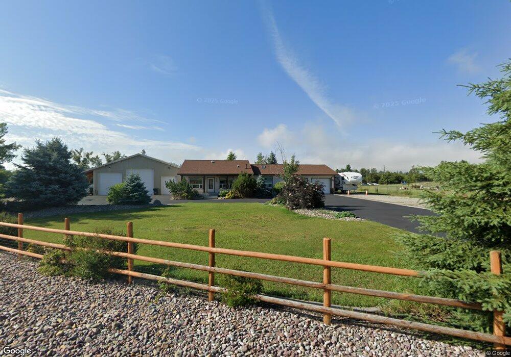
38 Aspen Ct Kalispell, MT 59901
Estimated Value: $673,000 - $796,000
4
Beds
3
Baths
1,590
Sq Ft
$456/Sq Ft
Est. Value
About This Home
This home is located at 38 Aspen Ct, Kalispell, MT 59901 and is currently estimated at $725,795, approximately $456 per square foot. 38 Aspen Ct is a home located in Flathead County with nearby schools including Helena Flats Elementary School, Helena Flats Junior High School, and Glacier High School.
Ownership History
Date
Name
Owned For
Owner Type
Purchase Details
Closed on
Aug 30, 2018
Sold by
Wisher Karen K
Bought by
Schmidt George A and Schmidt Diana L
Current Estimated Value
Home Financials for this Owner
Home Financials are based on the most recent Mortgage that was taken out on this home.
Original Mortgage
$292,800
Outstanding Balance
$254,813
Interest Rate
4.5%
Mortgage Type
New Conventional
Estimated Equity
$470,982
Purchase Details
Closed on
Jul 8, 2016
Sold by
Meehan Sharon D
Bought by
Wisher Karen K
Purchase Details
Closed on
May 2, 2008
Sold by
Slack John C and Slack Sharon Ann
Bought by
Albell Jay L and Meehan Sharon D
Home Financials for this Owner
Home Financials are based on the most recent Mortgage that was taken out on this home.
Original Mortgage
$24,776
Interest Rate
5.88%
Mortgage Type
Future Advance Clause Open End Mortgage
Create a Home Valuation Report for This Property
The Home Valuation Report is an in-depth analysis detailing your home's value as well as a comparison with similar homes in the area
Home Values in the Area
Average Home Value in this Area
Purchase History
| Date | Buyer | Sale Price | Title Company |
|---|---|---|---|
| Schmidt George A | -- | First American Title Ins Co | |
| Wisher Karen K | -- | Insured Titles | |
| Albell Jay L | -- | Stewart Title Of Flathead Co |
Source: Public Records
Mortgage History
| Date | Status | Borrower | Loan Amount |
|---|---|---|---|
| Open | Schmidt George A | $292,800 | |
| Previous Owner | Albell Jay L | $24,776 |
Source: Public Records
Tax History Compared to Growth
Tax History
| Year | Tax Paid | Tax Assessment Tax Assessment Total Assessment is a certain percentage of the fair market value that is determined by local assessors to be the total taxable value of land and additions on the property. | Land | Improvement |
|---|---|---|---|---|
| 2025 | $2,483 | $789,200 | $0 | $0 |
| 2024 | $1,838 | $563,900 | $0 | $0 |
| 2023 | $2,640 | $563,900 | $0 | $0 |
| 2022 | $1,890 | $394,400 | $0 | $0 |
| 2021 | $2,058 | $394,400 | $0 | $0 |
| 2020 | $3,040 | $336,200 | $0 | $0 |
| 2019 | $3,005 | $336,200 | $0 | $0 |
| 2018 | $2,992 | $315,700 | $0 | $0 |
| 2017 | $3,041 | $315,700 | $0 | $0 |
| 2016 | $1,668 | $186,700 | $0 | $0 |
| 2015 | $1,748 | $186,700 | $0 | $0 |
| 2014 | $1,945 | $126,987 | $0 | $0 |
Source: Public Records
Map
Nearby Homes
- 1139 Aspen Ln
- 701 Addison Square
- 650 Capistrano Dr Unit Parcel 4
- 650 Capistrano Dr Unit Parcels 1,2,3,4
- 650 Capistrano Dr Unit Parcel 3
- 650 Capistrano Dr Unit Parcel 2
- 650 Capistrano Dr Unit Parcel 1
- NHN Thompson Ln
- 457 Addison Square
- 791 Springwood Ln
- 654 Pebble Dr
- 580 Ezy Dr
- 1056 Clark Fork Dr
- 696 Mountain View Dr
- 111 Freedom Way Unit BARNDOMINIUM
- 136 Weimar Way
- 112 Freedom Way
- 547 Maple Dr
- 453 Forest Edge Trail
- 741 Shadow Ln