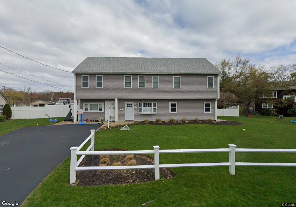
38 Brookfield Cir Framingham, MA 01701
Nobscot NeighborhoodEstimated Value: $589,000 - $811,000
3
Beds
2
Baths
1,242
Sq Ft
$556/Sq Ft
Est. Value
About This Home
This home is located at 38 Brookfield Cir, Framingham, MA 01701 and is currently estimated at $690,072, approximately $555 per square foot. 38 Brookfield Cir is a home located in Middlesex County with nearby schools including Framingham High School, MetroWest Jewish Day School, and Saint Bridget School.
Ownership History
Date
Name
Owned For
Owner Type
Purchase Details
Closed on
May 19, 2011
Sold by
38 Brookfield Circle R and Harris-Daley D
Bought by
Donnelly Alan T and Donnelly Kristin M
Current Estimated Value
Home Financials for this Owner
Home Financials are based on the most recent Mortgage that was taken out on this home.
Original Mortgage
$275,214
Outstanding Balance
$191,261
Interest Rate
4.88%
Mortgage Type
Purchase Money Mortgage
Estimated Equity
$498,811
Purchase Details
Closed on
Dec 30, 2010
Sold by
King Beverly C
Bought by
38 Brookfield Circle R and Harris-Daley
Create a Home Valuation Report for This Property
The Home Valuation Report is an in-depth analysis detailing your home's value as well as a comparison with similar homes in the area
Home Values in the Area
Average Home Value in this Area
Purchase History
| Date | Buyer | Sale Price | Title Company |
|---|---|---|---|
| Donnelly Alan T | $293,000 | -- | |
| Donnelly Alan T | $293,000 | -- | |
| 38 Brookfield Circle R | -- | -- | |
| 38 Brookfield Circle R | -- | -- |
Source: Public Records
Mortgage History
| Date | Status | Borrower | Loan Amount |
|---|---|---|---|
| Open | Donnelly Alan T | $275,214 | |
| Closed | 38 Brookfield Circle R | $275,214 | |
| Previous Owner | 38 Brookfield Circle R | $40,000 |
Source: Public Records
Tax History Compared to Growth
Tax History
| Year | Tax Paid | Tax Assessment Tax Assessment Total Assessment is a certain percentage of the fair market value that is determined by local assessors to be the total taxable value of land and additions on the property. | Land | Improvement |
|---|---|---|---|---|
| 2025 | $7,394 | $619,300 | $262,800 | $356,500 |
| 2024 | $7,107 | $570,400 | $234,700 | $335,700 |
| 2023 | $6,792 | $518,900 | $209,500 | $309,400 |
| 2022 | $6,470 | $470,900 | $190,100 | $280,800 |
| 2021 | $6,262 | $445,700 | $182,700 | $263,000 |
| 2020 | $5,167 | $344,900 | $166,000 | $178,900 |
| 2019 | $4,582 | $297,900 | $166,000 | $131,900 |
| 2018 | $4,522 | $277,100 | $159,800 | $117,300 |
| 2017 | $4,443 | $265,900 | $155,200 | $110,700 |
| 2016 | $4,385 | $252,300 | $155,200 | $97,100 |
| 2015 | $4,320 | $242,400 | $155,200 | $87,200 |
Source: Public Records
Map
Nearby Homes
- 19 Park Ave
- 11 Edith Rd
- 13 Edith Rd
- 81 Nicholas Rd Unit B
- 71 Nicholas Rd Unit H
- 62 Central St
- 2 Chesterfield St
- 1 Harvard Rd
- 36 Cider Mill Rd
- 38 Bradford Rd
- 1376 Concord St
- 472 Potter Rd
- 108 Cherry St
- 11 Danforth Park Rd
- 40 Gregory Rd
- 7 Ballydrain Rd
- 102 Spruce St
- 67 Meadow St
- 111 Indian Head Rd
- 30 Donlon St
- 40 Brookfield Cir
- 34 Brookfield Cir
- 42 Brookfield Cir
- 19 Brookfield Cir
- 30 Brookfield Cir
- 15 Brookfield Cir
- 46 Brookfield Cir
- 23 Brookfield Cir
- 23 Riverview Rd
- 26 Brookfield Cir
- 6 Brookfield Terrace
- 25 Riverview Rd
- 50 Brookfield Cir
- 21 Riverview Rd
- 11 Brookfield Cir
- 27 Brookfield Cir
- 22 Brookfield Cir
- 27 Riverview Rd
- 10 Brookfield Terrace
- 307 Water St