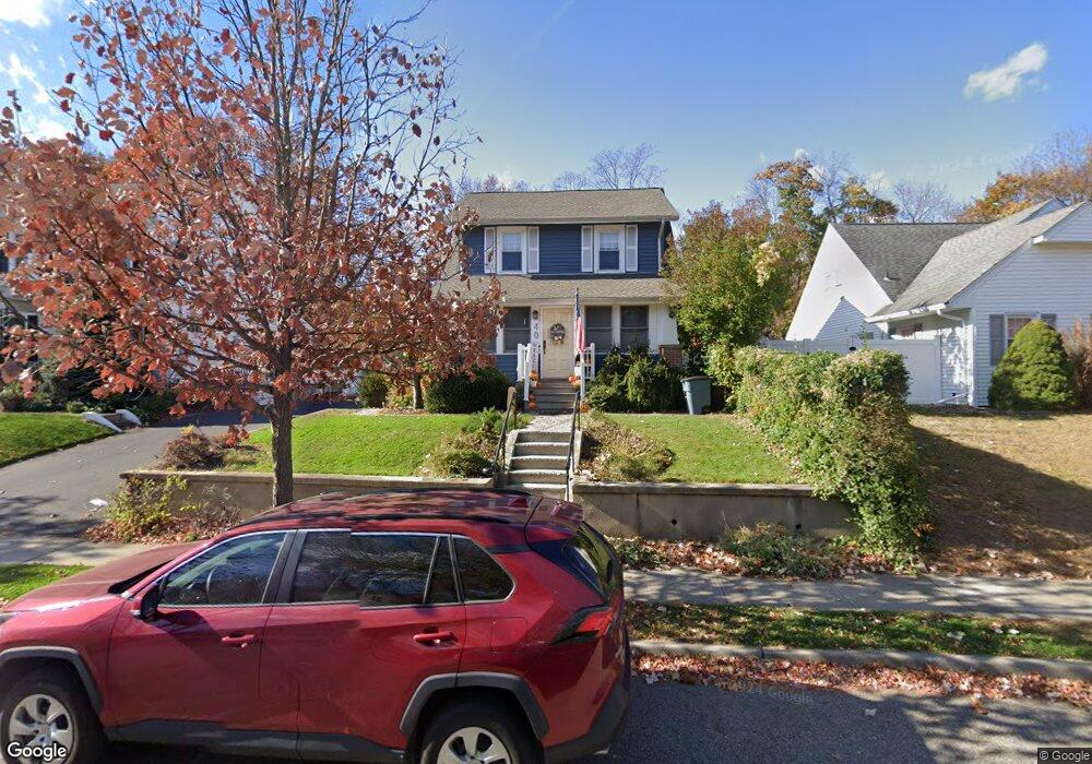
38 Brookside Ave Hawthorne, NJ 07506
Estimated Value: $664,000 - $676,734
3
Beds
2
Baths
1,594
Sq Ft
$419/Sq Ft
Est. Value
About This Home
This home is located at 38 Brookside Ave, Hawthorne, NJ 07506 and is currently estimated at $668,434, approximately $419 per square foot. 38 Brookside Ave is a home located in Passaic County with nearby schools including Hawthorne High School, St Anthony School, and Hawthorne Christian Academy.
Ownership History
Date
Name
Owned For
Owner Type
Purchase Details
Closed on
Jul 15, 2020
Sold by
Korn Jonathan L and Lien Korn Linh
Bought by
Pullara Farncis and Pullara Farnces
Current Estimated Value
Home Financials for this Owner
Home Financials are based on the most recent Mortgage that was taken out on this home.
Original Mortgage
$290,000
Outstanding Balance
$257,153
Interest Rate
3.1%
Mortgage Type
New Conventional
Estimated Equity
$411,281
Purchase Details
Closed on
Dec 24, 2007
Sold by
Korn Jonathan L
Bought by
Korn Jonathan L and Lien Linh
Purchase Details
Closed on
Dec 21, 2007
Sold by
Korn Jonathan L and Pandullo Ann Marie
Bought by
Korn Jonathan L
Purchase Details
Closed on
Sep 5, 2003
Sold by
Shunk Judy
Bought by
Korn Jonathan and Pandullo Ann
Home Financials for this Owner
Home Financials are based on the most recent Mortgage that was taken out on this home.
Original Mortgage
$250,000
Interest Rate
6.29%
Create a Home Valuation Report for This Property
The Home Valuation Report is an in-depth analysis detailing your home's value as well as a comparison with similar homes in the area
Home Values in the Area
Average Home Value in this Area
Purchase History
| Date | Buyer | Sale Price | Title Company |
|---|---|---|---|
| Pullara Farncis | $440,000 | Island Title Corporation | |
| Korn Jonathan L | -- | -- | |
| Korn Jonathan L | -- | -- | |
| Korn Jonathan | $315,000 | -- |
Source: Public Records
Mortgage History
| Date | Status | Borrower | Loan Amount |
|---|---|---|---|
| Open | Pullara Farncis | $290,000 | |
| Previous Owner | Korn Jonathan | $250,000 |
Source: Public Records
Tax History
| Year | Tax Paid | Tax Assessment Tax Assessment Total Assessment is a certain percentage of the fair market value that is determined by local assessors to be the total taxable value of land and additions on the property. | Land | Improvement |
|---|---|---|---|---|
| 2025 | $11,240 | $369,500 | $165,800 | $203,700 |
| 2024 | $11,085 | $369,500 | $165,800 | $203,700 |
| 2022 | $10,900 | $369,500 | $165,800 | $203,700 |
| 2021 | $10,686 | $369,500 | $165,800 | $203,700 |
| 2020 | $10,534 | $369,500 | $165,800 | $203,700 |
| 2019 | $9,079 | $151,900 | $80,200 | $71,700 |
| 2018 | $8,882 | $151,900 | $80,200 | $71,700 |
| 2017 | $8,736 | $151,900 | $80,200 | $71,700 |
| 2016 | $8,614 | $151,900 | $80,200 | $71,700 |
| 2015 | $8,512 | $151,900 | $80,200 | $71,700 |
| 2014 | $8,163 | $151,900 | $80,200 | $71,700 |
Source: Public Records
Map
Nearby Homes
- 10 Brookside Ave
- 75 Mazur Place
- 137 Cedar Ave
- 87 Buena Vista Ave
- 117 Maitland Ave
- 93 May St
- 45 Royal Ave Unit 46
- 45 Dietrich Ln
- 20 Forest Ave
- 80 Elberon Ave
- 5 Prospect St
- 155 Washington Ave
- 26 Birchwood Ln
- 18 Birchwood Ln
- 55 N 15th St
- 15 N 16th St
- 110 3rd Ave
- 764 Goffle Rd
- 140 Westervelt Ave
- 633 Lafayette Ave
- 30 Brookside Ave
- 44 Brookside Ave
- 37 Brookside Ave
- 26 Brookside Ave
- 43 Brookside Ave
- 31 Brookside Ave
- 50 Brookside Ave
- 33 Brookside Ave
- 41 Brookside Ave
- 29 Brookside Ave
- 39 Brookside Ave
- 45 Brookside Ave
- 54 Brookside Ave
- 22 Brookside Ave
- 25 Brookside Ave
- 20 Brookside Ave
- 49 Brookside Ave
- 21 Brookside Ave
- 58 Brookside Ave
- 18 Brookside Ave
Your Personal Tour Guide
Ask me questions while you tour the home.