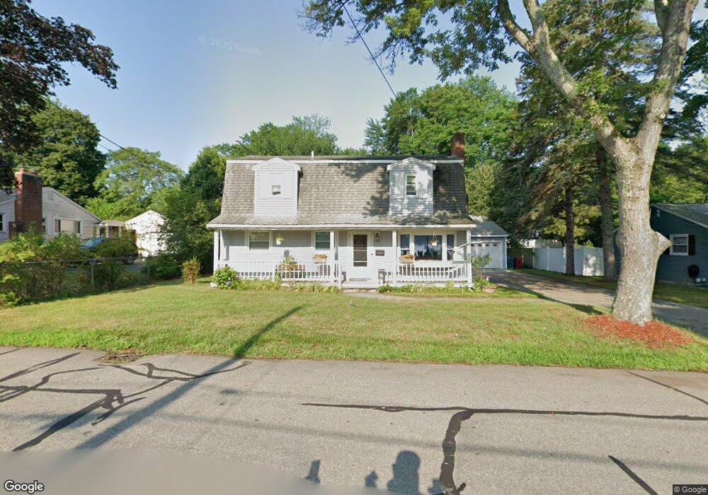
38 Burnham Rd Lowell, MA 01852
Belvidere NeighborhoodEstimated Value: $597,000 - $679,000
4
Beds
2
Baths
1,872
Sq Ft
$336/Sq Ft
Est. Value
About This Home
This home is located at 38 Burnham Rd, Lowell, MA 01852 and is currently estimated at $628,118, approximately $335 per square foot. 38 Burnham Rd is a home located in Middlesex County with nearby schools including Moody Elementary School, Abraham Lincoln Elementary School, and Greenhalge Elementary School.
Ownership History
Date
Name
Owned For
Owner Type
Purchase Details
Closed on
Oct 15, 1976
Bought by
Lynch William J and Lynch Loretta M
Current Estimated Value
Create a Home Valuation Report for This Property
The Home Valuation Report is an in-depth analysis detailing your home's value as well as a comparison with similar homes in the area
Home Values in the Area
Average Home Value in this Area
Tax History Compared to Growth
Tax History
| Year | Tax Paid | Tax Assessment Tax Assessment Total Assessment is a certain percentage of the fair market value that is determined by local assessors to be the total taxable value of land and additions on the property. | Land | Improvement |
|---|---|---|---|---|
| 2025 | $5,777 | $503,200 | $237,000 | $266,200 |
| 2024 | $5,810 | $487,800 | $221,600 | $266,200 |
| 2023 | $5,455 | $439,200 | $192,600 | $246,600 |
| 2022 | $4,928 | $388,300 | $169,600 | $218,700 |
| 2021 | $4,730 | $351,400 | $147,500 | $203,900 |
| 2020 | $4,584 | $343,100 | $147,500 | $195,600 |
| 2019 | $4,463 | $317,900 | $141,000 | $176,900 |
| 2018 | $4,372 | $303,800 | $134,400 | $169,400 |
| 2017 | $4,137 | $277,300 | $119,300 | $158,000 |
| 2016 | $4,117 | $271,600 | $113,600 | $158,000 |
| 2015 | $3,950 | $255,200 | $113,600 | $141,600 |
| 2013 | $3,724 | $248,100 | $116,800 | $131,300 |
Source: Public Records
Map
Nearby Homes
- 16 Wetherbee Ave
- 11 Merrimack Meadows Ln Unit 17
- 110 Longmeadow Dr
- 78 Merrimack Meadows Ln Unit 78
- 45 Clark Rd
- 173 Merrimack Meadows Ln Unit 162
- 16 Winding Ln
- 103 Westwind Rd
- 15 Sharyn Cir
- 251 Clark Rd
- 9 Cobleigh Dr
- 26 Luce St
- 111 Draper St
- 45 Luce St
- 70 Enfield St
- 4 Glenmere St
- 100 Merrimack Ave Unit 50
- 100 Merrimack Ave Unit 91
- 260 Mansur St
- 164 Bradley St
- 30 Burnham Rd
- 33 Wetherbee Ave
- 22 Burnham Rd
- 35 Wetherbee Ave
- 52 Burnham Rd
- 19 Wetherbee Ave
- 19 Wetherbee Ave Unit 19
- 15 Wetherbee Ave
- 58 Burnham Rd
- 35 Burnham Rd
- 45 Wetherbee Ave
- 14 Burnham Rd
- 45 Burnham Rd
- 29 Burnham Rd
- 886 Andover St
- 51 Burnham Rd
- 21 Burnham Rd
- 22 Wetherbee Ave
- 36 Wetherbee Ave
- 64 Burnham Rd