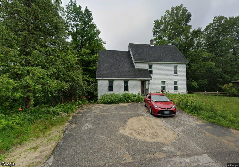
38 Courtney Rd North Woodstock, NH 03262
Estimated Value: $403,268 - $573,000
4
Beds
3
Baths
2,170
Sq Ft
$227/Sq Ft
Est. Value
About This Home
This home is located at 38 Courtney Rd, North Woodstock, NH 03262 and is currently estimated at $493,317, approximately $227 per square foot. 38 Courtney Rd is a home located in Grafton County with nearby schools including Lin-Wood Public Elementary School.
Ownership History
Date
Name
Owned For
Owner Type
Purchase Details
Closed on
Sep 24, 2025
Sold by
Keniston Tammy J
Bought by
Tammy J Keniston Ret and Keniston
Current Estimated Value
Purchase Details
Closed on
Sep 23, 1996
Sold by
Duguay William P
Bought by
Keniston Tammy J
Home Financials for this Owner
Home Financials are based on the most recent Mortgage that was taken out on this home.
Original Mortgage
$57,000
Interest Rate
7.89%
Mortgage Type
Purchase Money Mortgage
Create a Home Valuation Report for This Property
The Home Valuation Report is an in-depth analysis detailing your home's value as well as a comparison with similar homes in the area
Home Values in the Area
Average Home Value in this Area
Purchase History
| Date | Buyer | Sale Price | Title Company |
|---|---|---|---|
| Tammy J Keniston Ret | -- | -- | |
| Tammy J Keniston Ret | -- | -- | |
| Keniston Tammy J | $60,000 | -- |
Source: Public Records
Mortgage History
| Date | Status | Borrower | Loan Amount |
|---|---|---|---|
| Previous Owner | Keniston Tammy J | $57,000 |
Source: Public Records
Tax History Compared to Growth
Tax History
| Year | Tax Paid | Tax Assessment Tax Assessment Total Assessment is a certain percentage of the fair market value that is determined by local assessors to be the total taxable value of land and additions on the property. | Land | Improvement |
|---|---|---|---|---|
| 2024 | $3,389 | $166,760 | $65,400 | $101,360 |
| 2023 | $3,242 | $166,760 | $65,400 | $101,360 |
| 2022 | $3,065 | $166,760 | $65,400 | $101,360 |
| 2021 | $3,168 | $166,760 | $65,400 | $101,360 |
| 2020 | $3,327 | $166,760 | $65,400 | $101,360 |
| 2019 | $6,247 | $138,890 | $59,500 | $79,390 |
| 2018 | $2,780 | $138,890 | $59,500 | $79,390 |
| 2016 | $2,763 | $138,890 | $59,500 | $79,390 |
| 2015 | $2,629 | $138,890 | $59,500 | $79,390 |
| 2014 | $2,639 | $139,700 | $57,800 | $81,900 |
| 2012 | $2,902 | $162,280 | $59,900 | $102,380 |
Source: Public Records
Map
Nearby Homes
- 206-011 Lost River Rd
- 25 Main St
- 56 Kancamagus Hwy
- 11 Cascade Dr Unit 288
- 23 Oakes St
- 164 Deer Park Dr Unit 160D
- 164 Deer Park Dr Unit 161D
- 164 Deer Park Dr Unit 168D
- 156 Deer Park Dr Unit 135 A
- 17 Ridge Dr Unit A-14
- 65 Riverfront Dr Unit 217
- 14 Monroe Dr Unit 92
- 6 Monroe Dr Unit 111
- 45 Riverfront Dr Unit 242
- 16 Riverfront Dr Unit 293
- 16 Riverfront Dr Unit 292
- 252-254 Lost River Rd
- 9 Moose Ln
- 34 Franklin St
- 78 Main St Unit 3A
- 34 Courtney Rd
- 19 Courtney Rd
- 16 Courtney Rd
- 32 Courtney Rd
- 33 Courtney Rd
- 0 Courtney Rd
- 46 Courtney Rd
- 29 Courtney Rd
- 5 Sharon Hill Dr
- 12 Sharon Hill Dr
- 26 Courtney Rd
- 5 Sharon Hill Dr
- 16 Sharon Hill Dr
- 23 Courtney Rd
- 35 Courtney Rd
- 50 Courtney Rd
- 50 Courtney Rd
- 9 Nicholson Dr
- 21 Nicholson Dr
- 16 Sharon Hill Dr