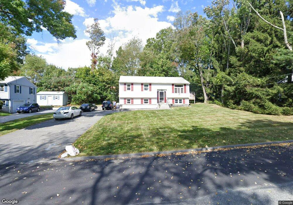
38 Iroquois St Worcester, MA 01602
Tatnuck NeighborhoodEstimated Value: $431,000 - $458,000
4
Beds
2
Baths
960
Sq Ft
$460/Sq Ft
Est. Value
About This Home
This home is located at 38 Iroquois St, Worcester, MA 01602 and is currently estimated at $441,396, approximately $459 per square foot. 38 Iroquois St is a home located in Worcester County with nearby schools including Chandler Magnet, Jacob Hiatt Magnet School, and May Street Elementary School.
Ownership History
Date
Name
Owned For
Owner Type
Purchase Details
Closed on
Jun 24, 1998
Sold by
Bernard R Paul and Bernard Karen C
Bought by
Rodriguez Harold and Rodrigue Janet
Current Estimated Value
Purchase Details
Closed on
Dec 30, 1997
Sold by
Household Fin Co Ii
Bought by
Bernard R Paul and Bernard Karen C
Purchase Details
Closed on
Sep 25, 1997
Sold by
Minor John M
Bought by
Household Finance Co 2
Create a Home Valuation Report for This Property
The Home Valuation Report is an in-depth analysis detailing your home's value as well as a comparison with similar homes in the area
Home Values in the Area
Average Home Value in this Area
Purchase History
| Date | Buyer | Sale Price | Title Company |
|---|---|---|---|
| Rodriguez Harold | $96,273 | -- | |
| Bernard R Paul | $72,500 | -- | |
| Household Finance Co 2 | $56,620 | -- |
Source: Public Records
Mortgage History
| Date | Status | Borrower | Loan Amount |
|---|---|---|---|
| Open | Household Finance Co 2 | $155,000 | |
| Closed | Household Finance Co 2 | $136,000 |
Source: Public Records
Tax History Compared to Growth
Tax History
| Year | Tax Paid | Tax Assessment Tax Assessment Total Assessment is a certain percentage of the fair market value that is determined by local assessors to be the total taxable value of land and additions on the property. | Land | Improvement |
|---|---|---|---|---|
| 2025 | $4,895 | $371,100 | $118,800 | $252,300 |
| 2024 | $4,785 | $348,000 | $118,800 | $229,200 |
| 2023 | $4,731 | $329,900 | $103,300 | $226,600 |
| 2022 | $4,098 | $269,400 | $82,700 | $186,700 |
| 2021 | $3,956 | $243,000 | $66,100 | $176,900 |
| 2020 | $3,794 | $223,200 | $66,100 | $157,100 |
| 2019 | $3,699 | $205,500 | $59,600 | $145,900 |
| 2018 | $3,729 | $197,200 | $59,600 | $137,600 |
| 2017 | $3,585 | $186,500 | $59,600 | $126,900 |
| 2016 | $3,500 | $169,800 | $43,900 | $125,900 |
| 2015 | $3,408 | $169,800 | $43,900 | $125,900 |
| 2014 | $3,318 | $169,800 | $43,900 | $125,900 |
Source: Public Records
Map
Nearby Homes
- 41 Walnut Hill Dr
- 250 May St
- 71 Glendale St
- 415 Mill St
- 5 Swan Ave
- 16 Sherwood Rd
- 5 Amber St
- 2 Carlisle St
- 47R Yarnie Unit 3B
- 47R Yarnie Unit 3A
- 47R Yarnie Unit 1B
- 47R Yarnie Unit 2B
- 47R Yarnie Unit 4B
- 47R Yarnie Unit 8B
- 47R Yarnie Unit 5A
- 47R Yarnie Unit 6B
- 47R Yarnie Unit 4A
- 47R Yarnie Unit 1A
- 47R Yarnie Unit 9
- 47R Yarnie Unit 8A