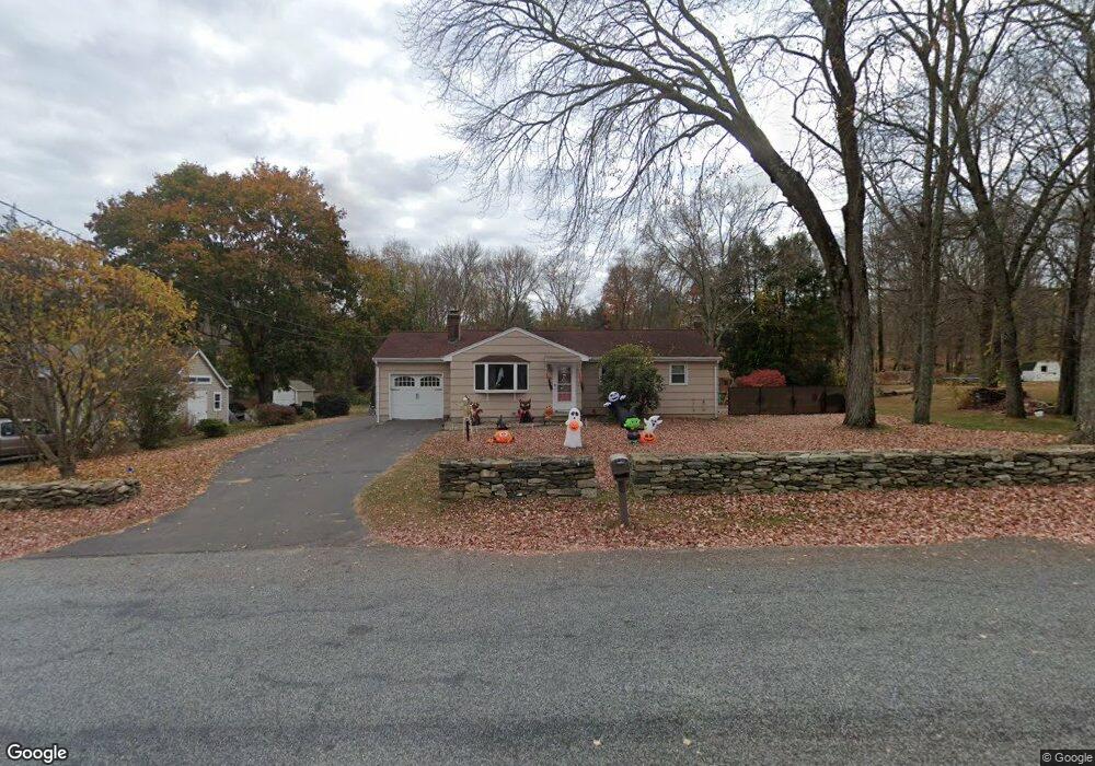
38 Joe Williams Rd Moodus, CT 06469
Estimated Value: $299,000 - $358,000
3
Beds
1
Bath
1,032
Sq Ft
$319/Sq Ft
Est. Value
About This Home
This home is located at 38 Joe Williams Rd, Moodus, CT 06469 and is currently estimated at $328,767, approximately $318 per square foot. 38 Joe Williams Rd is a home located in Middlesex County with nearby schools including East Haddam Elementary School, Nathan Hale-Ray Middle School, and Nathan Hale-Ray High School.
Ownership History
Date
Name
Owned For
Owner Type
Purchase Details
Closed on
Jan 1, 2021
Sold by
Miller Laurie A
Bought by
Winakor Scott
Current Estimated Value
Home Financials for this Owner
Home Financials are based on the most recent Mortgage that was taken out on this home.
Original Mortgage
$151,515
Outstanding Balance
$134,651
Interest Rate
2.6%
Mortgage Type
Balloon
Estimated Equity
$194,116
Purchase Details
Closed on
Jun 22, 2017
Sold by
Novak Peter M and Novak Trudy A
Bought by
Miller Laurie A
Purchase Details
Closed on
Jun 19, 1963
Bought by
Novak Peter M and Novak Trudy A
Create a Home Valuation Report for This Property
The Home Valuation Report is an in-depth analysis detailing your home's value as well as a comparison with similar homes in the area
Home Values in the Area
Average Home Value in this Area
Purchase History
| Date | Buyer | Sale Price | Title Company |
|---|---|---|---|
| Winakor Scott | -- | None Available | |
| Miller Laurie A | -- | -- | |
| Novak Peter M | -- | -- |
Source: Public Records
Mortgage History
| Date | Status | Borrower | Loan Amount |
|---|---|---|---|
| Open | Winakor Scott | $151,515 |
Source: Public Records
Tax History Compared to Growth
Tax History
| Year | Tax Paid | Tax Assessment Tax Assessment Total Assessment is a certain percentage of the fair market value that is determined by local assessors to be the total taxable value of land and additions on the property. | Land | Improvement |
|---|---|---|---|---|
| 2025 | $3,999 | $142,510 | $58,090 | $84,420 |
| 2024 | $3,814 | $142,510 | $58,090 | $84,420 |
| 2023 | $3,670 | $142,510 | $58,090 | $84,420 |
| 2022 | $3,539 | $111,310 | $41,380 | $69,930 |
| 2021 | $3,388 | $111,310 | $41,380 | $69,930 |
| 2020 | $3,388 | $111,310 | $41,380 | $69,930 |
| 2019 | $3,388 | $111,310 | $41,380 | $69,930 |
| 2018 | $3,301 | $111,310 | $41,380 | $69,930 |
| 2017 | $3,148 | $106,410 | $41,380 | $65,030 |
| 2016 | $3,123 | $106,410 | $41,380 | $65,030 |
| 2015 | $3,052 | $106,410 | $41,380 | $65,030 |
| 2014 | $2,969 | $106,400 | $41,370 | $65,030 |
Source: Public Records
Map
Nearby Homes
- 5 Joe Williams Rd
- 4 Valley Brook Rd
- 53 Falls Rd
- 67 Moodus Leesville Rd
- 53 Falls Bashan Rd
- 0 White Sands Rd
- 66 Falls Bashan Rd
- 90 Falls Bashan Rd
- 154 Falls Rd
- 80 Orchard Rd
- 1 Geronimo Rd
- 8 Tom Rd
- 8 Augusta Cir Unit 8
- 42 Dogwood Rd
- 55 Bogel Rd
- 114 Lakeside Dr
- 2 Morgan Ln
- 0 Lakeside Dr
- 71 Cherry Swamp Rd
- 10 Cherry Swamp Rd
- 0 William F Palmer Rd Unit M9146248
- 0 William F Palmer Rd Unit N357871
- 0 William F Palmer Rd Unit 24049857
- 42 Joe Williams Rd
- 36 Joe Williams Rd
- 21 Robbie Rd
- 44 Joe Williams Rd
- 17 Robbie Rd
- 39 Joe Williams Rd
- 25 Robbie Rd
- 11 Robbie Rd
- 30 Joe Williams Rd
- 22 Robbie Rd
- 28 Joe Williams Rd
- 9 Robbie Rd
- 24 Robbie Rd
- 14 Robbie Rd
- 26 Joe Williams Rd
- 5 Robbie Rd
- 10 Robbie Rd