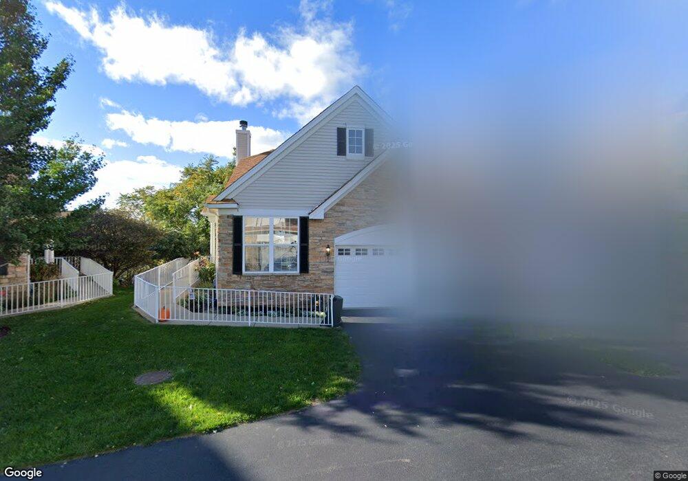
38 Kelsey Ct Algonquin, IL 60102
Far West Algonquin NeighborhoodEstimated Value: $352,098 - $360,000
2
Beds
2
Baths
1,278
Sq Ft
$279/Sq Ft
Est. Value
About This Home
This home is located at 38 Kelsey Ct, Algonquin, IL 60102 and is currently estimated at $356,275, approximately $278 per square foot. 38 Kelsey Ct is a home located in McHenry County with nearby schools including Westfield Community School, Lincoln Prairie Elementary School, and Harry D Jacobs High School.
Ownership History
Date
Name
Owned For
Owner Type
Purchase Details
Closed on
Nov 1, 2018
Sold by
Garrity Edward A and Garrity Tammie G
Bought by
Garrity Edward A and Garrity Tammie D
Current Estimated Value
Purchase Details
Closed on
Jul 27, 2005
Sold by
Drh Cambridge Homes Inc
Bought by
Garrity Edward A and Garrity Tammie D
Home Financials for this Owner
Home Financials are based on the most recent Mortgage that was taken out on this home.
Original Mortgage
$229,250
Interest Rate
5.71%
Mortgage Type
Fannie Mae Freddie Mac
Create a Home Valuation Report for This Property
The Home Valuation Report is an in-depth analysis detailing your home's value as well as a comparison with similar homes in the area
Home Values in the Area
Average Home Value in this Area
Purchase History
| Date | Buyer | Sale Price | Title Company |
|---|---|---|---|
| Garrity Edward A | -- | Attorney | |
| Garrity Edward A | $286,590 | First American Title |
Source: Public Records
Mortgage History
| Date | Status | Borrower | Loan Amount |
|---|---|---|---|
| Closed | Garrity Edward A | $229,250 |
Source: Public Records
Tax History
| Year | Tax Paid | Tax Assessment Tax Assessment Total Assessment is a certain percentage of the fair market value that is determined by local assessors to be the total taxable value of land and additions on the property. | Land | Improvement |
|---|---|---|---|---|
| 2024 | $6,394 | $97,743 | $18,583 | $79,160 |
| 2023 | $5,979 | $87,419 | $16,620 | $70,799 |
| 2022 | $5,752 | $78,068 | $16,326 | $61,742 |
| 2021 | $5,477 | $72,730 | $15,210 | $57,520 |
| 2020 | $5,312 | $70,156 | $14,672 | $55,484 |
| 2019 | $5,156 | $67,148 | $14,043 | $53,105 |
| 2018 | $4,864 | $62,031 | $12,973 | $49,058 |
| 2017 | $4,724 | $58,437 | $12,221 | $46,216 |
| 2016 | $4,607 | $54,808 | $11,462 | $43,346 |
| 2013 | -- | $44,711 | $10,692 | $34,019 |
Source: Public Records
Map
Nearby Homes
- 601 Woods Creek Ln
- 16 Springbrook Ln
- 432 Thunder Ridge
- 3260 Nottingham Dr
- 305 Harvest Gate
- 4 Greenbrier Ct
- 74 Harvest Gate
- 101 Oakleaf Rd
- 2380 Dawson Ln Unit 165
- 2660 Harnish Dr
- 145 S Oakleaf Rd
- 113 Pheasant Trail
- 531 Alpine Dr
- 3610 Lakeview Dr
- 4241 Wanderlust Dr
- 14 Wander Way
- 1920 Jester Ln
- 1157 Sawmill Ln
- 7 Falcon Ridge Ct
- 895 Eineke Blvd
- 34 Kelsey Ct Unit 2
- 40 Kelsey Ct
- 30 Kelsey Ct
- 42 Kelsey Ct Unit 2
- 130 Katrina Ln
- 44 Kelsey Ct Unit 2
- 28 Kelsey Ct Unit 2
- 24 Kelsey Ct Unit 2
- 50 Kelsey Ct
- 120 Katrina Ln
- 220 Katrina Ln Unit 2
- 66 Kelsey Ct
- 20 Kelsey Ct Unit 2
- 52 Kelsey Ct
- 110 Katrina Ln
- 54 Kelsey Ct
- 210 Katrina Ln
- 64 Kelsey Ct
- 56 Kelsey Ct
- 62 Kelsey Ct
Your Personal Tour Guide
Ask me questions while you tour the home.