Estimated Value: $1,110,802 - $1,353,000
4
Beds
3
Baths
2,756
Sq Ft
$446/Sq Ft
Est. Value
About This Home
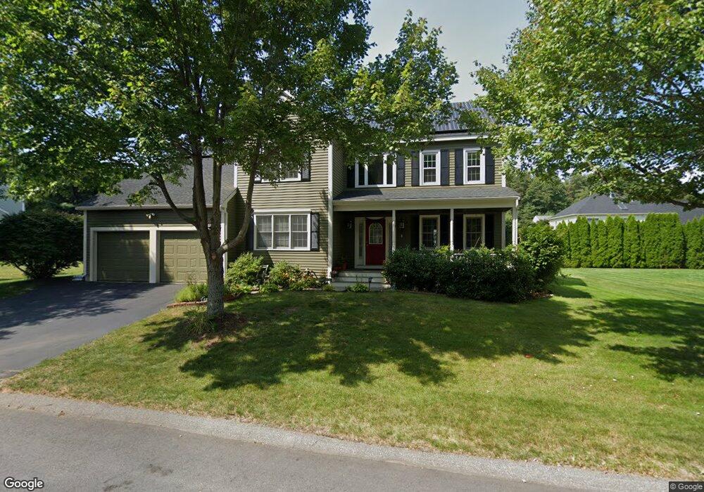
This home is located at 38 Lexington Dr, Acton, MA 01720 and is currently estimated at $1,230,201, approximately $446 per square foot. 38 Lexington Dr is a home located in Middlesex County with nearby schools including Acton-Boxborough Regional High School and The Imago School.
Ownership History
Date
Name
Owned For
Owner Type
Purchase Details
Closed on
Mar 31, 1999
Sold by
Lawsbrook Inc
Bought by
Sathanandam Balaji and Balaji Padma
Current Estimated Value
Home Financials for this Owner
Home Financials are based on the most recent Mortgage that was taken out on this home.
Original Mortgage
$318,320
Outstanding Balance
$78,863
Interest Rate
6.78%
Mortgage Type
Purchase Money Mortgage
Estimated Equity
$1,151,338
Create a Home Valuation Report for This Property
The Home Valuation Report is an in-depth analysis detailing your home's value as well as a comparison with similar homes in the area
Home Values in the Area
Average Home Value in this Area
Purchase History
| Date | Buyer | Sale Price | Title Company |
|---|---|---|---|
| Sathanandam Balaji | $397,900 | -- |
Source: Public Records
Mortgage History
| Date | Status | Borrower | Loan Amount |
|---|---|---|---|
| Open | Sathanandam Balaji | $318,320 |
Source: Public Records
Tax History
| Year | Tax Paid | Tax Assessment Tax Assessment Total Assessment is a certain percentage of the fair market value that is determined by local assessors to be the total taxable value of land and additions on the property. | Land | Improvement |
|---|---|---|---|---|
| 2025 | $16,942 | $987,900 | $305,100 | $682,800 |
| 2024 | $15,741 | $944,300 | $305,100 | $639,200 |
| 2023 | $15,391 | $876,500 | $277,400 | $599,100 |
| 2022 | $14,757 | $758,700 | $241,200 | $517,500 |
| 2021 | $14,430 | $713,300 | $223,200 | $490,100 |
| 2020 | $13,591 | $706,400 | $223,200 | $483,200 |
| 2019 | $12,978 | $670,000 | $223,200 | $446,800 |
| 2018 | $13,006 | $671,100 | $223,200 | $447,900 |
| 2017 | $12,652 | $663,800 | $223,200 | $440,600 |
| 2016 | $12,344 | $641,900 | $223,200 | $418,700 |
| 2015 | $12,089 | $634,600 | $223,200 | $411,400 |
| 2014 | $11,645 | $598,700 | $223,200 | $375,500 |
Source: Public Records
Map
Nearby Homes
- 59 Lexington Dr
- 65 Summit St
- 303 School St
- 31 Drummer Rd Unit 31
- 128 Parker St Unit 3B
- 7 Hillcrest Dr
- 1 Drummer Rd Unit A5
- 37 Water St
- 27 Water St
- 1844 Main St Unit 1844
- 245 Oak Hill Cir
- 66 Old Stow Rd
- 20 Westvale Meadows Unit C
- 100 Harrington Ave
- 1 Vanderbelt Rd
- 116 Conant St
- 42 Sunnyside Ln
- 70 River St
- 95 Conant St Unit 320
- 30 Brewster Ln
- 28 Lexington Dr
- 36 Lexington Dr
- 40 Lexington Dr
- 37 Lexington Dr
- 26 Lexington Dr
- 30 Lexington Dr
- 39 Lexington Dr
- 35 Lexington Dr
- 23 Lexington Dr
- 33 Lexington Dr
- 24 Lexington Dr
- 41 Lexington Dr
- 25 Lexington Dr
- 31 Lexington Dr
- 21 Lexington Dr
- 29 Lexington Dr
- 27 Lexington Dr
- 31 Lawsbrook Rd
- 19 Lexington Dr
- 44 Lexington Dr
Your Personal Tour Guide
Ask me questions while you tour the home.