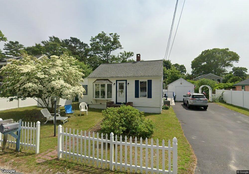
38 Martin St Buzzards Bay, MA 02532
Estimated Value: $408,000 - $497,000
2
Beds
1
Bath
1,276
Sq Ft
$364/Sq Ft
Est. Value
About This Home
This home is located at 38 Martin St, Buzzards Bay, MA 02532 and is currently estimated at $464,940, approximately $364 per square foot. 38 Martin St is a home.
Ownership History
Date
Name
Owned For
Owner Type
Purchase Details
Closed on
Aug 15, 2007
Sold by
Simas Joan E and Roberts Joan E
Bought by
Simas Joan E and Simas Jeremias
Current Estimated Value
Home Financials for this Owner
Home Financials are based on the most recent Mortgage that was taken out on this home.
Original Mortgage
$390,000
Outstanding Balance
$245,919
Interest Rate
6.67%
Mortgage Type
Purchase Money Mortgage
Estimated Equity
$219,021
Purchase Details
Closed on
Jan 5, 2005
Sold by
Franklin James W
Bought by
Franklin James W and Franklin Pamela Sue
Create a Home Valuation Report for This Property
The Home Valuation Report is an in-depth analysis detailing your home's value as well as a comparison with similar homes in the area
Purchase History
| Date | Buyer | Sale Price | Title Company |
|---|---|---|---|
| Simas Joan E | -- | -- | |
| Simas Joan E | -- | -- | |
| Franklin James W | -- | -- | |
| Franklin James W | -- | -- |
Source: Public Records
Mortgage History
| Date | Status | Borrower | Loan Amount |
|---|---|---|---|
| Open | Franklin James W | $390,000 | |
| Closed | Franklin James W | $390,000 |
Source: Public Records
Tax History
| Year | Tax Paid | Tax Assessment Tax Assessment Total Assessment is a certain percentage of the fair market value that is determined by local assessors to be the total taxable value of land and additions on the property. | Land | Improvement |
|---|---|---|---|---|
| 2025 | $4,321 | $393,500 | $118,000 | $275,500 |
| 2024 | $4,330 | $370,700 | $91,400 | $279,300 |
| 2023 | $3,846 | $331,700 | $83,100 | $248,600 |
| 2022 | $3,846 | $282,400 | $83,100 | $199,300 |
| 2021 | $3,825 | $273,200 | $83,100 | $190,100 |
| 2020 | $3,534 | $257,800 | $83,100 | $174,700 |
| 2019 | $3,309 | $244,000 | $77,600 | $166,400 |
| 2018 | $3,122 | $222,400 | $77,600 | $144,800 |
| 2017 | $2,902 | $207,600 | $77,600 | $130,000 |
| 2016 | $2,626 | $186,400 | $74,300 | $112,100 |
| 2015 | $2,554 | $186,400 | $74,300 | $112,100 |
| 2014 | $2,404 | $180,900 | $74,300 | $106,600 |
Source: Public Records
Map
Nearby Homes
- 60 Martin St
- 67 Algonquin St
- 92 Choctaw Dr
- 29 Wenonah Rd
- 29 Wenonah Rd
- 3132 Cranberry Hwy Unit 59
- 13 Bay Pointe Drive Extension
- 13 Bay Pointe Drive Extension Unit 13
- 3 Fairway Dr Unit F
- 1 Downey St
- 22 Long Neck Rd
- 56 Rip Van Winkle Way
- 11 Buzzards Bay Dr
- 29 Walnut St
- 4 Van Bummel Rd
- 13 Hideaway Village Unit G
- 9 Hideaway Rd Unit F
- 23 Starboard Dr Unit Lot 50
- 40-A Lafayette Ave
- 36B Starboard Dr Unit 36E
Your Personal Tour Guide
Ask me questions while you tour the home.