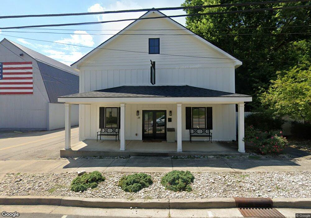
38 N Main St Bellbrook, OH 45305
Estimated Value: $308,347
3
Beds
1
Bath
2,856
Sq Ft
$108/Sq Ft
Est. Value
About This Home
This home is located at 38 N Main St, Bellbrook, OH 45305 and is currently estimated at $308,347, approximately $107 per square foot. 38 N Main St is a home located in Greene County with nearby schools including Bell Creek Intermediate School, Stephen Bell Elementary School, and Bellbrook Middle School.
Ownership History
Date
Name
Owned For
Owner Type
Purchase Details
Closed on
Aug 15, 2024
Sold by
Be Team Llc
Bought by
Victorian Bellbrook Llc
Current Estimated Value
Purchase Details
Closed on
Apr 25, 2019
Sold by
Dyer Douglas and Dyer Dawn M
Bought by
The Be Team Llc
Purchase Details
Closed on
Feb 25, 2002
Sold by
Bartram Larry E
Bought by
Dyer Douglas and Dyer Dawn M
Create a Home Valuation Report for This Property
The Home Valuation Report is an in-depth analysis detailing your home's value as well as a comparison with similar homes in the area
Home Values in the Area
Average Home Value in this Area
Purchase History
| Date | Buyer | Sale Price | Title Company |
|---|---|---|---|
| Victorian Bellbrook Llc | $300,000 | None Listed On Document | |
| The Be Team Llc | $175,000 | None Available | |
| Dyer Douglas | $52,000 | -- |
Source: Public Records
Tax History Compared to Growth
Tax History
| Year | Tax Paid | Tax Assessment Tax Assessment Total Assessment is a certain percentage of the fair market value that is determined by local assessors to be the total taxable value of land and additions on the property. | Land | Improvement |
|---|---|---|---|---|
| 2024 | $4,758 | $61,430 | $13,720 | $47,710 |
| 2023 | $4,758 | $61,430 | $13,720 | $47,710 |
| 2022 | $4,939 | $57,570 | $13,720 | $43,850 |
| 2021 | $4,984 | $57,570 | $13,720 | $43,850 |
| 2020 | $4,672 | $57,570 | $13,720 | $43,850 |
| 2019 | $2,030 | $23,500 | $9,530 | $13,970 |
| 2018 | $2,040 | $23,500 | $9,530 | $13,970 |
| 2017 | $1,943 | $23,500 | $9,530 | $13,970 |
| 2016 | $1,912 | $23,040 | $9,530 | $13,510 |
| 2015 | $1,953 | $23,040 | $9,530 | $13,510 |
| 2014 | $1,833 | $23,040 | $9,530 | $13,510 |
Source: Public Records
Map
Nearby Homes
- 1667 Ardennes Oak Dr
- 3553 Shellbark Dr
- 144 Upper Hillside Dr
- 161 Belair Cir
- 3852 W Franklin St
- 3509 Marwood Dr
- 3656 Persimmon Ridge Place
- 3849 Sable Ridge Dr
- 3604 Cypress Pointe Dr
- 3604 Cypress Pointe Dr
- 3930 Beechwood Dr
- 2042 Wentworth Village Dr Unit 2042
- 2317 Barnett Dr
- 1939 Sugar Run Trail
- 1713 Fox Trail
- 2018 Amberwood Ct
- 2215 S Linda Dr
- 1753 Cedar Ridge Dr
- 1478 Kensington Dr
- Winslow Plan at Bent Creek Woods - Masterpiece Collection
- 0 N Main St Unit 393994
- 0 N Main St Unit 411377
- 0 N Main St Unit 421223
- 43 N West St
- 21 N Main St
- 25 N Main St
- 63 N West St
- 63 N West St
- 15 N Main St
- 62 N Main St
- 62 N Main St
- 12 N Main St
- 0 Lower Bellbrook Rd Unit 745202
- 70 N Main St
- 70 N Main St
- 11 E Walnut St
- 0 W Franklin St
- 71 N West St
- 1 State Rd 725
- 42 W Franklin St