Estimated Value: $446,000 - $563,000
3
Beds
2
Baths
2,047
Sq Ft
$246/Sq Ft
Est. Value
About This Home
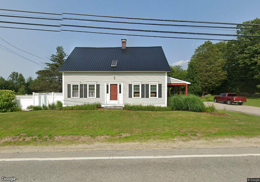
This home is located at 38 N Stark Hwy, Weare, NH 03281 and is currently estimated at $503,061, approximately $245 per square foot. 38 N Stark Hwy is a home with nearby schools including Center Woods Elementary School, Weare Middle School, and John Stark Regional High School.
Create a Home Valuation Report for This Property
The Home Valuation Report is an in-depth analysis detailing your home's value as well as a comparison with similar homes in the area
Home Values in the Area
Average Home Value in this Area
Tax History Compared to Growth
Tax History
| Year | Tax Paid | Tax Assessment Tax Assessment Total Assessment is a certain percentage of the fair market value that is determined by local assessors to be the total taxable value of land and additions on the property. | Land | Improvement |
|---|---|---|---|---|
| 2024 | $7,200 | $353,100 | $125,200 | $227,900 |
| 2023 | $6,323 | $335,600 | $125,200 | $210,400 |
| 2022 | $5,839 | $335,600 | $125,200 | $210,400 |
| 2021 | $5,772 | $335,600 | $125,200 | $210,400 |
| 2020 | $5,988 | $250,000 | $95,500 | $154,500 |
| 2019 | $5,928 | $250,000 | $95,500 | $154,500 |
| 2018 | $5,633 | $244,600 | $95,500 | $149,100 |
| 2016 | $5,147 | $230,100 | $95,500 | $134,600 |
| 2015 | $4,592 | $204,900 | $90,000 | $114,900 |
| 2014 | $4,569 | $205,700 | $90,800 | $114,900 |
| 2013 | $3,558 | $163,600 | $90,800 | $72,800 |
Source: Public Records
Map
Nearby Homes
- 233 N Stark Hwy
- 11 Ski Tow Rd
- 10 Sap House Rd
- 92 Woodbury Rd
- 1747 River Rd
- 207 Thorndike Rd
- 114 Reservoir Dr
- 281 Hodgdon Rd
- 116 Martin Rd
- 59 E Shore Dr
- 194 Buckley Rd Unit 62
- 194 Buckley Rd Unit 2
- 194 Buckley Rd Unit 44
- 194 Buckley Rd Unit 78
- 30 Dels Way
- 0 Huntington Hill Rd Unit 69
- 101-125 Winslow Rd
- 108 E Shore Dr
- 1097 River Rd
- 849 River Rd