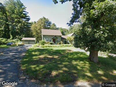
38 Nedwied Rd Tolland, CT 06084
Estimated Value: $318,000 - $473,245
3
Beds
6
Baths
2,493
Sq Ft
$165/Sq Ft
Est. Value
About This Home
This home is located at 38 Nedwied Rd, Tolland, CT 06084 and is currently estimated at $410,561, approximately $164 per square foot. 38 Nedwied Rd is a home located in Tolland County with nearby schools including Birch Grove Primary School, Tolland Intermediate School, and Tolland Middle School.
Ownership History
Date
Name
Owned For
Owner Type
Purchase Details
Closed on
Aug 31, 2009
Sold by
Us Bk
Bought by
Carey Brian and Carey Teresa
Current Estimated Value
Home Financials for this Owner
Home Financials are based on the most recent Mortgage that was taken out on this home.
Original Mortgage
$132,000
Interest Rate
5.36%
Purchase Details
Closed on
Jun 25, 2009
Sold by
Mallow Lynn
Bought by
Lasalle Bank Na
Purchase Details
Closed on
May 14, 2007
Sold by
West Maylah
Bought by
Mallow Lynn
Create a Home Valuation Report for This Property
The Home Valuation Report is an in-depth analysis detailing your home's value as well as a comparison with similar homes in the area
Home Values in the Area
Average Home Value in this Area
Purchase History
| Date | Buyer | Sale Price | Title Company |
|---|---|---|---|
| Carey Brian | $165,000 | -- | |
| Us Bk | -- | -- | |
| Us Bk | -- | -- | |
| Lasalle Bank Na | -- | -- | |
| Lasalle Bank Na | -- | -- | |
| Mallow Lynn | $255,000 | -- | |
| Mallow Lynn | $255,000 | -- |
Source: Public Records
Mortgage History
| Date | Status | Borrower | Loan Amount |
|---|---|---|---|
| Closed | Carey Brain P | $266,000 | |
| Closed | West William | $132,000 | |
| Closed | West William | $132,000 |
Source: Public Records
Tax History Compared to Growth
Tax History
| Year | Tax Paid | Tax Assessment Tax Assessment Total Assessment is a certain percentage of the fair market value that is determined by local assessors to be the total taxable value of land and additions on the property. | Land | Improvement |
|---|---|---|---|---|
| 2024 | $7,898 | $209,100 | $66,600 | $142,500 |
| 2023 | $6,872 | $184,100 | $66,600 | $117,500 |
| 2022 | $5,099 | $139,400 | $66,600 | $72,800 |
| 2021 | $5,173 | $139,400 | $66,600 | $72,800 |
| 2020 | $5,025 | $139,400 | $66,600 | $72,800 |
| 2019 | $4,726 | $131,100 | $68,700 | $62,400 |
| 2018 | $4,589 | $131,100 | $68,700 | $62,400 |
| 2017 | $4,482 | $131,100 | $68,700 | $62,400 |
| 2016 | $4,482 | $131,100 | $68,700 | $62,400 |
| 2015 | $4,373 | $131,100 | $68,700 | $62,400 |
| 2014 | $4,462 | $143,700 | $76,200 | $67,500 |
Source: Public Records
Map
Nearby Homes
- 51 Nedwied Rd
- 10 Depot Rd Unit 28
- 162 Pinney Hill Rd
- 65 Walbridge Hill Rd
- 100 Sherry Cir
- 100 Tolland Turnpike
- 1728 Stafford Rd
- 77 Timber Trail
- 117 Woodhenge Dr
- 312 Merrow Rd
- 151 Woodhenge Dr
- 68 Luchon Rd
- 548 Merrow Rd
- 280 Merrow Rd
- 151 Luchon Rd
- 157 Goose Ln
- 74 Cisar Rd
- 52 Crystal Ln Unit D
- 26 Crystal Ln Unit A
- 230 Geraldine Dr
- 38 Nedwied Rd
- 41 Nedwied Rd
- 46 Nedwied Rd
- 35 Nedwied Rd
- 27 Nedwied Rd
- 28 Nedwied Rd
- 54 Nedwied Rd
- 21 Nedwied Rd
- 210 Walbridge Hill Rd
- 211 Walbridge Hill Rd
- 74 Nedwied Rd
- 63 Nedwied Rd
- 192 Walbridge Hill Rd
- 86 Fox Ridge Ln
- 428 S River Rd
- 8 Nedwied Rd
- 438 S River Rd
- 199 Walbridge Hill Rd
- 24 Fox Ridge Ln
- 92 Fox Ridge Ln