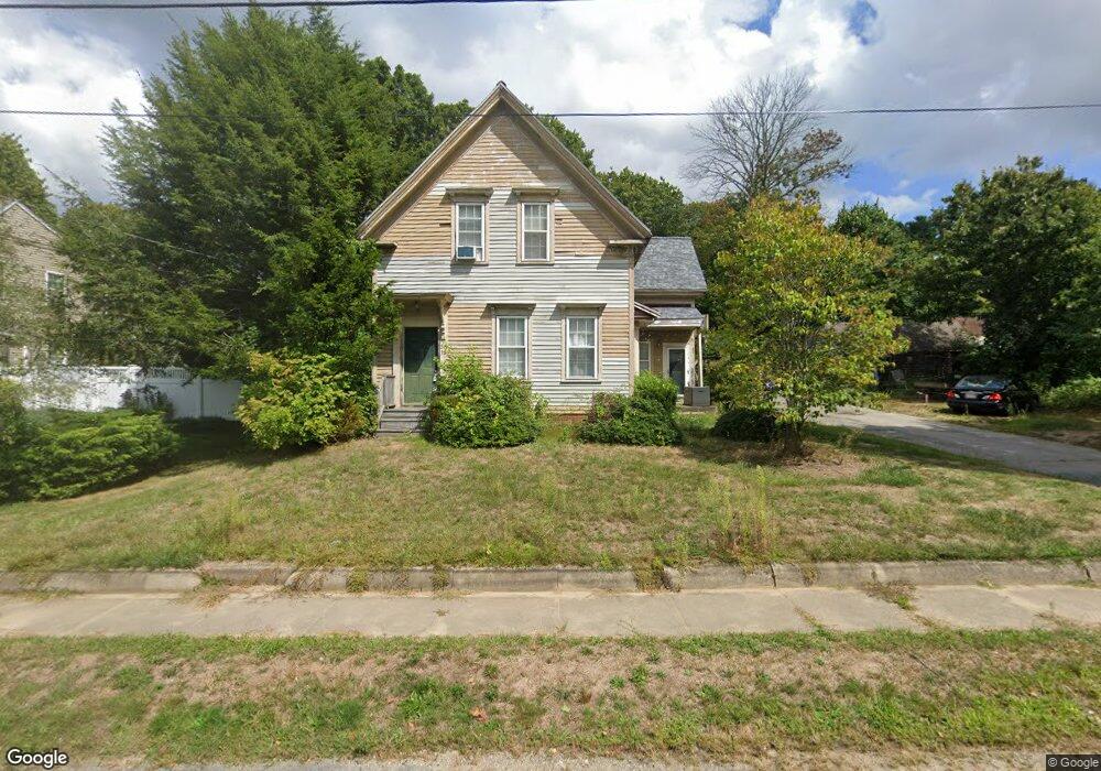
38 Perry Ave Whitman, MA 02382
Estimated Value: $677,361 - $804,000
5
Beds
3
Baths
2,680
Sq Ft
$277/Sq Ft
Est. Value
About This Home
This home is located at 38 Perry Ave, Whitman, MA 02382 and is currently estimated at $742,090, approximately $276 per square foot. 38 Perry Ave is a home located in Plymouth County with nearby schools including St Bridget School.
Ownership History
Date
Name
Owned For
Owner Type
Purchase Details
Closed on
Jan 28, 2008
Sold by
Montgomery Frank W and Montgomery Rosemary H
Bought by
Gerrior Paul F
Current Estimated Value
Home Financials for this Owner
Home Financials are based on the most recent Mortgage that was taken out on this home.
Original Mortgage
$326,378
Interest Rate
6.17%
Mortgage Type
Purchase Money Mortgage
Create a Home Valuation Report for This Property
The Home Valuation Report is an in-depth analysis detailing your home's value as well as a comparison with similar homes in the area
Home Values in the Area
Average Home Value in this Area
Purchase History
| Date | Buyer | Sale Price | Title Company |
|---|---|---|---|
| Gerrior Paul F | $331,500 | -- |
Source: Public Records
Mortgage History
| Date | Status | Borrower | Loan Amount |
|---|---|---|---|
| Open | Gerrior Paul F | $329,144 | |
| Closed | Gerrior Paul F | $326,378 |
Source: Public Records
Tax History Compared to Growth
Tax History
| Year | Tax Paid | Tax Assessment Tax Assessment Total Assessment is a certain percentage of the fair market value that is determined by local assessors to be the total taxable value of land and additions on the property. | Land | Improvement |
|---|---|---|---|---|
| 2025 | $7,553 | $575,700 | $230,500 | $345,200 |
| 2024 | $7,114 | $558,400 | $226,000 | $332,400 |
| 2023 | $6,747 | $497,200 | $196,000 | $301,200 |
| 2022 | $6,603 | $453,500 | $178,200 | $275,300 |
| 2021 | $6,539 | $421,900 | $163,700 | $258,200 |
| 2020 | $6,563 | $414,100 | $155,900 | $258,200 |
| 2019 | $5,600 | $364,100 | $155,900 | $208,200 |
| 2018 | $5,437 | $339,600 | $147,000 | $192,600 |
| 2017 | $4,940 | $327,600 | $147,000 | $180,600 |
| 2016 | $4,931 | $316,300 | $139,200 | $177,100 |
| 2015 | $4,543 | $291,000 | $122,500 | $168,500 |
Source: Public Records
Map
Nearby Homes
- 55 Plymouth St Unit A5
- 131 Holly Ridge Dr
- 684 South Ave
- 214 Winter St
- 1057 Whitman St
- 35 Dana St
- 23 Reed Place
- 417 Birchbark Dr
- 170 Pleasant St
- 40 Lazel St
- 842 Whitman St
- 22 Howland Trail Unit 34
- 5 Hayford Trail Unit 11
- 7 Hayford Trail Unit 12
- 12 Hayford Trail Unit 17
- 13 Hayford Trail Unit 15
- 608 Plymouth St
- 679 Plymouth St
- 54-56 Stetson St
- 168 Spring St