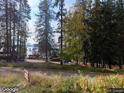
38 Power Line Rd Coolin, ID 83821
Estimated Value: $2,651,000 - $4,200,585
6
Beds
6
Baths
7,571
Sq Ft
$452/Sq Ft
Est. Value
About This Home
This home is located at 38 Power Line Rd, Coolin, ID 83821 and is currently estimated at $3,425,793, approximately $452 per square foot. 38 Power Line Rd is a home located in Bonner County.
Ownership History
Date
Name
Owned For
Owner Type
Purchase Details
Closed on
Mar 22, 2019
Sold by
Gallagher Thomas and Gallagher Kathleen
Bought by
Kolendich Gallagher Thomas Ray and Kolendich Gallagher Kathleen
Current Estimated Value
Purchase Details
Closed on
Oct 20, 2015
Sold by
State Board Of Land Commissioners
Bought by
Gallagher Thomas and Gallagher Kathleen
Create a Home Valuation Report for This Property
The Home Valuation Report is an in-depth analysis detailing your home's value as well as a comparison with similar homes in the area
Home Values in the Area
Average Home Value in this Area
Purchase History
| Date | Buyer | Sale Price | Title Company |
|---|---|---|---|
| Kolendich Gallagher Thomas Ray | -- | None Available | |
| Gallagher Thomas | -- | First American Title And Mic |
Source: Public Records
Mortgage History
| Date | Status | Borrower | Loan Amount |
|---|---|---|---|
| Open | Priest Lake Family Cabin Revoc | $3,632,944 | |
| Closed | Gallagher Thomas Ray | $710,000 |
Source: Public Records
Tax History Compared to Growth
Tax History
| Year | Tax Paid | Tax Assessment Tax Assessment Total Assessment is a certain percentage of the fair market value that is determined by local assessors to be the total taxable value of land and additions on the property. | Land | Improvement |
|---|---|---|---|---|
| 2024 | $15,826 | $4,165,401 | $1,304,531 | $2,860,870 |
| 2023 | $15,654 | $4,053,089 | $1,012,520 | $3,040,569 |
| 2022 | $3,924 | $734,070 | $620,043 | $114,027 |
| 2021 | $3,716 | $498,711 | $495,879 | $2,832 |
| 2020 | $2,586 | $498,711 | $495,879 | $2,832 |
| 2019 | $4,552 | $641,238 | $636,679 | $4,559 |
| 2018 | $4,820 | $739,341 | $735,751 | $3,590 |
| 2017 | $4,820 | $739,341 | $0 | $0 |
| 2016 | $3,690 | $542,225 | $0 | $0 |
| 2015 | -- | $3,590 | $0 | $0 |
| 2014 | -- | $0 | $0 | $0 |
Source: Public Records
Map
Nearby Homes
- 85 Palouse Dr Unit A-4
- 27 Fremont Ln
- 56 56 Palouse Dr (B9)
- B2-B6 Grandview Estates
- 21 Fremont Ln
- 109 Palouse Dr
- 485 Jim Low Rd
- 40 Palouse Dr (B12) Dr
- 52 Palouse Dr
- 74 Palouse Dr
- 88 Palouse Dr
- 96 Palouse Dr
- 44 Palouse Dr
- Lot 5 Brown Bear Dr
- Lot 6 Brown Bear Dr
- Lot 3 Brown Bear Dr
- 240 Brown Bear Dr
- 52 White Fir Ln
- 6 Brown Bear Dr
- 5 Brown Bear Dr
- 38 Power Line Rd
- 40 Power Line Rd
- 0 Corner of Hwy 57 Unit 14-4659
- 1205 Sherwood Terrace
- 1934 Cape Horn Rd
- 72 Power Line Rd
- 72 Powerline Rd
- 30 Woodys Point Rd
- 52 Woodys Point Rd
- 106 Power Line Rd
- 32 Woodys Point Rd
- 32 Woodys Point Rd
- 108 Powerline Rd
- 144 Char Ln
- 0 Sherwood Dr Unit 7-7527
- 0 Sherwood Dr Unit 15-10673
- 104 Char Ln
- 168 Power Line Rd
- 102 Char Ln
- 1975 Cape Horn Rd
