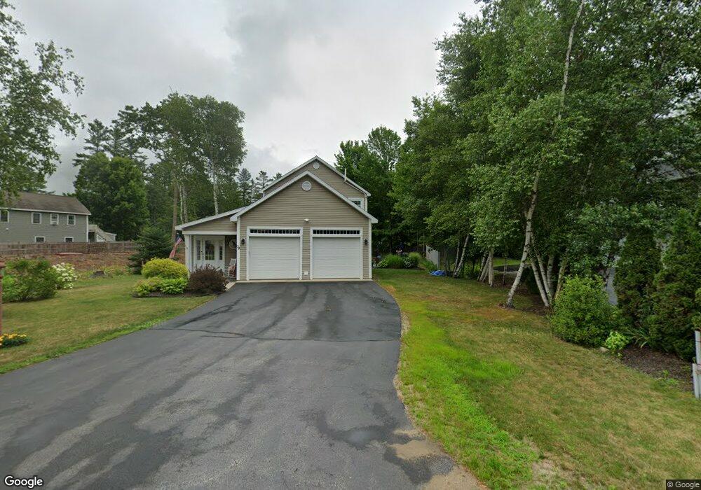
38 Profile Dr Woodstock, NH 03262
Estimated Value: $839,160 - $1,148,000
4
Beds
4
Baths
3,600
Sq Ft
$280/Sq Ft
Est. Value
About This Home
This home is located at 38 Profile Dr, Woodstock, NH 03262 and is currently estimated at $1,009,790, approximately $280 per square foot. 38 Profile Dr is a home located in Grafton County with nearby schools including Lin-Wood Public Elementary School.
Ownership History
Date
Name
Owned For
Owner Type
Purchase Details
Closed on
May 19, 2017
Sold by
Conn Alton H and Conn Barbara J
Bought by
Noonan Heather E
Current Estimated Value
Purchase Details
Closed on
Feb 25, 2011
Sold by
Michienzi Vincent and Michienzi Noreen
Bought by
Conn Alton H and Conn Barbara J
Create a Home Valuation Report for This Property
The Home Valuation Report is an in-depth analysis detailing your home's value as well as a comparison with similar homes in the area
Home Values in the Area
Average Home Value in this Area
Purchase History
| Date | Buyer | Sale Price | Title Company |
|---|---|---|---|
| Noonan Heather E | -- | -- | |
| Conn Alton H | $376,700 | -- |
Source: Public Records
Mortgage History
| Date | Status | Borrower | Loan Amount |
|---|---|---|---|
| Previous Owner | Conn Alton H | $250,000 |
Source: Public Records
Tax History Compared to Growth
Tax History
| Year | Tax Paid | Tax Assessment Tax Assessment Total Assessment is a certain percentage of the fair market value that is determined by local assessors to be the total taxable value of land and additions on the property. | Land | Improvement |
|---|---|---|---|---|
| 2024 | $8,443 | $415,500 | $125,200 | $290,300 |
| 2023 | $8,077 | $415,500 | $125,200 | $290,300 |
| 2022 | $7,637 | $415,500 | $125,200 | $290,300 |
| 2021 | $7,895 | $415,500 | $125,200 | $290,300 |
| 2020 | $8,289 | $415,500 | $125,200 | $290,300 |
| 2019 | $5,673 | $341,540 | $104,700 | $236,840 |
| 2018 | $6,334 | $341,540 | $104,700 | $236,840 |
| 2016 | $6,793 | $341,540 | $104,700 | $236,840 |
| 2015 | $6,465 | $341,540 | $104,700 | $236,840 |
| 2014 | $6,497 | $343,960 | $104,700 | $239,260 |
| 2012 | $6,611 | $369,730 | $117,600 | $252,130 |
Source: Public Records
Map
Nearby Homes
- 56 Kancamagus Hwy
- 206-011 Lost River Rd
- 25 Main St
- 11 Cascade Dr Unit 288
- 164 Deer Park Dr Unit 160D
- 164 Deer Park Dr Unit 161D
- 164 Deer Park Dr Unit 168D
- 156 Deer Park Dr Unit 135 A
- 17 Ridge Dr Unit A-14
- 23 Oakes St
- 65 Riverfront Dr Unit 217
- 45 Riverfront Dr Unit 242
- 16 Riverfront Dr Unit 293
- 16 Riverfront Dr Unit 292
- 14 Monroe Dr Unit 92
- 6 Monroe Dr Unit 111
- 9 Moose Ln
- 252-254 Lost River Rd
- 34 Franklin St
- 78 Main St Unit 3A
- 2 Profile Dr Unit 3
- 2 Profile Dr
- 3 Profile Dr
- 5 Profile Dr
- 25 Profile Dr
- 51 Profile Dr
- 0 Profile Dr
- 0 Profile Dr Unit 4036447
- 0 Profile Dr Unit 4129296
- 45 Profile Dr
- 229 Riverfront Dr Unit 229
- 48 Profile Dr
- 26 Profile Dr
- Lots 8 & 9 Profile Dr
- Lot 9 Profile Dr
- Lot 8 Profile Dr
- 54 Kancamagus Hwy
- 36 Profile Dr
- 6 Depot St
- 54 Main St