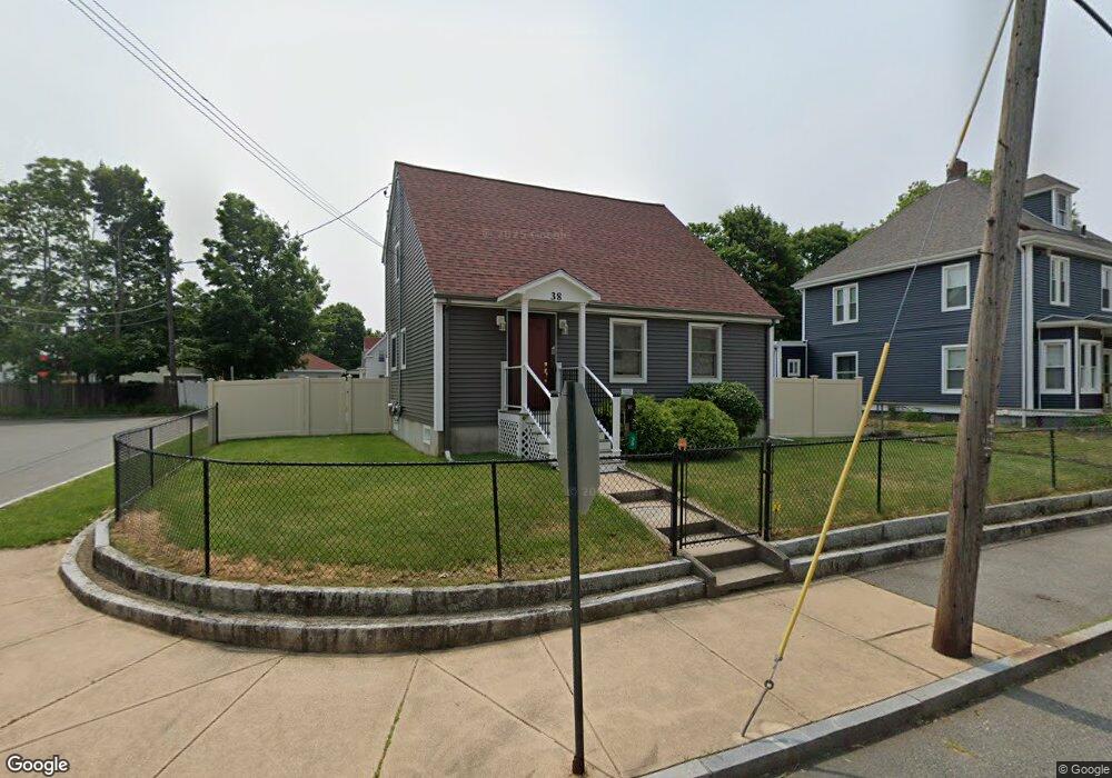
38 Rutland Square Brockton, MA 02301
Campello NeighborhoodEstimated Value: $424,000 - $484,000
3
Beds
2
Baths
1,140
Sq Ft
$402/Sq Ft
Est. Value
About This Home
This home is located at 38 Rutland Square, Brockton, MA 02301 and is currently estimated at $458,657, approximately $402 per square foot. 38 Rutland Square is a home located in Plymouth County with nearby schools including Davis K-8 School, John F. Kennedy Elementary School, and South Middle School.
Ownership History
Date
Name
Owned For
Owner Type
Purchase Details
Closed on
Sep 1, 1998
Sold by
Eranio James and Eranio Barbara A
Bought by
Hernandez Hazel and Hernandez Thomas
Current Estimated Value
Purchase Details
Closed on
May 14, 1993
Sold by
Fhlmc
Bought by
Eranio James and Eranio Barbara A
Purchase Details
Closed on
Dec 4, 1992
Sold by
Estrella Julio C
Bought by
Fhlmc
Purchase Details
Closed on
Nov 30, 1987
Sold by
D & B Realty Tr
Bought by
Estrella Julio C
Create a Home Valuation Report for This Property
The Home Valuation Report is an in-depth analysis detailing your home's value as well as a comparison with similar homes in the area
Home Values in the Area
Average Home Value in this Area
Purchase History
| Date | Buyer | Sale Price | Title Company |
|---|---|---|---|
| Hernandez Hazel | $94,000 | -- | |
| Eranio James | $33,990 | -- | |
| Fhlmc | $110,696 | -- | |
| Estrella Julio C | $119,900 | -- |
Source: Public Records
Mortgage History
| Date | Status | Borrower | Loan Amount |
|---|---|---|---|
| Open | Estrella Julio C | $25,600 | |
| Open | Estrella Julio C | $282,200 |
Source: Public Records
Tax History Compared to Growth
Tax History
| Year | Tax Paid | Tax Assessment Tax Assessment Total Assessment is a certain percentage of the fair market value that is determined by local assessors to be the total taxable value of land and additions on the property. | Land | Improvement |
|---|---|---|---|---|
| 2025 | $5,171 | $427,000 | $140,000 | $287,000 |
| 2024 | $4,944 | $411,300 | $140,000 | $271,300 |
| 2023 | $4,831 | $372,200 | $104,000 | $268,200 |
| 2022 | $4,704 | $336,700 | $94,500 | $242,200 |
| 2021 | $4,463 | $307,800 | $78,400 | $229,400 |
| 2020 | $4,356 | $287,500 | $73,500 | $214,000 |
| 2019 | $4,081 | $262,600 | $71,800 | $190,800 |
| 2018 | $3,795 | $236,300 | $71,800 | $164,500 |
| 2017 | $3,672 | $228,100 | $71,800 | $156,300 |
| 2016 | $3,548 | $204,400 | $69,500 | $134,900 |
| 2015 | $3,173 | $174,800 | $69,500 | $105,300 |
| 2014 | $3,120 | $172,100 | $69,500 | $102,600 |
Source: Public Records
Map
Nearby Homes
- 115 Market St
- 223 Clinton St Unit 10
- 223 Clinton St Unit 3
- 65 Tremont St
- 977 Warren Ave
- 936 Warren Ave
- 103 Clinton St
- 163 S Leyden St
- 35 Longworth Ave Unit 17
- 47 Southworth St
- 137 Channing Ave
- 15 Longworth Ave Unit 231
- 15 1st St
- 29 Hancock St
- 16 Hancock St
- 20 Custer St
- 54 Ferris Ave
- 61 Myrtle St
- 153 Bouve Ave
- 99 Grove St
- 42 Rutland Square
- 27 Lyon Ave
- 44 Rutland Square
- 33 Keith Ave
- 28 Rutland Square
- 37 Keith Ave
- 27 Keith Ave
- 50 Rutland Square
- 25 Lyon Ave
- 30 Rutland Square
- 43 Keith Ave
- 24 Rutland Square
- 21 Keith Ave
- 54 Rutland Square
- 23 Lyon Ave
- 24 Lyon Ave
- 24 Lyon Ave Unit 2
- 18 Rutland Square
- 21 Lyon Ave
- 49 Keith Ave