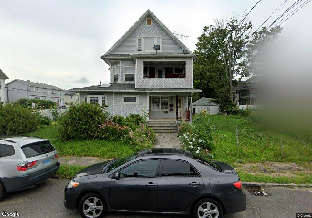
38 Savoy St Unit 40 Bridgeport, CT 06606
North End NeighborhoodEstimated Value: $411,074 - $866,000
6
Beds
3
Baths
3,432
Sq Ft
$186/Sq Ft
Est. Value
About This Home
This home is located at 38 Savoy St Unit 40, Bridgeport, CT 06606 and is currently estimated at $639,019, approximately $186 per square foot. 38 Savoy St Unit 40 is a home located in Fairfield County with nearby schools including Blackham School, Central High School, and Catholic Academy of Bridgeport-St. Raphael Academy.
Ownership History
Date
Name
Owned For
Owner Type
Purchase Details
Closed on
Oct 15, 1999
Sold by
Csontos Wm J and Cooney Gerald
Bought by
Rowe Rupert E and Anderson Julette
Current Estimated Value
Home Financials for this Owner
Home Financials are based on the most recent Mortgage that was taken out on this home.
Original Mortgage
$148,000
Outstanding Balance
$44,585
Interest Rate
7.8%
Estimated Equity
$594,434
Create a Home Valuation Report for This Property
The Home Valuation Report is an in-depth analysis detailing your home's value as well as a comparison with similar homes in the area
Home Values in the Area
Average Home Value in this Area
Purchase History
| Date | Buyer | Sale Price | Title Company |
|---|---|---|---|
| Rowe Rupert E | $150,000 | -- | |
| Rowe Rupert E | $150,000 | -- |
Source: Public Records
Mortgage History
| Date | Status | Borrower | Loan Amount |
|---|---|---|---|
| Open | Rowe Rupert E | $148,000 | |
| Closed | Rowe Rupert E | $148,000 | |
| Closed | Rowe Rupert E | $3,900 |
Source: Public Records
Tax History Compared to Growth
Tax History
| Year | Tax Paid | Tax Assessment Tax Assessment Total Assessment is a certain percentage of the fair market value that is determined by local assessors to be the total taxable value of land and additions on the property. | Land | Improvement |
|---|---|---|---|---|
| 2025 | $10,054 | $231,390 | $79,530 | $151,860 |
| 2024 | $10,054 | $231,390 | $79,530 | $151,860 |
| 2023 | $10,054 | $231,390 | $79,530 | $151,860 |
| 2022 | $10,054 | $231,390 | $79,530 | $151,860 |
| 2021 | $10,054 | $231,390 | $79,530 | $151,860 |
| 2020 | $8,551 | $158,380 | $41,520 | $116,860 |
| 2019 | $8,551 | $158,380 | $41,520 | $116,860 |
| 2018 | $8,611 | $158,380 | $41,520 | $116,860 |
| 2017 | $8,611 | $158,380 | $41,520 | $116,860 |
| 2016 | $8,611 | $158,380 | $41,520 | $116,860 |
| 2015 | $8,951 | $212,120 | $50,230 | $161,890 |
| 2014 | $8,951 | $212,120 | $50,230 | $161,890 |
Source: Public Records
Map
Nearby Homes
- 234 Savoy St
- 1265 Lindley St
- 3401 Main St
- 5 Stevens St
- 123 Harlem Ave
- 45 Stevens St Unit 2
- 106 Manhattan Ave Unit 108
- 113 Clark St
- 631 Fairview Ave
- 376 Savoy St
- 252 Harlem Ave Unit B6
- 252 Harlem Ave Unit B5
- 926 Hart St
- 916 Hart St
- 203 Wayne St
- 105 Tremont Ave Unit E
- 105 Tremont Ave Unit B
- 936 Lindley St
- 508 Hawley Ave
- 260 Birmingham St
- 3175 Main St
- 21 Savoy St
- 31 Savoy St
- 3163 Main St
- 99 Savoy St Unit 3rd
- 3183 Main St Unit 3185
- 3185 Main St
- 60 Savoy St
- 30 Rocton Place Unit 32
- 41 Savoy St
- 41-43 Savoy St
- 51 Savoy St
- 3129 E Main St
- 3129 E Main St Unit 700sf
- 3129 E Main St Unit End unit
- 31 Rocton Place
- 68 Savoy St
- 61 Savoy St Unit 2nd Flr
- 33 Rocton Place
- 59 Savoy St