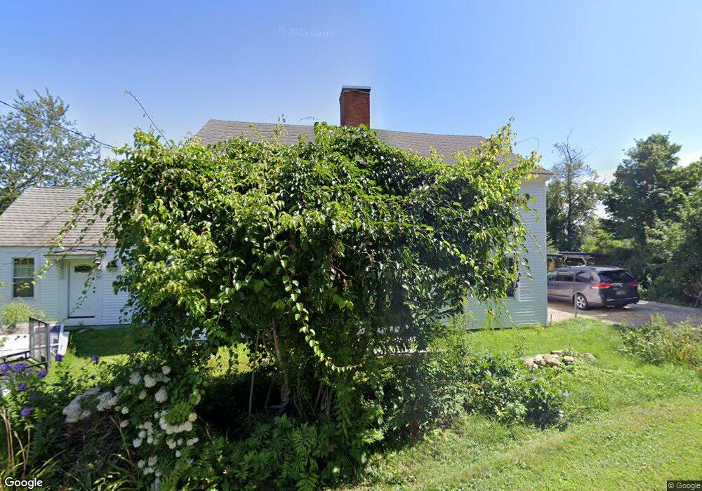
38 Stephens Rd Wilton, NH 03086
Estimated Value: $620,592 - $832,000
3
Beds
3
Baths
3,185
Sq Ft
$219/Sq Ft
Est. Value
About This Home
This home is located at 38 Stephens Rd, Wilton, NH 03086 and is currently estimated at $697,898, approximately $219 per square foot. 38 Stephens Rd is a home located in Hillsborough County with nearby schools including Florence Rideout Elementary School, Wilton-Lyndeborough Cooperative Middle School, and Wilton-Lyndeborough Cooperative High School.
Ownership History
Date
Name
Owned For
Owner Type
Purchase Details
Closed on
Jul 7, 2008
Sold by
Washington Mutual Bank
Bought by
Emberger Michael J and Emberger Melissa L
Current Estimated Value
Home Financials for this Owner
Home Financials are based on the most recent Mortgage that was taken out on this home.
Original Mortgage
$161,405
Outstanding Balance
$102,001
Interest Rate
6.01%
Mortgage Type
Purchase Money Mortgage
Estimated Equity
$595,897
Purchase Details
Closed on
May 1, 2008
Sold by
Wilbert Gwen E
Bought by
Washington Mutual Bank
Create a Home Valuation Report for This Property
The Home Valuation Report is an in-depth analysis detailing your home's value as well as a comparison with similar homes in the area
Home Values in the Area
Average Home Value in this Area
Purchase History
| Date | Buyer | Sale Price | Title Company |
|---|---|---|---|
| Emberger Michael J | $169,900 | -- | |
| Washington Mutual Bank | $245,600 | -- |
Source: Public Records
Mortgage History
| Date | Status | Borrower | Loan Amount |
|---|---|---|---|
| Open | Washington Mutual Bank | $161,405 | |
| Previous Owner | Washington Mutual Bank | $100,000 |
Source: Public Records
Tax History
| Year | Tax Paid | Tax Assessment Tax Assessment Total Assessment is a certain percentage of the fair market value that is determined by local assessors to be the total taxable value of land and additions on the property. | Land | Improvement |
|---|---|---|---|---|
| 2025 | $11,777 | $436,500 | $124,300 | $312,200 |
| 2024 | $9,625 | $387,000 | $124,300 | $262,700 |
| 2023 | $8,591 | $387,000 | $124,300 | $262,700 |
| 2022 | $7,995 | $387,000 | $124,300 | $262,700 |
| 2021 | $7,438 | $387,000 | $124,300 | $262,700 |
| 2020 | $7,524 | $256,000 | $94,900 | $161,100 |
| 2019 | $7,568 | $260,600 | $94,900 | $165,700 |
| 2018 | $7,495 | $260,600 | $94,900 | $165,700 |
| 2017 | $7,081 | $260,600 | $94,900 | $165,700 |
| 2016 | $6,864 | $260,600 | $94,900 | $165,700 |
| 2015 | $7,178 | $272,500 | $96,900 | $175,600 |
| 2014 | $7,018 | $272,000 | $96,900 | $175,100 |
| 2013 | $7,202 | $276,800 | $96,900 | $179,900 |
Source: Public Records
Map
Nearby Homes
- 0 Captain Clark Hwy
- F-88-11 Aria Hill Dr
- F-88-12 Aria Hill Dr
- F-88-7 Aria Hill Dr
- 85 Intervale Rd
- 124 Abbot Hill Rd
- 97 Timber Ridge Dr
- 87 Timber Ridge Dr
- 121 Badger Hill Dr
- 589 Gibbons Hwy
- 17 Ches Mae Ln
- F88-9 McGettigan Rd
- F/88-5 McGettigan Rd
- F/88-4 McGettigan Rd
- 24 Falcon Ridge Rd Unit 24
- 23 Falcon Ridge Rd Unit 23
- F88-10 McGettigan Rd
- Lots 4 & 7 Gibbons & Robbins Rd
- 33 Falcon Ridge Rd Unit 33
- 10 Whiting Hill Rd
Your Personal Tour Guide
Ask me questions while you tour the home.