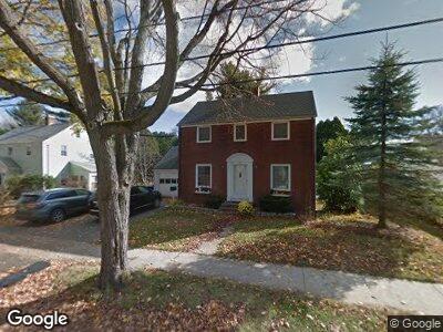
38 Sylvan Rd South Portland, ME 04106
Meetinghouse Hill NeighborhoodEstimated Value: $577,000 - $665,850
3
Beds
2
Baths
1,867
Sq Ft
$335/Sq Ft
Est. Value
About This Home
This home is located at 38 Sylvan Rd, South Portland, ME 04106 and is currently estimated at $626,213, approximately $335 per square foot. 38 Sylvan Rd is a home located in Cumberland County with nearby schools including Frank I Brown Elementary School, Daniel F. Mahoney Middle School, and South Portland High School.
Ownership History
Date
Name
Owned For
Owner Type
Purchase Details
Closed on
Oct 13, 2020
Sold by
Hauser Thomas J
Bought by
Bourque Matthew D and Solomita Andrea
Current Estimated Value
Home Financials for this Owner
Home Financials are based on the most recent Mortgage that was taken out on this home.
Original Mortgage
$380,000
Outstanding Balance
$341,786
Interest Rate
2.9%
Mortgage Type
New Conventional
Estimated Equity
$286,099
Purchase Details
Closed on
Aug 31, 2005
Sold by
Sterns Stearns W and Sterns Claire L
Bought by
Hauser Thomas J
Create a Home Valuation Report for This Property
The Home Valuation Report is an in-depth analysis detailing your home's value as well as a comparison with similar homes in the area
Home Values in the Area
Average Home Value in this Area
Purchase History
| Date | Buyer | Sale Price | Title Company |
|---|---|---|---|
| Bourque Matthew D | -- | None Available | |
| Hauser Thomas J | -- | -- |
Source: Public Records
Mortgage History
| Date | Status | Borrower | Loan Amount |
|---|---|---|---|
| Open | Bourque Matthew D | $380,000 | |
| Previous Owner | Hauser Thomas J | $174,411 |
Source: Public Records
Tax History Compared to Growth
Tax History
| Year | Tax Paid | Tax Assessment Tax Assessment Total Assessment is a certain percentage of the fair market value that is determined by local assessors to be the total taxable value of land and additions on the property. | Land | Improvement |
|---|---|---|---|---|
| 2024 | $7,531 | $570,500 | $198,300 | $372,200 |
| 2023 | $6,387 | $451,700 | $138,500 | $313,200 |
| 2022 | $5,434 | $349,200 | $110,800 | $238,400 |
| 2021 | $5,154 | $350,600 | $110,800 | $239,800 |
| 2020 | $4,880 | $247,100 | $100,600 | $146,500 |
| 2019 | $4,608 | $247,100 | $100,600 | $146,500 |
| 2018 | $4,479 | $247,100 | $100,600 | $146,500 |
| 2017 | $4,448 | $247,100 | $100,600 | $146,500 |
| 2016 | $4,374 | $247,100 | $100,600 | $146,500 |
| 2015 | $4,300 | $247,100 | $100,600 | $146,500 |
| 2014 | $4,225 | $247,100 | $100,600 | $146,500 |
| 2013 | -- | $247,100 | $100,600 | $146,500 |
Source: Public Records
Map
Nearby Homes
- 32 Bayberry Way
- 25 Preservation Ln Unit 9
- 101 Parrott St
- 75 Parrott St
- 340 Ocean St
- 30 Bennett St
- 71 Anthoine St
- 4 Beaufort St
- 239 Spurwink Ave
- 42 Buchanan St
- 2 Phoebes Way
- 23 Blue Meadow Ln Unit 23
- 61 Providence Ave
- Lot B Broadway
- 32 Chapel St
- 34 Romano Rd
- 109 Hillside Ave
- 226 Alfred St
- 38 Latham St
- 66 Evans St Unit 12