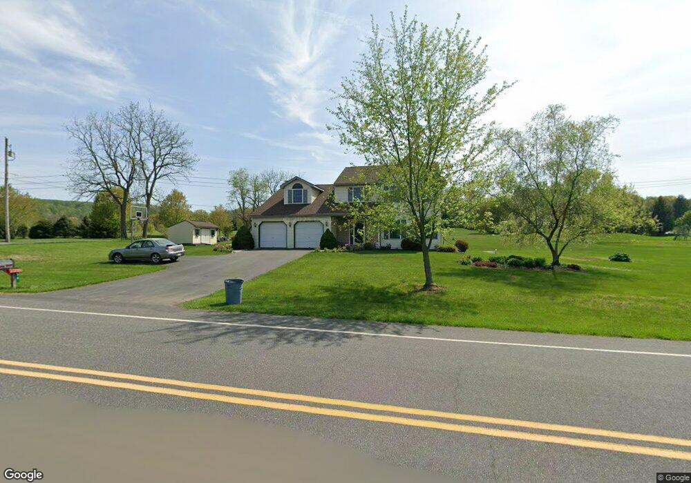
38 Timothy Dr Mertztown, PA 19539
Rockland NeighborhoodEstimated Value: $443,974 - $547,000
4
Beds
3
Baths
2,543
Sq Ft
$195/Sq Ft
Est. Value
About This Home
This home is located at 38 Timothy Dr, Mertztown, PA 19539 and is currently estimated at $494,994, approximately $194 per square foot. 38 Timothy Dr is a home located in Berks County with nearby schools including Brandywine Heights Elementary School, Brandywine Intermediate School, and Brandywine Heights High School.
Ownership History
Date
Name
Owned For
Owner Type
Purchase Details
Closed on
Sep 16, 2005
Sold by
Kutz David R and Kutz Sherry G
Bought by
Dougherty Daniel B and Dougherty Marjorie E
Current Estimated Value
Home Financials for this Owner
Home Financials are based on the most recent Mortgage that was taken out on this home.
Original Mortgage
$155,000
Interest Rate
6.33%
Mortgage Type
Fannie Mae Freddie Mac
Create a Home Valuation Report for This Property
The Home Valuation Report is an in-depth analysis detailing your home's value as well as a comparison with similar homes in the area
Home Values in the Area
Average Home Value in this Area
Purchase History
| Date | Buyer | Sale Price | Title Company |
|---|---|---|---|
| Dougherty Daniel B | $269,900 | None Available |
Source: Public Records
Mortgage History
| Date | Status | Borrower | Loan Amount |
|---|---|---|---|
| Previous Owner | Dougherty Daniel B | $155,000 |
Source: Public Records
Tax History Compared to Growth
Tax History
| Year | Tax Paid | Tax Assessment Tax Assessment Total Assessment is a certain percentage of the fair market value that is determined by local assessors to be the total taxable value of land and additions on the property. | Land | Improvement |
|---|---|---|---|---|
| 2025 | $1,552 | $155,000 | $35,100 | $119,900 |
| 2024 | $7,026 | $155,000 | $35,100 | $119,900 |
| 2023 | $6,837 | $155,000 | $35,100 | $119,900 |
| 2022 | $6,677 | $155,000 | $35,100 | $119,900 |
| 2021 | $6,624 | $155,000 | $35,100 | $119,900 |
| 2020 | $6,572 | $155,000 | $35,100 | $119,900 |
| 2019 | $6,495 | $155,000 | $35,100 | $119,900 |
| 2018 | $6,423 | $155,000 | $35,100 | $119,900 |
| 2017 | $6,304 | $155,000 | $35,100 | $119,900 |
| 2016 | $1,272 | $155,000 | $35,100 | $119,900 |
| 2015 | $1,272 | $155,000 | $35,100 | $119,900 |
| 2014 | $1,272 | $155,000 | $35,100 | $119,900 |
Source: Public Records
Map
Nearby Homes
- 101 Cider Mill Rd
- 13 Timothy Dr
- 0 State St Unit PABK2055498
- 0 State St Unit PABK2047158
- 106 Hoch Ave
- 37 S Herbein Dr
- 116 W Franklin St
- 210 S Home Ave
- 32 N Main St
- 149 Smoketown Rd
- 11 Woodland Ln
- 3 Woodland Ln
- 573 State St
- 145 Fredericksville Rd
- 44 S Park Ave
- 0 S Park Ave
- 334 Old Topton Rd
- 20 Heffner Rd
- 0 Chestnut St
- 608 Old Topton Rd
- 73 Cider Mill Rd
- 37 Timothy Dr
- 34 Timothy Dr
- 35 Timothy Dr
- 33 Timothy Dr
- 32 Timothy Dr
- 71 Cider Mill Rd
- 76 Cider Mill Rd
- 76 Cider Mill Rd Unit L 26
- 31 Timothy Dr
- 74 Cider Mill Rd
- 74 Cider Mill Rd Unit L 25
- 109 Main St
- 30 Timothy Dr
- 111 Main St
- 29 Timothy Dr
- 84 Cider Mill Rd
- 113 Main St
- 68 Cider Mill Rd
- 68 Cider Mill Rd Unit L 24