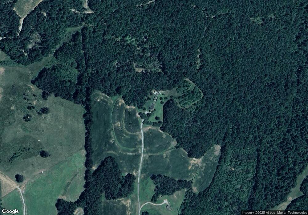
380 Brandon Ln Cedar Grove, TN 38321
Estimated Value: $252,053 - $336,000
4
Beds
3
Baths
2,581
Sq Ft
$109/Sq Ft
Est. Value
About This Home
This home is located at 380 Brandon Ln, Cedar Grove, TN 38321 and is currently estimated at $281,013, approximately $108 per square foot. 380 Brandon Ln is a home located in Henderson County.
Ownership History
Date
Name
Owned For
Owner Type
Purchase Details
Closed on
Jan 18, 2013
Sold by
Mitchell Amy C
Bought by
Mitchell Amy C and Mitchell Brent
Current Estimated Value
Purchase Details
Closed on
Dec 10, 2012
Sold by
Jpmorgan Chase Bank Na
Bought by
Mitchell Amy C
Purchase Details
Closed on
May 16, 2012
Sold by
Marshall Woody J
Bought by
Jpmorgan Chase Bank Na
Purchase Details
Closed on
Jul 14, 2010
Sold by
Koon Eric
Bought by
Marshall Elsa A
Purchase Details
Closed on
Jun 11, 1993
Bought by
Wood Jeffery T and Wood Sandra
Purchase Details
Closed on
May 2, 1985
Bought by
Wood Joe Thomas and Wood Barbra
Create a Home Valuation Report for This Property
The Home Valuation Report is an in-depth analysis detailing your home's value as well as a comparison with similar homes in the area
Home Values in the Area
Average Home Value in this Area
Purchase History
| Date | Buyer | Sale Price | Title Company |
|---|---|---|---|
| Mitchell Amy C | -- | -- | |
| Mitchell Amy C | $27,500 | -- | |
| Jpmorgan Chase Bank Na | $108,800 | -- | |
| Marshall Elsa A | $103,300 | -- | |
| Wood Jeffery T | -- | -- | |
| Wood Joe Thomas | -- | -- |
Source: Public Records
Tax History Compared to Growth
Tax History
| Year | Tax Paid | Tax Assessment Tax Assessment Total Assessment is a certain percentage of the fair market value that is determined by local assessors to be the total taxable value of land and additions on the property. | Land | Improvement |
|---|---|---|---|---|
| 2024 | $831 | $52,525 | $800 | $51,725 |
| 2023 | $831 | $52,525 | $800 | $51,725 |
| 2022 | $672 | $28,325 | $975 | $27,350 |
| 2021 | $672 | $28,325 | $975 | $27,350 |
| 2020 | $672 | $28,325 | $975 | $27,350 |
| 2019 | $672 | $28,325 | $975 | $27,350 |
| 2018 | $641 | $28,075 | $975 | $27,100 |
| 2017 | $641 | $28,075 | $975 | $27,100 |
| 2016 | $625 | $26,325 | $975 | $25,350 |
| 2015 | $625 | $26,325 | $975 | $25,350 |
| 2014 | $625 | $26,322 | $0 | $0 |
Source: Public Records
Map
Nearby Homes
- 213 Jason Hollow Rd
- 255 Jason Hollow Rd
- Lot 5 Jason Hollow Rd
- 5 Jason Hollow Rd
- Lot 30 Stan Ln
- 30 Stan Ln
- 163 Jason Hollow Rd
- 00 Stan Ln
- 155 Fire Tower Rd
- 000 Mt Gilead
- 4260 Highfield Rd
- 0 Daws Ln
- 115 Baudy James Rd
- 151 Williams Ln
- 413 Law Ln
- 780 Hickory Flat Rd
- 4555 Rue Hamner Rd
- 00 Frye Rd
- 0 Hwy 70 Ave Unit RTC2802275
- 00 Royal Fox Point
- 100 Brandon Ln
- 98 Brandon Ln
- 0 Obrien Rd Unit 224716
- 2200 Obrien Rd
- 2381 Obrien Rd
- 2405 Obrien Rd
- 1864 Obrien Rd
- 2931 Obrien Rd
- 2900 Obrien Rd
- 1865 Obrien Rd
- 1865 Brien Rd
- 2560 Obrien Rd
- 2560 Obrien Rd
- 2557 Obrien Rd
- 2572 Obrien Rd
- 1751 Obrien Rd
- 2670 Obrien Rd
- 1727 Obrien Rd
- 2611 Obrien Rd
- 2714 Obrien Rd
