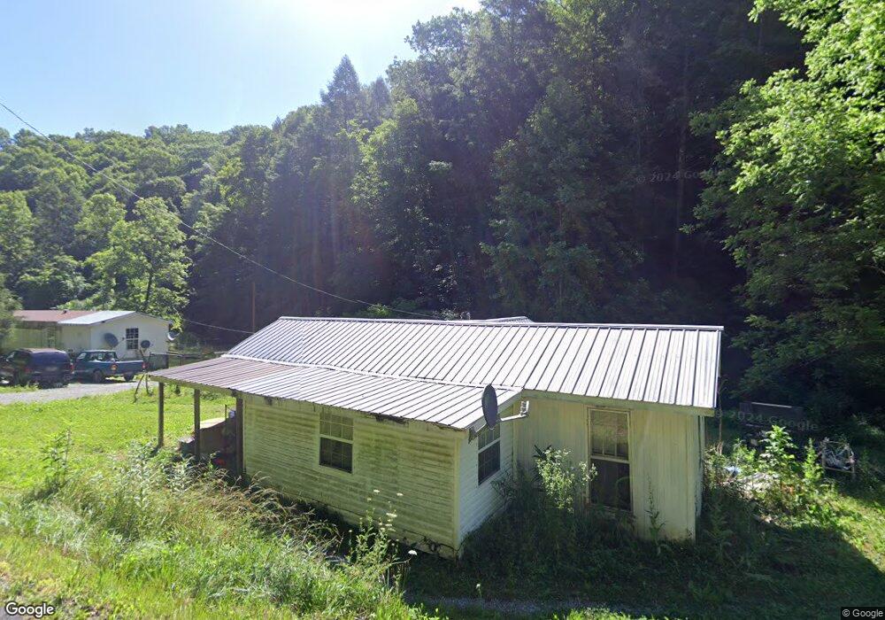
380 Laurel Branch Rd La Follette, TN 37766
Estimated Value: $48,908 - $162,000
--
Bed
1
Bath
720
Sq Ft
$133/Sq Ft
Est. Value
About This Home
This home is located at 380 Laurel Branch Rd, La Follette, TN 37766 and is currently estimated at $95,477, approximately $132 per square foot. 380 Laurel Branch Rd is a home located in Campbell County.
Ownership History
Date
Name
Owned For
Owner Type
Purchase Details
Closed on
Jul 20, 1990
Bought by
Steakley Ronald and Steakley Marilynn A
Current Estimated Value
Purchase Details
Closed on
May 21, 1990
Bought by
Steakley Ronald and Steakley Marilynn A
Purchase Details
Closed on
Apr 26, 1988
Bought by
Ayers Haskel Real Estate & Auction Co In
Purchase Details
Closed on
Dec 7, 1977
Bought by
Black Lassie
Purchase Details
Closed on
Jan 2, 1900
Create a Home Valuation Report for This Property
The Home Valuation Report is an in-depth analysis detailing your home's value as well as a comparison with similar homes in the area
Home Values in the Area
Average Home Value in this Area
Purchase History
| Date | Buyer | Sale Price | Title Company |
|---|---|---|---|
| Steakley Ronald | -- | -- | |
| Steakley Ronald | $2,600 | -- | |
| Ayers Haskel Real Estate & Auction Co In | $3,000 | -- | |
| Black Lassie | -- | -- | |
| -- | -- | -- |
Source: Public Records
Tax History Compared to Growth
Tax History
| Year | Tax Paid | Tax Assessment Tax Assessment Total Assessment is a certain percentage of the fair market value that is determined by local assessors to be the total taxable value of land and additions on the property. | Land | Improvement |
|---|---|---|---|---|
| 2025 | $128 | $10,525 | $0 | $0 |
| 2024 | $128 | $10,525 | $2,800 | $7,725 |
| 2023 | $85 | $4,100 | $1,175 | $2,925 |
| 2022 | $85 | $4,100 | $1,175 | $2,925 |
| 2021 | $85 | $4,100 | $1,175 | $2,925 |
| 2020 | $83 | $4,100 | $1,175 | $2,925 |
| 2019 | $85 | $4,100 | $1,175 | $2,925 |
| 2018 | $76 | $3,375 | $1,175 | $2,200 |
| 2017 | $76 | $3,375 | $1,175 | $2,200 |
| 2016 | $76 | $3,375 | $1,175 | $2,200 |
| 2015 | $67 | $3,375 | $1,175 | $2,200 |
| 2014 | -- | $3,375 | $1,175 | $2,200 |
| 2013 | -- | $3,375 | $1,175 | $2,200 |
Source: Public Records
Map
Nearby Homes
- 0 Melvin Hollow Rd Unit LotWP001 23933593
- 0 Melvin Hollow Rd Unit LotWP003 23933595
- 0 Melvin Hollow Rd Unit 1305423
- 0 Melvin Hollow Rd Unit 1305420
- 0 Melvin Hollow Rd Unit 1271460
- 3329 Stinking Creek Rd
- 1055 Big 4 Rd
- 3866 Highway 297
- 256 Ensley Ln
- 130 Lowwood Ln
- 936 Stinking Creek Rd
- 739 Rock Creek Ln
- 143 Elk Ridge Ln
- 150 Timber Oaks Ln
- 241 Oswego Rd
- 163 Wooldridge Ln
- 0 Wooldridge Rd
- 1911 Branam Hill Rd
- 1732 Branam Hill Rd
- 0 6th Ave
- 346 Laurel Branch Rd
- 426 Laurel Branch Rd
- 296 Laurel Branch Rd
- 482 Laurel Branch Rd
- 265 Laurel Branch Rd
- 523 Laurel Branch Rd
- 1470 Melvin Hollow Rd
- 1488 Melvin Hollow Rd
- 0 Melvin Hollow Rd Unit LotWP002 23933594
- 0 Melvin Hollow Rd Unit 1305410
- 0 Melvin Hollow Rd Unit LotWp001 14413383
- 0 Melvin Hollow Rd Unit 1260948
- 0 Melvin Hollow Rd Unit 1193991
- 0 Melvin Hollow Rd Unit 1192128
- 1502 Melvin Hollow Rd
- 1395 Melvin Hollow Rd
- 158 Laurel Branch Rd
- 1527 Melvin Hollow Rd
- 312 Old Stinking Creek Rd
- 456 Doc Hollow Ln