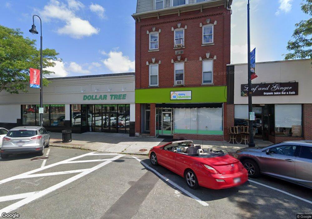
380 Main St Unit 382 Wakefield, MA 01880
Downtown Wakefield NeighborhoodEstimated Value: $1,894,607
8
Beds
6
Baths
8,554
Sq Ft
$221/Sq Ft
Est. Value
About This Home
This home is located at 380 Main St Unit 382, Wakefield, MA 01880 and is currently estimated at $1,894,607, approximately $221 per square foot. 380 Main St Unit 382 is a home located in Middlesex County with nearby schools including Wakefield Memorial High School, St Joseph School, and Odyssey Day School.
Ownership History
Date
Name
Owned For
Owner Type
Purchase Details
Closed on
Jun 28, 2007
Sold by
Hpm Rt
Bought by
Oweis Realty Llc
Current Estimated Value
Home Financials for this Owner
Home Financials are based on the most recent Mortgage that was taken out on this home.
Original Mortgage
$547,500
Outstanding Balance
$337,531
Interest Rate
6.24%
Mortgage Type
Commercial
Estimated Equity
$1,557,076
Create a Home Valuation Report for This Property
The Home Valuation Report is an in-depth analysis detailing your home's value as well as a comparison with similar homes in the area
Home Values in the Area
Average Home Value in this Area
Purchase History
| Date | Buyer | Sale Price | Title Company |
|---|---|---|---|
| Oweis Realty Llc | $730,000 | -- |
Source: Public Records
Mortgage History
| Date | Status | Borrower | Loan Amount |
|---|---|---|---|
| Open | Oweis Realty Llc | $547,500 |
Source: Public Records
Tax History Compared to Growth
Tax History
| Year | Tax Paid | Tax Assessment Tax Assessment Total Assessment is a certain percentage of the fair market value that is determined by local assessors to be the total taxable value of land and additions on the property. | Land | Improvement |
|---|---|---|---|---|
| 2025 | -- | $1,627,600 | $283,100 | $1,344,500 |
| 2024 | -- | $1,611,500 | $280,300 | $1,331,200 |
| 2023 | $0 | $1,463,900 | $254,600 | $1,209,300 |
| 2022 | $0 | $1,160,500 | $233,500 | $927,000 |
| 2021 | $0 | $1,183,000 | $210,800 | $972,200 |
| 2020 | $0 | $1,130,600 | $201,500 | $929,100 |
| 2019 | $0 | $1,064,700 | $190,100 | $874,600 |
| 2018 | $0 | $961,500 | $178,900 | $782,600 |
| 2017 | -- | $849,300 | $172,800 | $676,500 |
| 2016 | -- | $856,500 | $169,900 | $686,600 |
| 2015 | -- | $580,000 | $162,000 | $418,000 |
| 2014 | -- | $568,600 | $158,800 | $409,800 |
Source: Public Records
Map
Nearby Homes
- 51 Crescent St
- 9 Avon St Unit 2
- 50 Albion St
- 16 Pleasant St
- 24 Park St
- 22 Jefferson Rd
- Unit 208 Plan at Wrenly
- Unit 310 Plan at Wrenly
- 62 Foundry St Unit 310
- 62 Foundry St Unit 312
- 62 Foundry St Unit 506
- 62 Foundry St Unit 202
- 62 Foundry St Unit 208
- 62 Foundry St Unit 414
- 62 Foundry St Unit 406
- 62 Foundry St Unit 313
- 6 Avon Ct Unit 2
- 69 Foundry St Unit 416
- 69 Foundry St Unit 310
- 38 Bennett St Unit 3D
- 382 Main St
- 380-382 Main St
- 380 - 382 Main
- 9 Princess St
- 21 Princess St Unit 21A
- 19 Princess St Unit 3,19
- 19 Princess St
- 21-2 Princess St
- 21 Princess St Unit 3
- 410 Main St
- 12 Princess St
- 16 Princess St Unit 1R
- 16 Princess St
- 16 Princess St Unit 2
- 394 Main St Unit 400
- 377 Main St
- 1 Albion St Unit 3
- 1 Albion St Unit 2
- 1 Albion St Unit 1
- 1 Albion St